skip to main |
skip to sidebar
This short stretch of shoreline just west of Volunteer Park, between Kitsilano and Jericho Beach, is a fascinating collision of public beach, geology, seawalls, and art. I really had trouble figuring out how to separate these things. My posts get confusing (or simply never get done) when I try to cover too many different topics in a single entry, so I'm going to break this 45-minute beach walk into three four separate posts. That also makes it easier to use more photos.
The Point Grey Foreshore is carved into a low bluff of Eocene sandstone. As we'll see in the next couple of posts, the cliff itself is now largely hidden behind high walls, but the sandstone makes extensive appearances on the foreshore as southerly dipping ledges. These can be seen in both the photos and in the aerial imagery.
AERIAL VIEW
There's not a lot of sand or gravel on the platform, although there are sporadic patches of beach associated with irregularities in the uneven shoreface. Much of the sediment is actually shell hash, suggesting that the sandstone erodes slowly enough to allow crustaceans to establish and not fast enough to generate much mineral sediment. What sand and gravel does exist is probably moved rapidly eastward by westerly wave action - to end up at Kitsilano Beach in another few posts.
Point Grey seems a pretty appropriate name for these photos, given the drab afternoon - but the next couple of posts will at least try to add some local color. By the way, I believe Point Grey refers to the entire peninsula, which extends out to Wreck Beach (a prime future post) at UBC, but "Point Grey Foreshore" typically refers to this northern shore.
I've got better pictures of this shoreline from my last visit, but the tide was lower this last week and revealed more of the beach. This was just a quick stop before dinner and we didn't stay long.
Dundarave: October 2011
The groin (or mole) here at the end of 25th Street probably started as a pier, but was eventually filled in, and a nice pocket beach has formed on its western (updrift) side. A smaller, lower energy beach has formed in the lee of the structure as well. But there isn't much mobile sediment on these beaches once you get away from the structure.
AERIAL VIEW
The shoreline farther east (in the distance) is heavily armored and gets hammered during high tide storms. But there probably aren't many people strolling along the trail on those days - just work crews clearing logs and gravel off the walkway.
I visited this shoreline four and a half years ago (also at the end of a long day at the Salish Sea Conference) and made a note to come back at a lower tide. I've been hearing about this project from a number of directions and wanted to see it for myself. I dragged a few other folks along, too.
Previous Post: West Vancouver 2011
West Vancouver's shoreline is subject to highly oblique wave action from the west, which moves whatever sediment is available eastward. Prior to development, most of this material probably ended up stacked against the delta of the Capilano River (under the Lion's Gate Bridge), in a more natural version of today's engineered Ambleside Beach (Ambleside 2011). Now much of it is trapped against groins or other obstructions at Dundarave and Ambleside.
I don't know this area well, but I suspect most of the sediment comes from the streams that flow to the beach off the hills above West Vancouver. And I don't know how that budget has changed with development - is it increased, or is it trapped in detention ponds? The problem is keeping it on the steep foreshore when it gets there.
At Lawson Creek just west of Ambleside, there have been efforts to add large boulders to the beach face in order to retain, or trap, sand and gravel. The result is a beach covered with (almost) randomly placed clusters of rocks. I suppose there were already scattered glacial boulders on the beach, but the result here was one of the weirder beaches I've seen. This approach has also been tried, or is planned, at other West Vancouver creek mouths.
(Now that I've looked at the aerials again, I'm wishing we'd gone a little farther west to see the next creek, where this basic idea has been taken to a another level)
AERIAL VIEW
I admit to being a little skeptical about this approach. It's not that it may not work locally, but it seems like it depends on how much sediment is really available. And whether the volumes are sufficient to make a substantial difference in the profile on these steep, narrow beaches.
Engineers have been proposing placing objects of some sort on the foreshore to trap sediment and prevent erosion forever (only a minor exaggeration). Groins, artificial seagrass, submerged sills and breakwaters, and a whole series of patented concrete devices sold for their promise of building back a beach where one has been lost. They may work, in some places, for a while, but they often do not. When sediment is successfully retained, the consequence can adversely impact down-drift beaches (much as with traditional groins). This may not be an issue here where the beach sediment is already largely confined to the big pockets against the projecting groins and piers.
Marine Park in Blaine, just south of the Canadian border, is located on the northwestern edge of a large peninsula built out of fill when they dredged their port and marina. The shoreline edge is pretty ragged and was composed of rocky headlands formed from old concrete and rock debris and a few scattered, somewhat accidental beaches. I visited it six years ago when the City was contemplating improvements to the park's shoreline (Blaine 2010).
AERIAL VIEW
One segment of the shoreline has recently been fixed up. The concrete has been replaced with better constructed and more attractive riprap promontories and the pocket beach has been enhanced. The idea of taking advantage of the existing headlands is a good one and it facilitates the creation of stable pocket beaches. There's probably more that they could do along here, but this is a great start.
There were signs of some erosion of the bank just north of the large log and root wad (see pictures). This isn't anything serious, although it bears watching. I wonder if it's a result of last months high tide storm interacting with the large log that's been placed on the bank. This log, which includes a big root wad, seems too high to have just floated in, so I assume it's an installation. As we've seen on other sites, there's some risk associated with placing big wood high on a steep profile - - it may eventually get undermined. But then it roll down to a more natural place on the beach.
We were in Chicago a little less than three weeks ago, winding up our brief trip back to the midwest. My only foray to the beach was on the morning we left, when I dodged rain squalls on my way to meeting M for breakfast at Tempo.
I've got much better shots of these beaches from an earlier trip: Chicago: July 2010
The first three photos are from Oak Street; the bottom one is from Ohio Street Beach.
But rain or not, I still love these public beaches against the backdrop of Chicago's skyline. There's nothing terribly natural about them - nourished and groomed pocket beaches have replaced the spits and marshes that once marked the mouth of the Chicago River - but it shows that we can still provide ways for people to interact directly with the water, even in our most urban settings.
There are a lot more photos from this trip, mainly of skyscrapers, over on the other blog (hshipman: Chicago).
Much of the southeastern shore of Lake Michigan, from Wisconsin south through Chicago towards the Indiana Dunes at the south end of the Lake, consists of eroding bluffs. But there are a number of locations where the bluff is absent, either because a lower river valley intersects the shore or because the beaches have accreted out into the lake.
AERIAL VIEW
I don't know the explanation for Wind Point, just north of Racine, but it extends out into the lake. It's low, but doesn't appear depositional. I suspect there may be bedrock control - a more resistant layer at modern lake level - but would need to do considerably more homework for this to be anything more than speculation.
Sediment transport is pretty strongly from north to south on this shore of the lake, reflecting the strong north wave action (winds and long fetch). The presence of both sand and gravel, like on Puget Sound, is mainly a function of glacial sediment sources.
These small trees being eroded away just south of the lighthouse tell a story, but it's not a story I learned during my short visit!
A couple of days after getting back to Seattle, I was throwing out some old stuff in my cubicle and ran across a 2" thick report I had obtained in the mid-1990s that described in detail the geology and engineering of the Lake Michigan shoreline of Milwaukee County. Aerial photos show that this beach was constructed in 1988 (Photos from Southeastern Wisconsin Regional Planning Commission, 1989).
Like other Great Lakes cities, much of Milwaukee's shoreline was built out into the lake with fill, the better to create marinas, public facilities, and recreational space. As a result, beaches tend to be highly engineered pocket beaches, often shaped by groins, adjacent jetties, and offshore breakwaters. McKinley Beach is part of a segmented headland breakwater system - there's a longer beach a short distance farther north (see aerial below).
AERIAL VIEW
The gap in the riprap constrains the direction that waves can approach the beach and the breakwater prevents sand and gravel from escaping the confined pocket. Regardless of the direction with which waves approach (the big waves come mainly from the north on Lake Michigan), they pass through the narrow opening and break in regular curves on the crescent-shaped beach.
My brief search for beaches turned up this small pocket in Olin Park, on Lake Monona southwest of downtown Madison. There's a nice view back at the State Capitol and Monona Terrace (hshipman).
AERIAL VIEW
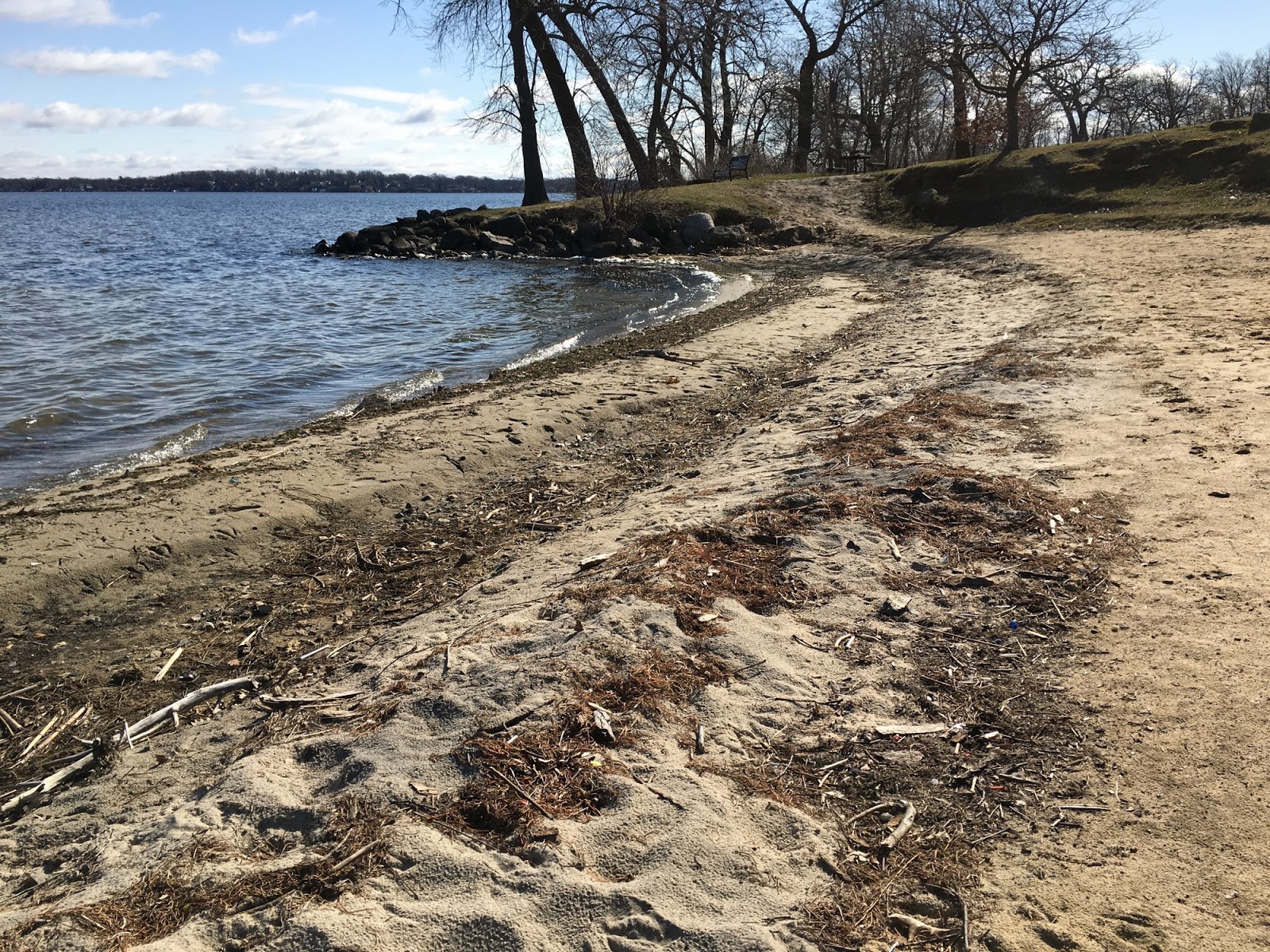
I don't know enough about these midwestern lakes to understand much about the formation of beaches and their distribution. Things that are always important are water levels (I think this lake is controlled pretty tightly), along with wind and wave conditions, particularly during larger storms. But there are also local factors like ice cover in the winter, the geology of the shoreline, and the original riparian forest. The history of a site is also critical - sometimes fill has been placed to extend the shoreline farther out into the lake. Small beaches are often created from scratch or are nourished. This one has formed in a small cove bracketed by riprapped shorelines on both sides.
Although probably not relevant to the beach itself, this area was originally the site of many hundreds of native american mounds in various sizes and shapes. It's so easy to overlook the prehistory of these places - particularly where so much of it has been obliterated. And in the midwest, we often forget that the aboriginal cultures first encountered by Europeans were in themselves hugely transformed from the extensive Mississippian Culture that existed hundreds of years earlier.
After a weekend in Madison, I thought some sort of post was in order, although the gray weather, the limited time to explore the shoreline, and the paucity of actual beaches didn't exactly lend itself to exciting content.
Downtown Madison is located on an isthmus between Lake Mendota on the north (this post) and Lake Monona on the south (next post).
AERIAL VIEW
These first few photos are from the University of Wisconsin, showing the UW Limnology Lab and the Memorial Union Terrace (being remodeled).
These last two photos are from Burrows Park, in Maple Bluff, on the east end of the lake. I suppose once upon a time the lake's shorelines were heavily forested, but as the trees came down and the shoreline developed, erosion became a problem, and much of the lake is probably hardened.
I guess this year's mild winter led to the lake only being frozen for a couple of months - and it was fully thawed by our late March visit.
A major windstorm coincided with high tide early on the morning of March 10th. The Seattle tide gauge pushed 14.3', a little less than 2' above the predicted 12.4'. In some places, the impacts were reported greater than the storm on February 4th, 2006 (ten years ago). In others, the effects were less. The differences may have been due to the relative role of high water versus waves, to local variability in wind intensity and orientation, and to small changes in beach conditions that can lead to big differences in how waves impact the landward area.
A week later, I was finally able to get to the beach - a quick series of stops on the way to an event in Langley. But it was enough to get some sense of the effects of the storm at a few places that I'm getting to know pretty well.
So here we are back at Ala Spit. The overtopped and eroded berm was rebuilt this fall (Ala Spit: November 2015) and this storm gave it a serious test. Pictures forwarded by others showed this portion of the spit pretty much submerged during the peak of the storm, but apparently not enough for the waves to wash the drift wood over the back into the lagoon - or at least not much of it.
AERIAL VIEW
But farther out the spit, beyond the area of the recent projects, the effects of the previous week's storm were much more evident. The spit had been overwashed, the logs largely floated off, much of the vegetation stripped or buried, and the previous berm spread out in a relatively uniform sheet of gravel back from the leading edge of the spit.
The gravelly overwash deposits contrast nicely with the sandier material farther inboard of the beach and also suggests some differences between the processes that shaped each. I suspect the gravel sheet is classic bedload transport by breaking waves, thus the abrupt landward edge and the fact that smaller overwash lobes were generally oriented northwesterly, perpendicular to the beachface. The ripples in the coarse sand suggest flowing water -- with currents flowing in a much more northerly direction (more parallel to the overall trend of the spit).
Overwash is typically accompanied by erosion of the upper beach face - it's where much of that gravel comes from. Here you can see how it stripped the the area of the previous berm right down to the underlying substrate (some organic, some anthropogenic, confirming a complex natural and human history).
The fact that the most significant overwash occurred here rather than at the rebuilt neck of the spit is interesting, but not necessarily surprising. The new berm had been built very high, probably higher than the natural berm in this area, and therefore was less prone to inundation (this in marked contrast to the circumstances five years ago during a lesser storm when an earlier attempt at a restored berm washed over into the lagoon (Ala Spit: December 2011). It's also possible that the orientation of the storm was a little different. But there's another possible twist, one that only really good morphological monitoring could confirm. This segment of beach may have been starved of sediment by the 2011-2012 washover events just updrift. In which case, this is exactly where you might expect the spit to be most vulnerable!