skip to main |
skip to sidebar
There are beaches up and down Chicago's long shoreline - including some great lakefront parks south of the city, such as at 63rd Street and at Rainbow Beach. Where there isn't beach, there is seawall (though it comes in a variety of forms). But whether beach or seawall, it's almost all public and easily accessible.
AERIAL VIEW
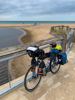
I'm convinced the best way to explore Chicago's beaches is by bicycle along the Lakefront Trail. I spent a few hours going in and out of the city on two different days in early September. On another trip I'll have to explore more of the beaches north of downtown up towards Evanston.
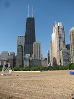
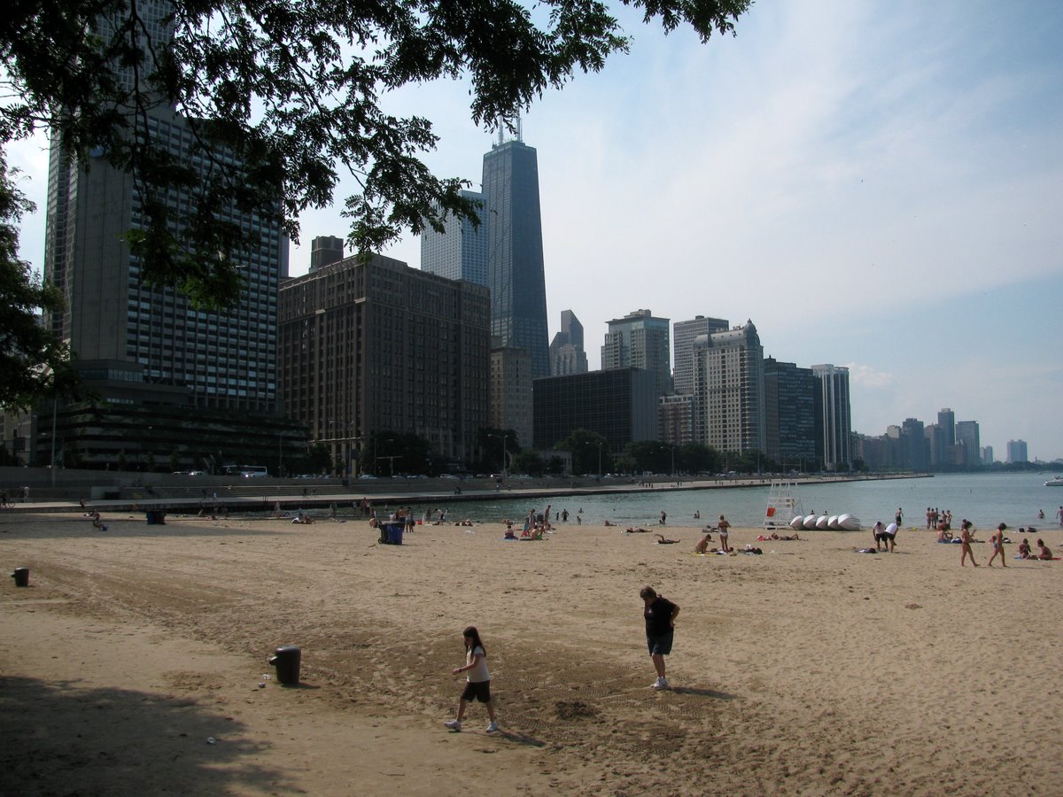
Oak Street Beach, like all of Chicago's beaches, was created from scratch in one of many appropriately-oriented (to north wind and waves) bends along the city's vast linear lake fill. Historically, this was a low shoreline consisting of southward-directed spits on the north side of the mouth of the Chicago River.
Water levels have been high this year and the lake was lapping onto the heavily-used lake shore trail. It would probably be a lot more exciting during a big storm. This is an interesting contrast to my last post from here, back in July 2010, when the lake was much lower.
 This visit was in early September, almost four months ago.
Wind, and therefore waves, blowing down Lake Michigan (on both sides), results in southward sediment transport and the accumulation of sand towards the south end of the lake. Here on the southeastern corner, the sand has built a robust series of dunes (many of them now well back from the advancing shoreline and largely transformed into forested ridges separated by linear wetlands).
These photos don't show it, but I could see the Chicago skyline across the lake (still a long ways away). What you do see in these photos are the stacks of steel mills and generating plants in the middle distance. It's nice that the Indiana Dunes (a State Park) preserve some natural shoreline on a coast that has suffered historically from intense industrial development (and much now in disrepair).
AERIAL VIEW
 Ironically, today's wind was blowing strongly from the south and this leeward shore was welcome relief. I actually modified my route the last couple of days specifically to avoid the strong winds blowing north along Michigan's shoreline. By tomorrow (September 4th), unfortunately, they will be from the north again as I turn the corner and ride into Chicago.
Much of the southeastern shore of Lake Michigan, from Wisconsin south through Chicago towards the Indiana Dunes at the south end of the Lake, consists of eroding bluffs. But there are a number of locations where the bluff is absent, either because a lower river valley intersects the shore or because the beaches have accreted out into the lake.
AERIAL VIEW
I don't know the explanation for Wind Point, just north of Racine, but it extends out into the lake. It's low, but doesn't appear depositional. I suspect there may be bedrock control - a more resistant layer at modern lake level - but would need to do considerably more homework for this to be anything more than speculation.
Sediment transport is pretty strongly from north to south on this shore of the lake, reflecting the strong north wave action (winds and long fetch). The presence of both sand and gravel, like on Puget Sound, is mainly a function of glacial sediment sources.
These small trees being eroded away just south of the lighthouse tell a story, but it's not a story I learned during my short visit!
A couple of days after getting back to Seattle, I was throwing out some old stuff in my cubicle and ran across a 2" thick report I had obtained in the mid-1990s that described in detail the geology and engineering of the Lake Michigan shoreline of Milwaukee County. Aerial photos show that this beach was constructed in 1988 (Photos from Southeastern Wisconsin Regional Planning Commission, 1989).
Like other Great Lakes cities, much of Milwaukee's shoreline was built out into the lake with fill, the better to create marinas, public facilities, and recreational space. As a result, beaches tend to be highly engineered pocket beaches, often shaped by groins, adjacent jetties, and offshore breakwaters. McKinley Beach is part of a segmented headland breakwater system - there's a longer beach a short distance farther north (see aerial below).
AERIAL VIEW
The gap in the riprap constrains the direction that waves can approach the beach and the breakwater prevents sand and gravel from escaping the confined pocket. Regardless of the direction with which waves approach (the big waves come mainly from the north on Lake Michigan), they pass through the narrow opening and break in regular curves on the crescent-shaped beach.


 Once upon a time, sand worked its way southward down the west side of Lake Michigan, building out into the lake in a series of spits at the mouth of the Chicago River. But one thing led to another and the beaches were gradually (or not so gradually) left behind as the city moved into the lake.
Then David Burnham came along and saw the potential for a hugely public, albeit hugely artificial, shoreline. Like many other Great Lakes cities, lake fill was an obvious solution, but in Chicago they seemed to have done it better and bigger than others. The result is miles of public park along the lake front, trimmed with stepped concrete walls, artificial beaches, marinas, and park space. The wind and wave regime hasn't changed appreciably since the city arrived, so sand placed along the shore would move southward rapidly were it not configured with jetties and landfill into a series of north facing pocket beaches. Some are isolated, some segmented by groins.
Oak Street Beach, at the north end of Michigan Avenue, fits into a corner in the lake fill - kept in place by Lake Shore Drive as it curves east around the northern part of downtown. The straight seawall north of Oak Street precludes a beach, so it sort of pretends to be one. Despite what could easily have been viewed as ugly, I thought it was actually pretty neat and it certainly got its share of use, at least later in the day (these shots are mainly early in the morning). I suppose it was underwater in the mid-1980s when lake levels were high.

 We skirted the northeastern edge of Lake Michigan in the dark and wound up in St. Ignace for the night. We stayed on the lake and in the morning I was reminded that we were back on Lake Huron (the eastern extension of Lake Michigan - it's not like there is anything actually separating the two except for the bridge) by the grassy shoreline exposed out in front of the seawalls. It reminded me of the shorelines in Inverhuron and Craigleith, where the falling lake had left similar stranded shorelines.


 This visit was in early September, almost four months ago.


 Ironically, today's wind was blowing strongly from the south and this leeward shore was welcome relief. I actually modified my route the last couple of days specifically to avoid the strong winds blowing north along Michigan's shoreline. By tomorrow (September 4th), unfortunately, they will be from the north again as I turn the corner and ride into Chicago.


 Silver Beach in St. Joseph was crowded at lunchtime on Saturday when we passed through (more pictures at hshipman).


