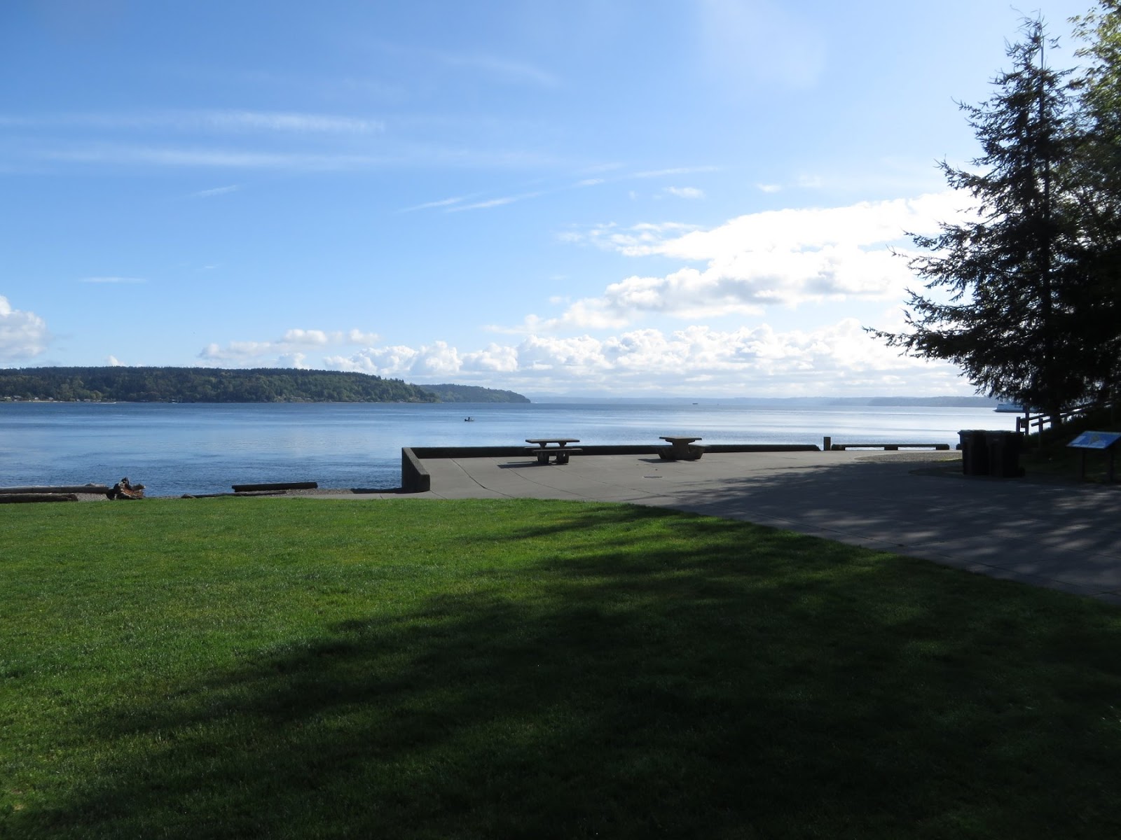
The Dick Gilmur Shoreline Access point is located along Marine View Drive on the north side of Commencement Bay, on the way out towards Browns Point. It's a relatively recent soft shore project intended to restore a more natural beach while also allowing for a small parking area and kayak launch.
AERIAL VIEW
One of the questions that keeps coming up for me is how to catalog and disseminate information about the large number of soft shore and beach restoration projects going on around Puget Sound. Overall, it's a remarkably positive story that needs to be told. It would provide people with design ideas and inspiration to do more projects and to do them better. It might provide an inventory from which people could choose sites for monitoring, for documentation, or simply for visiting.
But this has proven difficult. The number of projects is large, but they vary enormously and there is much disagreement about what types of projects should be included and how to assess performance. Many are poorly known and poorly documented. There is sensitivity among funders and landowners and contractors about possible problems and this makes it difficult to discuss the less successful projects (or more commonly, successful projects with unsuccessful elements), even if those are the ones we would all learn the most from.
Showing posts with label pierce. Show all posts
Wednesday, August 08, 2018
Monday, March 09, 2015
Dickman Mill
This mill in Tacoma's Old Town was the last of the lumber mills along Ruston Way to close. It shut down in 1977 and burned down in 1979.
In the late 1990s, Tacoma Parks developed a plan to clean up the site and turn it into a park. It required sifting through issues of remediation, wetlands, public access and recreation, ecological restoration, and historic preservation (and probably many others, too). Which wasn't easy, but was eventually successful.
The concept envisioned a beach and an estuarine marshand it was tricky to figure out how to configure this given the geometry of the old site, but the design actually ended up taking advantage of the historic footprint. The beach is a swash-aligned pocket beach, constrained by the concrete foundation of the mill. The tidal lagoon fills and empties through an inlet that runs through the old structure, which reduces the likelihood that sediment clogs the inlet (an early idea was to create an inlet in the beach itself, but there was no way to make this work without extensive maintenance).
AERIAL VIEW
To see what this site once looked like, check out the Tacoma Library collection:
Dickman Mill, 1948
The old field of piles still lies offshore. The base of the old cone burner is a weird lagoon at high tide. The backshore has filled up with wood debris. and the estuary seems to be doing pretty well (as often the case, it took a while for the vegetation to get established). On the other hand, the park (completed in 2000) looked like it needed some work. Some of the concrete walkaways were having to be repaired and blackberry was taking over the fringes of the marsh.
Labels:
pierce,
puget sound,
restoration,
salish sea,
tacoma,
washington
Monday, April 28, 2014
Point Defiance
While Owen Beach was broad and stable and seemed well stocked with sediment, the situation changes as you walk north toward Point Defiance itself. Much of this stretch consists of relatively high sandy bluffs, eroding over the top of clay layers exposed at beach level. There's tilting to the beds, and some faulting, suggesting more structural activity than we typically see on Puget Sound bluffs. And as you approach the point the beach thins and there are dramatic ledges of older, more resistant materials outcropping at low tide. This stretch really deserves a post of its own, but this entry is actually about something else.
AERIAL VIEW
The best part is on the western side of the tip of Point Defiance, where a dramatic divot has been taken out of the beach. The beach simply vanishes -- dropping off into the head of a deep submarine ravine. Locals said that it had cut back significantly just this past winter. There wasn't much room to get around and there was something pretty spooky about this spot. I'd love to see some high resolution bathymetry of this place.
Rounding the point and heading back south along the Tacoma Narrows, the beach changes completely. There really isn't much beach on this side -- a combination, I suspect, of the steep topography/bathymetry and the strong tidal currents that probably carry most loose sediment off into deep water pretty rapidly.
Point Defiance is a distinctive feature in the geography of Puget Sound - something pretty special is going on here, most likely related to the underlying geology and its subsequent influence over glacial drainage patterns.
Labels:
pierce,
puget sound,
salish sea,
tacoma,
washington
Location:
Washington, USA
Owen Beach
AERIAL VIEW
Labels:
pierce,
puget sound,
salish sea,
tacoma,
washington
Location:
Tacoma, WA, USA
Tuesday, October 01, 2013
Penrose Point
Pulling out seawalls has become pretty popular in the last few years around Puget Sound. I guess we've discovered that many of them are either unnecessary, or can be rendered unnecessary by rethinking the way we use the area behind them. We've also found that they can make the shoreline a whole lot nicer!
Labels:
pierce,
puget sound,
salish sea,
washington
Monday, March 25, 2013
Chambers Bay
I think this beach is where I'll bring the class in May, since it's close to the classroom (which looks down on it from the top of the hill) and because it's a beach that looks like it can tell some interesting stories. The challenge will be finding geologic stories that are relevant to other Puget Sound shorelines, not just stories unique to this strange anthropogenic coastline.
Just like Richmond Beach in the previous post, this site began as a late glacial delta, become a gravel pit (a very large one), and has ended up a park.
Previous post from here: Pioneer: October, 2010
Post from the active mine at Dupont, south of here: Sequalitchew Delta, October 2011
AERIAL VIEW
A high bluff once rose steeply from this beach. The beach itself probably ran in a fairly straight line, interrupted only by occasional clusters of large logs and downed trees. The bluffs receded rapidly when the mining began and now they now lie 1000 meters to the east.
Beaches are active and often very young geologic landscapes. The wave environment at this one probably hasn't changed much in the last 150 years, but much else has, and the beach has responded accordingly. Resistant headlands have been imposed in the form of concrete structures, pier abutments, and coarse cobble lags leftover from loading operations, and these have altered the configuration of the beach. The original bluff sediment sources have been replaced by the beach itself, as one part erodes to supply another. Transport patterns have changed to reflect the beach's new shape and the shifting sediment sources.
It's a wonderful beach, but also a very different one than the one that had gradually transgressed into the forested bluffs for thousands of years. It tells some neat stories, but the most obvious have to do with its human history.
Labels:
pierce,
puget sound,
salish sea,
washington
Location:
Chambers Creek Properties
Tuesday, August 28, 2012
McNeil Island
The erosion control structures of choice were massive piles of coiled cable (old submarine nets? but they looked like giant mattress springs) and tall stacks of precast Ecology blocks.
AERIAL VIEW
Labels:
pierce,
puget sound,
salish sea,
washington
Location:
McNeil Island
Hyde Point
This little pair of spits is located just north of Hyde Point on the east side of McNeil Island. Most of our mapping was from the boat, but we had permission to land and this was a great spot to pull the boat up and wander over to look at the back-barrier marsh. The aerial view shows the relationship of these two small lagoons - the southern one tucked into a cove in the upland, the northern one enclosed within a hooked spit.
AERIAL VIEW
At one time, I suspect these two lagoons may have been connected with everything draining out the north end, but now they seem to be plumbed separately since the southern one has it's own tidal channel.
Labels:
pierce,
puget sound,
salish sea,
washington
Location:
McNeil Island
Gertrude Island
Gertrude is another small island just offshore of McNeil, this one on the north side at the mouth of Still Harbor. It's off limits to folks like us to protect the seals that haul out on the beaches - particularly at the south end. The east side is very sheltered, with salicornia growing on the beach and a low bank overhung with trees. The west side is a bit more exposed and there is more evidence of erosion.
The funky little spit at the south end appears to be a low terrace -- the flat surface is well above normal backshore elevations and consists of a low erosional scarp. Another geologic question goes unanswered!
AERIAL VIEW
Labels:
pierce,
puget sound,
salish sea,
washington
Location:
Gertrude Island
Pitt Island
Pitt Island is pretty small - a hectare or so of madrone and fir and poison oak sticking out of the narrow channel between the Key Peninsula and McNeil Island. Wave action from the north (infrequent but significant fetch) and from the south (frequent but sheltered) results in two small cusps at the east and west ends - about the extent of the beach on this island.
AERIAL VIEW
This is part of the McNeil Island Corrections (now Commitment) Facility, so we had permission to land (although it took a phone call to remind the guards with the bullhorn on McNeil about that).
Labels:
pierce,
puget sound,
salish sea,
washington
Location:
Pitt Island
Sunday, April 22, 2012
Foss Waterway
Tacoma, the City of Destiny, was destined to be built on the hills that rise above the western edge of the Puyallup Delta. The Foss probably began as a tidal slough along this edge, fed by the creeks that emerged from the hills to the south and west. In some ways, this is still what it is, albeit straightened, deepened, and devegetated. The streams enter through storm drains - two very large ones at the head end, in particular -- cascading across rocks at low tide and into the Sound.
It's hard to define what a natural shoreline is along such an artificial body of water, but the current banks are probably higher and steeper than they were before the waterway was dredged and the adjacent land was filled. In recent years, there have been some efforts to soften the edges a little bit - for habitat, for recreation, for aesthetic variety.
On the west side of the Foss, where most of the recent redevelopment has occurred, there have been attempts to build narrow benches into the steep bank, often just below the seawall at the edge of the promenade. These benches become narrow strips of marsh, perched atop walls made from rows of logs and large boulders. I can't speak to how much biological value these features add, but they certainly appear more diverse and more interesting than the uniformly rocked banks typically found in such situations.
More pictures at hshipman: Tacoma
Labels:
pierce,
puget sound,
salish sea,
tacoma,
washington
Location:
1616 E D St, Tacoma, WA 98421, USA
Subscribe to:
Posts (Atom)