skip to main |
skip to sidebar
Duluth is built at the northern end of an impressive barrier beach tucked into the western tip of Lake Superior. Much of the shoreline in the Canal Park area has been hardened through more than a century of industrial and port development, but a nice red gravel beach remains in the corner formed between the northern shoreline of the lake (below downtown) and the base of the barrier.
AERIAL VIEW
The urban/industrial context was different, but the red gravel and the multiple storm berms were the same we had been seeing all the way down the North Shore.
I also posted briefly from Duluth during a brief drive-through two years ago (Duluth: June 2010).
 Pebble Beach lies in a cove just west of the Split Rock Lighthouse. The pebble part of the beach is limited to the western end of the little bay and the pebbles run out in both directions. On the south side, the tombolo looks like it has barely enough gravel to reach its island (see aerial below). And on the north side, captured in one of these photos, the pebbles transition abruptly to a sediment-starved beach. The local bedrock is sufficiently resistant so that it may provide little new material to the beach and the beach is left with whatever the glaciers and any local streams originally left it.
AERIAL VIEW
This was a neat find, discovered while flipping through a book in the gift store earlier in the morning at Grand Portage. I was afraid we'd have trouble locating the turnoff, but it turned out to be well marked. The walk to the beach is a short one.
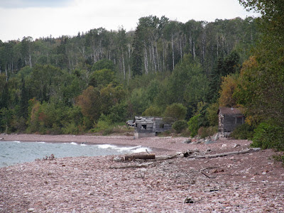
This used to be a log landing, where timber was collected before being rafted to pulp mills, but it has now been wonderfully stewarded back into health.
UMD - Restoration
North Shore Stewardship Association

I'm sure the industrial history impacted the site topographically geologically and biologically, but I felt I could still sort out some of the beach's story from our short visit.
 A rocky point, once an island, anchors the tombolo. The point reportedly consists of thin-bedded lavas (very old ones), covered with lichen, and visitors were encouraged to avoid damaging the latter.
AERIAL VIEW
 The beach in the cove - an east-facing pocket again - is a mix of boulders, cobbles, and gravel, with the beach coarsening out towards the point. Some of this may be the inherent sorting one often finds on pocket beaches, but the cobble at the outer end was awfully large for the protected bay. I suspect that it may be overwash from the coarser grained beach on the exposed side of the tombolo.
This place felt a lot like Acadia National Park in Maine, with its bedrock cliffs, cascading stream, and isolated gravel beach. I think the road right along the edge and the stone guard rails helped, too.
 The beach again faces a little east, rather than directly offshore, suggesting the influence of northeasterly storms in shaping it. Maybe it was the light, or my imagination, but the beach looked like maybe the red gravel of the last few places is now mixed with gray, possibly signaling some sort of local geologic change. Could the river be draining an area with darker rocks?
AERIAL VIEW
The beach again faces a little east, rather than directly offshore, suggesting the influence of northeasterly storms in shaping it. Maybe it was the light, or my imagination, but the beach looked like maybe the red gravel of the last few places is now mixed with gray, possibly signaling some sort of local geologic change. Could the river be draining an area with darker rocks?
AERIAL VIEW
 Grand Marais is built at the base of a tombolo, so it's got beaches on both sides. The one on the east side is another broad sweep of reddish gravel, much like some of the beaches we visited earlier. There's some large riprap and an assortment of partially failed seawalls trying to protect the places where development pushed a little too far across the beach. (Isn't this so often the case, where erosion is essentially a hazard of our own making).
AERIAL VIEW
 The beach on the west side consists mainly of a small pocket beach with a sheet pile wall on the tombolo end and an impressive riprap revetment protecting the road and the Java Moose coffee house at the landward end.
The french fur traders left more than one Grand Marais on Lake Superior - we visited another a couple years ago (Grand Marais, Michigan) after visiting the Grand Sable Dunes. A mere 200 miles east of here across the big lake Gitche Gumee.
Nothing spectacular, just a small stream mouth on a gravel beach. I guess stream flows must be high enough to occasionally flush out the mouth, but then the waves rebuild the beach right back across.
I don't think that secular changes in lake level can explain the higher berms, so I assume they represent the high water that accompanies big storms on the lake.
 AERIAL VIEW
The highlight of this beach is not actually the beach, but the lodge (hshipman: Naniboujou Lodge), and lunch in the colorful dining room took precedence over exploring the beach.
It's another long, curved gravel beach on the northeast side of a small promontory. The mouth of the Brule River nudges the beach into the lake just to the southwest. There have been some feeble, and not terribly necessary, efforts at erosion control in front of the lodge, where waves have nibbled away at the low bank - perhaps the edge of an old river terrace formed at a higher lake level?
AERIAL VIEW
This will be the first of several entries from Minnesota's north shore of Lake Superior. All are based on fairly short visits during a one day drive between Thunder Bay and Duluth. On a long trip dominated by prairies and mountains, this was the day reserved for beaches. As usual, the posts are based on a combination of cursory observations and small amounts of pre- and post- trip web-work. I hope my interpretations aren't too far off the mark - but if you're writing a term paper on the North Shore Volcanic Group or on Lake Superior sediment transport, I recommend you consult more rigorous sources! But feel free to borrow my pictures.
The bedrock along this shoreline consists largely of mafic volcanics over a billion years old, although they are contained in a broader landscape of gabbro and diabase. Glaciers modified the surface much more recently, creating the coarse grained sediment that has subsequently been reorganized to form beaches. The gravel beaches vary from dark gray to red (although red certainly dominates), depending I assume, on local variation in the oxidation of the Proterozoic source rock. In a blog about beaches, I rarely get to use words like Proterozoic, but I have written about Proterozoic beaches previously, like the rippled Belt Series rocks in the riprap at Shipwreck Point in June 2007 and the beautiful Tapeats beaches at Blacktail Canyon (Cambrian beaches composed of Proterozoic sediment) in June 2009.
The beach on Deronda Bay is typical of many beaches along the north shore. It is basically a pocket beach, oriented towards the east and therefore fairly oblique to the coastline. This presumably is a function of the dominant wave action being out of the east. On straight segments of this coastline with sufficient sediment, this would tend to transport material southwest, forming accumulations on the eastern sides of rocky promontories.
AERIAL VIEW
The gravel was stacked up into a series of berms, suggesting storms at several lake levels. And the gravel on this beach was uniformly red. I would have looked more carefully at the lithology, but my mineralogy is as rusty as the oxidized volcanics. I only picked up the flatter stones, and that was only to see how many times I could get them to skip.
Much of Thunder Bay's waterfront is industrial or otherwise difficult to access. Marina Park in the north part of downtown was nice, but all riprap. Chippewa Park south of town has two beaches. The main swimming beach (I guess some people swim in Lake Superior) is a sandy curve along a small cove sheltered by a rock breakwater.
The pictures here are of Sandy Beach, which is more exposed than Chippewa's swimming beach and lies just to the south. It's the only sand along this stretch, which made me wonder if it could have been trucked in. The beach is broken into several small curves by rock groins.
This is a uneven stretch of coastline. The adjacent shores are ragged (see aerial below), suggesting that the geology may be irregular (maybe piles of glacial cobble in otherwise soft material, or resistant ledges in softer bedrock). Or perhaps, the shoreline has simply eroded for decades and those little points are old rock groins, sort of like the ones on this beach, but without the sand in between. I have no idea and only noticed the pattern once I was back in Seattle.
AERIAL VIEW
 This beach must be icebound all winter - so wave action is probably most significant in fall before it freezes over. I don't have enough experience in these settings to know what peculiar things moving ice does to beach gravel, although I assume under certain conditions it can leave some pretty cool landforms - ice thrusts, rafted pebbles, ice scour.
Thunder Bay at hshipman. As usual, my other blog parallels this one, but instead of rambling commentary about beaches, you get rambling commentary about other stuff. Sometimes it includes a little non-beach geology; sometimes it just has pictures of food.


One of the neatest places to find coastal sand dunes is high on the top of bluffs. The Grand Sable Dunes, west of the town of Grand Marais, on the southern shore of Lake Superior are one of the best examples of perched dunes anywhere. Wind blowing across the lake accelerates up the bluff face, eroding the sandy sediments and carrying the sand over the crest where it is deposited to form dunes.
Our visit, and these pictures, captured very little of the actual dunes. The dunes themselves are on top of the bluffs, which consist of sandy non-aeolian deposits. The Google Maps aerial image linked to the title of the shows the dunes better. The bluffs are still very dune-like and I'm sure when D ran down and slogged back up the 300' vertical log slide, he didn't really care that it was a bluff and not a sand dune.
My post-visit homework was fascinating. Like dunes in many places, these have built in discrete episodes, the most recent 300 years ago. The episodes are driven by sand availability, which in turn is driven by the condition of the bluffs. High water levels lead to more rapid toe erosion. More rapid toe erosion leads to active, exposed bluffs. Active, exposed bluffs make more sand available for the wind to blow up the face of the bluff. More sand makes bigger dunes. And when the dunes are growing, they block streams, raising base level and creating ponds, which can create a stratigraphic record of dune building events and of variations in the level of Lake Superior.
We have perched dunes on Puget Sound, too. One set are high on the northwestern shore of Protection Island, north of Port Townsend. My favorite ones on Puget Sound would have been the dunes perched on the high bluffs of northwest Whidbey Island, overlooking the Strait of Juan de Fuca. Unfortunately, these dunes have been pretty much eliminated - leveled and buried under view homes on West Beach Road. They were not as large or extensive as these in Michigan, but they still would have been cool.


