skip to main |
skip to sidebar
There are beaches up and down Chicago's long shoreline - including some great lakefront parks south of the city, such as at 63rd Street and at Rainbow Beach. Where there isn't beach, there is seawall (though it comes in a variety of forms). But whether beach or seawall, it's almost all public and easily accessible.
AERIAL VIEW
I'm convinced the best way to explore Chicago's beaches is by bicycle along the Lakefront Trail. I spent a few hours going in and out of the city on two different days in early September. On another trip I'll have to explore more of the beaches north of downtown up towards Evanston.
Oak Street Beach, like all of Chicago's beaches, was created from scratch in one of many appropriately-oriented (to north wind and waves) bends along the city's vast linear lake fill. Historically, this was a low shoreline consisting of southward-directed spits on the north side of the mouth of the Chicago River.
Water levels have been high this year and the lake was lapping onto the heavily-used lake shore trail. It would probably be a lot more exciting during a big storm. This is an interesting contrast to my last post from here, back in July 2010, when the lake was much lower.
 This visit was in early September, almost four months ago.
Wind, and therefore waves, blowing down Lake Michigan (on both sides), results in southward sediment transport and the accumulation of sand towards the south end of the lake. Here on the southeastern corner, the sand has built a robust series of dunes (many of them now well back from the advancing shoreline and largely transformed into forested ridges separated by linear wetlands).
These photos don't show it, but I could see the Chicago skyline across the lake (still a long ways away). What you do see in these photos are the stacks of steel mills and generating plants in the middle distance. It's nice that the Indiana Dunes (a State Park) preserve some natural shoreline on a coast that has suffered historically from intense industrial development (and much now in disrepair).
AERIAL VIEW
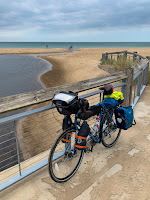 Ironically, today's wind was blowing strongly from the south and this leeward shore was welcome relief. I actually modified my route the last couple of days specifically to avoid the strong winds blowing north along Michigan's shoreline. By tomorrow (September 4th), unfortunately, they will be from the north again as I turn the corner and ride into Chicago.
My route west paralleled the shore of Lake Ontario, but was generally far enough inland to miss most of the shoreline itself. One exception was at Sodus Point, where I rode out to the beach and followed the 'coast' for a few miles west before heading south again. These photos were taken back in late August (yes, I am a long way behind).
The north-facing shoreline of Lake Ontario in New York State consists of bluffs and a series of barrier beaches built across the mouths of north trending valleys. I'm not sure whether to call the drowned stream mouths and lagoons behind the barriers estuaries or not - it sort of depends on whether you define estuaries around salt water (this is a freshwater system), or around their physical geomorphology (which works for me).
AERIAL VIEW
I don't know much about this shoreline, other than from a few articles over the years and from what I can infer from the maps and imagery. Sediment transport along the beaches is generally from west to east and this is clearly shown by the assymetric build up of material at jetties. Big wide beaches on the west sides (like here at Sodus Point), and very thin, sketchy barriers on the east sides.
The Great Lakes have been running pretty high and Lake Ontario is no exception. This fall there were news stories about funding efforts to address flooding and erosion at a variety of spots along this coast both east and west of Rochester (including the sediment-starved barrier immediately east of these jetties). Water levels on the Great Lakes vary over cycles of many years as the large watershed is a great integrator of long-term regional hydrologic patterns.
We were in Chicago a little less than three weeks ago, winding up our brief trip back to the midwest. My only foray to the beach was on the morning we left, when I dodged rain squalls on my way to meeting M for breakfast at Tempo.
I've got much better shots of these beaches from an earlier trip: Chicago: July 2010
The first three photos are from Oak Street; the bottom one is from Ohio Street Beach.
But rain or not, I still love these public beaches against the backdrop of Chicago's skyline. There's nothing terribly natural about them - nourished and groomed pocket beaches have replaced the spits and marshes that once marked the mouth of the Chicago River - but it shows that we can still provide ways for people to interact directly with the water, even in our most urban settings.
There are a lot more photos from this trip, mainly of skyscrapers, over on the other blog (hshipman: Chicago).
Much of the southeastern shore of Lake Michigan, from Wisconsin south through Chicago towards the Indiana Dunes at the south end of the Lake, consists of eroding bluffs. But there are a number of locations where the bluff is absent, either because a lower river valley intersects the shore or because the beaches have accreted out into the lake.
AERIAL VIEW
I don't know the explanation for Wind Point, just north of Racine, but it extends out into the lake. It's low, but doesn't appear depositional. I suspect there may be bedrock control - a more resistant layer at modern lake level - but would need to do considerably more homework for this to be anything more than speculation.
Sediment transport is pretty strongly from north to south on this shore of the lake, reflecting the strong north wave action (winds and long fetch). The presence of both sand and gravel, like on Puget Sound, is mainly a function of glacial sediment sources.
These small trees being eroded away just south of the lighthouse tell a story, but it's not a story I learned during my short visit!
A couple of days after getting back to Seattle, I was throwing out some old stuff in my cubicle and ran across a 2" thick report I had obtained in the mid-1990s that described in detail the geology and engineering of the Lake Michigan shoreline of Milwaukee County. Aerial photos show that this beach was constructed in 1988 (Photos from Southeastern Wisconsin Regional Planning Commission, 1989).
Like other Great Lakes cities, much of Milwaukee's shoreline was built out into the lake with fill, the better to create marinas, public facilities, and recreational space. As a result, beaches tend to be highly engineered pocket beaches, often shaped by groins, adjacent jetties, and offshore breakwaters. McKinley Beach is part of a segmented headland breakwater system - there's a longer beach a short distance farther north (see aerial below).
AERIAL VIEW
The gap in the riprap constrains the direction that waves can approach the beach and the breakwater prevents sand and gravel from escaping the confined pocket. Regardless of the direction with which waves approach (the big waves come mainly from the north on Lake Michigan), they pass through the narrow opening and break in regular curves on the crescent-shaped beach.
Duluth is built at the northern end of an impressive barrier beach tucked into the western tip of Lake Superior. Much of the shoreline in the Canal Park area has been hardened through more than a century of industrial and port development, but a nice red gravel beach remains in the corner formed between the northern shoreline of the lake (below downtown) and the base of the barrier.
AERIAL VIEW
The urban/industrial context was different, but the red gravel and the multiple storm berms were the same we had been seeing all the way down the North Shore.
I also posted briefly from Duluth during a brief drive-through two years ago (Duluth: June 2010).
 Pebble Beach lies in a cove just west of the Split Rock Lighthouse. The pebble part of the beach is limited to the western end of the little bay and the pebbles run out in both directions. On the south side, the tombolo looks like it has barely enough gravel to reach its island (see aerial below). And on the north side, captured in one of these photos, the pebbles transition abruptly to a sediment-starved beach. The local bedrock is sufficiently resistant so that it may provide little new material to the beach and the beach is left with whatever the glaciers and any local streams originally left it.
AERIAL VIEW
This was a neat find, discovered while flipping through a book in the gift store earlier in the morning at Grand Portage. I was afraid we'd have trouble locating the turnoff, but it turned out to be well marked. The walk to the beach is a short one.
This used to be a log landing, where timber was collected before being rafted to pulp mills, but it has now been wonderfully stewarded back into health.
UMD - Restoration
North Shore Stewardship Association

I'm sure the industrial history impacted the site topographically geologically and biologically, but I felt I could still sort out some of the beach's story from our short visit.
 A rocky point, once an island, anchors the tombolo. The point reportedly consists of thin-bedded lavas (very old ones), covered with lichen, and visitors were encouraged to avoid damaging the latter.
AERIAL VIEW
 The beach in the cove - an east-facing pocket again - is a mix of boulders, cobbles, and gravel, with the beach coarsening out towards the point. Some of this may be the inherent sorting one often finds on pocket beaches, but the cobble at the outer end was awfully large for the protected bay. I suspect that it may be overwash from the coarser grained beach on the exposed side of the tombolo.
This place felt a lot like Acadia National Park in Maine, with its bedrock cliffs, cascading stream, and isolated gravel beach. I think the road right along the edge and the stone guard rails helped, too.
 The beach again faces a little east, rather than directly offshore, suggesting the influence of northeasterly storms in shaping it. Maybe it was the light, or my imagination, but the beach looked like maybe the red gravel of the last few places is now mixed with gray, possibly signaling some sort of local geologic change. Could the river be draining an area with darker rocks?
AERIAL VIEW
The beach again faces a little east, rather than directly offshore, suggesting the influence of northeasterly storms in shaping it. Maybe it was the light, or my imagination, but the beach looked like maybe the red gravel of the last few places is now mixed with gray, possibly signaling some sort of local geologic change. Could the river be draining an area with darker rocks?
AERIAL VIEW
 Grand Marais is built at the base of a tombolo, so it's got beaches on both sides. The one on the east side is another broad sweep of reddish gravel, much like some of the beaches we visited earlier. There's some large riprap and an assortment of partially failed seawalls trying to protect the places where development pushed a little too far across the beach. (Isn't this so often the case, where erosion is essentially a hazard of our own making).
AERIAL VIEW
 The beach on the west side consists mainly of a small pocket beach with a sheet pile wall on the tombolo end and an impressive riprap revetment protecting the road and the Java Moose coffee house at the landward end.
The french fur traders left more than one Grand Marais on Lake Superior - we visited another a couple years ago (Grand Marais, Michigan) after visiting the Grand Sable Dunes. A mere 200 miles east of here across the big lake Gitche Gumee.


 This visit was in early September, almost four months ago.


 Ironically, today's wind was blowing strongly from the south and this leeward shore was welcome relief. I actually modified my route the last couple of days specifically to avoid the strong winds blowing north along Michigan's shoreline. By tomorrow (September 4th), unfortunately, they will be from the north again as I turn the corner and ride into Chicago.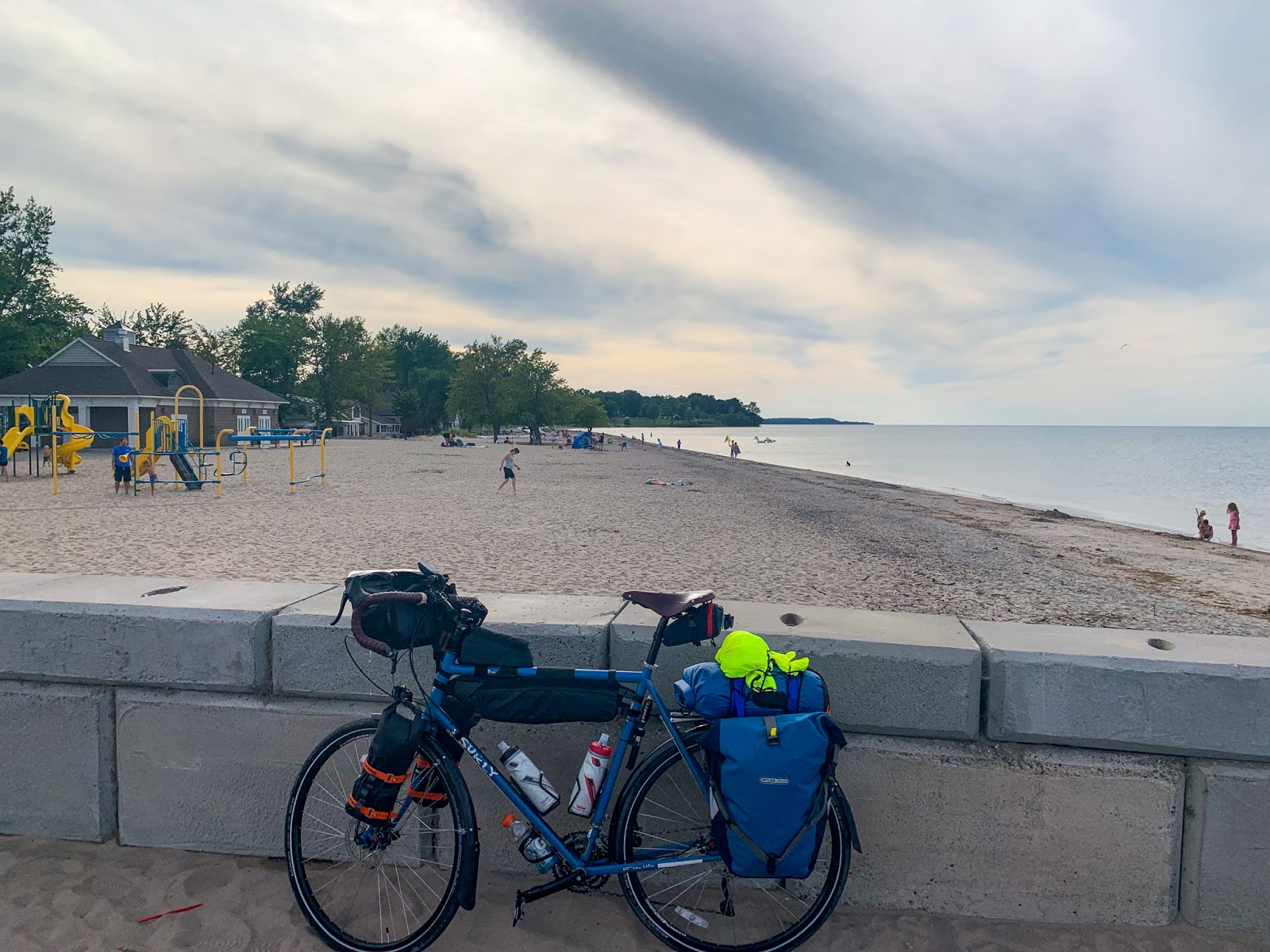


 Pebble Beach lies in a cove just west of the Split Rock Lighthouse. The pebble part of the beach is limited to the western end of the little bay and the pebbles run out in both directions. On the south side, the tombolo looks like it has barely enough gravel to reach its island (see aerial below). And on the north side, captured in one of these photos, the pebbles transition abruptly to a sediment-starved beach. The local bedrock is sufficiently resistant so that it may provide little new material to the beach and the beach is left with whatever the glaciers and any local streams originally left it.


 A rocky point, once an island, anchors the tombolo. The point reportedly consists of thin-bedded lavas (very old ones), covered with lichen, and visitors were encouraged to avoid damaging the latter.
  The beach in the cove - an east-facing pocket again - is a mix of boulders, cobbles, and gravel, with the beach coarsening out towards the point. Some of this may be the inherent sorting one often finds on pocket beaches, but the cobble at the outer end was awfully large for the protected bay. I suspect that it may be overwash from the coarser grained beach on the exposed side of the tombolo.

 The beach again faces a little east, rather than directly offshore, suggesting the influence of northeasterly storms in shaping it. Maybe it was the light, or my imagination, but the beach looked like maybe the red gravel of the last few places is now mixed with gray, possibly signaling some sort of local geologic change. Could the river be draining an area with darker rocks?


 Grand Marais is built at the base of a tombolo, so it's got beaches on both sides. The one on the east side is another broad sweep of reddish gravel, much like some of the beaches we visited earlier. There's some large riprap and an assortment of partially failed seawalls trying to protect the places where development pushed a little too far across the beach. (Isn't this so often the case, where erosion is essentially a hazard of our own making).
 The beach on the west side consists mainly of a small pocket beach with a sheet pile wall on the tombolo end and an impressive riprap revetment protecting the road and the Java Moose coffee house at the landward end.


