skip to main |
skip to sidebar


The northern shore of lake Erie (Google Maps) is punctuated by three elegant landforms. The location of each may be determined by glacial features like moraines, but the shape of each is all about wind and waves and moving sediment. There are good bathymetric maps and geologic explanations of Lake Erie at NOAA's NGDC.
Long Point is a spit, neither a simple nor a small one.
Point aux Pins (Rondeau Provincial Park) is an arcuate promontory that might be categorized as a recurved or cuspate spit. Its southeastern shore is composed of a beautiful series of accreted beach ridges, while its western shore is somewhat more tenuous. There is a big offset in the shoreline at the jetties at Erieau and the map on the wall at the Eau Buoy Cafe showed that in 1868 the natural opening was much larger and located pretty much where the town is today.
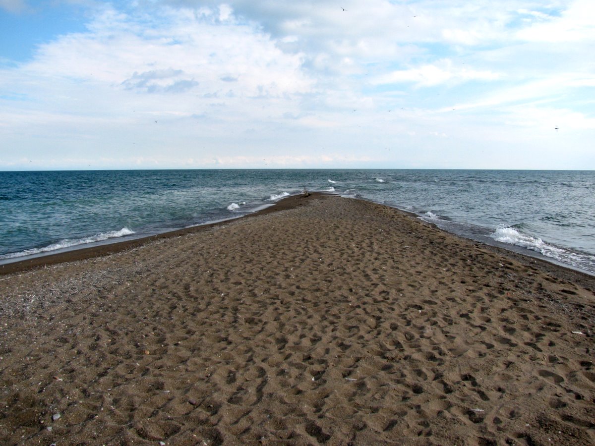
Point Pelee, where all of the these photos are from, is a large cuspate foreland, tapering to a slender point. It has lost ground, or at least changed shape, over time, making the riprap on the west side of the tip seem both unfortunate and sort of futile. The sinuous tip vanished southward under the waves, tempting me to wade out farther, but the biting flies argued against it.
Point Pelee is the southernmost point in mainland Canada. The country's true southernmost point is a very similar looking spit at the southern tip of Pelee Island, maybe 25 km south of here.


This is a more geographically general post than most, since my goal was simply to capture several shots taken as we traveled between the Cape Rondeau area and the western end of the lake. This shoreline consists mainly of bluffs, many of clay or silt, but there are also low beaches, including the large barriers that have formed at Point aux Pins and Point Pelee.
The geography of this shoreline appears to be controlled by larger glacial features and sediment variability, subsequently reshaped by Holocene coastal processes. Humans have left their mark, too, with jetties, lots of groins, and a mish mash of armoring, at least locally. Most of the shoreline development is on the low beaches, probably because the bluffs are eroding quickly enough to discourage building and because the demand for Lake Erie view property isn't the same as on Puget Sound.
The timber groins are at Erie Beach?, just west of Erieau (Aerial).
The bluffs are at Point Alma (Aerial).
The sheetpile groins are on the west side of Point Pelee, near Seacliffe. (Aerial)


 The Black Swamp used to extend along most of this southwestern shoreline of Lake Erie, but much of it has been drained or otherwise converted. A number of canals have been dredged into the landscape, connecting marinas and nuclear power plants to the lake. Where the wetlands still remain along the lake, the shoreline has been riprapped to prevent erosion. From what I can tell, the beaches along this shoreline must have been narrow, sandy, and eroding landward rapidly, probably with some variability around points of land or river mouths.
Maumee Bay State Park abuts the marsh and has a system of trails, but the developed portion is an artificial landscape, with an artificial beach on the lake, an artificial lagoon (with its own created beach), and a large resort, complete with a golf course. It looks like a recreational magnet, even if it bears little resemblance to the original shoreline (aerial view).
The beach was built about 20 years ago with fine gravel made from crushed limestone. The shoreline is configured using a series of segmented breakwaters, which form artificial headlands separating a series of small pocket beaches. The beach berm was piled high with mussel shells - zebra mussels, I think, although they could also be quagga mussels (also invasive). The lake was incredibly turbid - I don't know if this reflects recent runoff from the Maumee River or whether this is typical of this end of the lake or this time of year.