skip to main |
skip to sidebar
A new beach (several, actually) and a very small pocket estuary. An amazing contrast to the remains of the old Custom Plywood mill. And probably quite a contrast to whatever marsh or beach marked this shoreline before the 1860s.
Here are two previous entries on this site:
AERIAL VIEW (probably out of date)

 These beach projects often rearrange themselves very rapidly after construction. After all, they involve placing loose sediment in places where waves and tidal currents are expected to move it around. This isn't necessarily a problem - good projects are designed to allow this kind of adjustment. But often these early changes are not well documented and as a result, we lose an opportunity to learn and to improve future projects. There will be some sort of formal monitoring of this site, but these programs often miss some of the most important (and often most interesting) geomorphic details.
On a brief, late afternoon visit, here's what caught my eye:
- A new flood tide delta was building inside the southern edge of the inlet, shifting gravel from the beachface into the lagoon.
- A mid-tide berm was building northward across the outlet channel, pushing it northward.
- The sandy crest of the outer spit was eroding on both sides, although more on the south. I wonder if this sandy material - and the beach grass - will make it through next winter.
- The beach to the north was looking pretty cool, but I didn't have time to explore further.

This small, unadvertised state park at the southern tip of Whidbey is a great place for an early morning walk on the beach below Possession Head, a tall landslide prone bluff that faces south down the Sound. Wave action erodes the bluff, carrying sediment northward up the southeast side of the island, past this state park, the county boat ramp, and the Glendale pier. Later it sneaks under the Clinton ferry dock, along Brighton Beach, and eventually to Sandy Point. Much of the sediment probably never makes it, getting detoured to the bottom of Puget Sound by the steep offshore slope, which in some places is not far from shore at all.


The old house at the park is built on what appears to be fill at the mouth of a steep ravine. The shoreline had been held together by an old timber pile bulkhead for many decades, but by 2004 when I first saw it, it was in serious disrepair. There was discussion of replacing it, but a few years ago the old wall was removed, the bank regraded and planted, and some of the large wood rearranged. I wondered how this site would behave - fill usually erodes rapidly and this site is exposed to strong oblique waves from the south. But it looks like it is doing just fine without the wall. There is some continuing erosion, but not much.

Rounding the corner from one of these south-facing headlands, we often encounter local complications in the beaches. Small spit-like accretional features are common. Basically, the beach can't turn the corner that fast and it overshoots before gradually reconnecting with the drift-aligned shoreline farther north (in reality it is a little bit more complicated than this). There's another neat example just a few miles west at Maple Point.
AERIAL VIEW
 Here, there is a small accretional bulge right in front of the site and bank erosion is reduced as a result. Thus the success of the bulkhead removal. Sure it would be great if you could apply general principles and regional assessments to beach projects, but in the end, it's all local.
Despite the wide place in the berm, the beach itself is incredibly narrow here. In one spot along here, a good spring low tide will actually expose the edge of the platform - which is abrupt and plunges into several hundred feet of water. I'll come back at one of those tides someday and then post a picture.
We spent last weekend outside of Columbus, Ohio, watching a national collegiate Ultimate tournament. The event was held in Westerville, in the floodplain of Alum Creek, which flows through the northern and eastern suburbs of Columbus before joining Big Walnut Creek and then the Scioto River, south of the city.
Alum Creek Dam was three miles upstream of the tournament and in a brief break between games, on a quick trip primarily to buy coffee and to top off the tank of the rental car, I swung by the only nearby beach my pre-trip reconnaissance had found. I had about five minutes on site.
AERIAL VIEW
Reservoirs can be neat exhibits of beach behavior under changing water levels -- at least where lake level intersects a gradually sloping surface with abundant sand and gravel. Rising water levels can push berms and barrier beaches upslope. Falling water levels can leave a series of regressive beach ridges and stranded spits.
As best as I can tell from some quick searches, the reservoir is pretty much at its normal summer level. From the photos, it appears that the water has been slightly higher this season, but not more than a few inches. I have no idea whether the stranded berm is the result of higher water over a period of weeks, or whether it's simply the result of rainfall, wind set up, and waves during the heavy squalls that came through the previous afternoon.
 This long artificial beach is broken by numerous small runoff channels, spaced roughly 100' apart (zoom in on Google Earth image). They may reflect drainage points in the sidewalk that marks the back of the beach or they may just represent the break between sheet flow and channelized flow on this particular man made landscape. Regardless, each ends in a small lagoon and inlet at the lake's edge, resulting in a series of several dozen fairly similar micro-estuaries and regressive spit complexes.


While Owen Beach was broad and stable and seemed well stocked with sediment, the situation changes as you walk north toward Point Defiance itself. Much of this stretch consists of relatively high sandy bluffs, eroding over the top of clay layers exposed at beach level. There's tilting to the beds, and some faulting, suggesting more structural activity than we typically see on Puget Sound bluffs. And as you approach the point the beach thins and there are dramatic ledges of older, more resistant materials outcropping at low tide. This stretch really deserves a post of its own, but this entry is actually about something else.
AERIAL VIEW
The best part is on the western side of the tip of Point Defiance, where a dramatic divot has been taken out of the beach. The beach simply vanishes -- dropping off into the head of a deep submarine ravine. Locals said that it had cut back significantly just this past winter. There wasn't much room to get around and there was something pretty spooky about this spot. I'd love to see some high resolution bathymetry of this place.
Rounding the point and heading back south along the Tacoma Narrows, the beach changes completely. There really isn't much beach on this side -- a combination, I suspect, of the steep topography/bathymetry and the strong tidal currents that probably carry most loose sediment off into deep water pretty rapidly.
Point Defiance is a distinctive feature in the geography of Puget Sound - something pretty special is going on here, most likely related to the underlying geology and its subsequent influence over glacial drainage patterns.
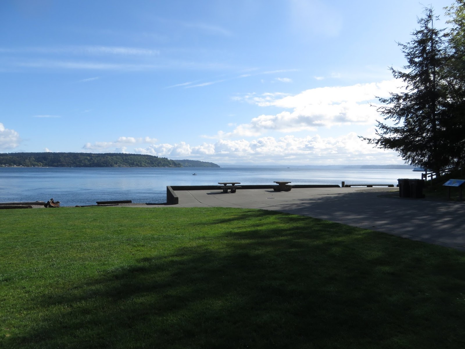 The shoreline of Point Defiance offers some interesting contrasts - as this and the next post will show. On the east side, Owen Beach is a broad gravel beach that shows little evidence of long-term erosion or accretion. Southeasterly winds blowing out of Commencement Bay probably wrap into this beach with enough energy to drive sediment northwestward. Northerlies coming down Colvos Passage do the opposite. The net result appears to be a fairly stable beach. Some new sediment may get here from the bluffs towards the Point, but I suspect most of that goes north and is lost over the edge (see next post).
AERIAL VIEW
 The beach to the south is backed by a long seawall that supports the promenade that connects with the southern end of the park. At the northwest end, in front of the parking area, the wall ends and the sidewalk is stepped back far enough so that a modest berm and backshore remains, along with the normal drift logs. Again, it looks like a pretty stable beach, although I suppose on exceptionally high tides, waves can push debris back onto the lawn. But that's flooding, not erosion.
 Farther north, concrete debris has been used to stabilize some old fill (on which a trail is built), and this is eroding (slowly) - but that's because the fill extended waterward of the natural beach profile. It would be easy to just pull it out.
The Permian Sea that dominated this part of Pangaea 250 million years ago left the gypsum rich deposits that have now been recycled to form the dunes at White Sands (previous post). This sea (or some smaller connected seas) also gave rise to large carbonate reefs, one of which has been subsequently uplifted and exposed by erosion as the current Guadalupe Escarpment (Guadalupe Mountains National Park).
AERIAL VIEW
 Guadalupe Peak is the highest point in Texas (8751'). El Capitan, the distinctive prow immediately to the south, marks the southern end of the Guadalupe Escarpment. Carlsbad Caverns was carved (dissolved, actually) into the core of the reef much later, aided by the presence of hydrocarbons in the adjacent basin that leaked hydrogen sulfide and produced sulfuric acid, a much more effective cave-forming agent than the more common carbonic acid.
 The Capitan Reef faced eastward across the Delaware Sea (an arm of the larger Permian Sea). The Delaware Basin and the Midland Basin farther east are now both major oil and gas fields and driving south towards Carlsbad I was reminded of this by the pump jacks and well heads, the pipe yards, and the lines of red Halliburton trucks. I spent the fall of 1981 in Schlumberger's training program in Midland and spent weekends exploring west Texas in my new little pickup truck. That was a long time ago!
I suppose there may have been beaches on the shores of this Permian ocean - but the environment behind these reefs was probably pretty quiet and the shores were probably muddy and perhaps vegetated (although I suspect they didn't look like the mangroves or salt marshes you might find in similar settings today).
I try to stick to a fairly standard theme in this blog. Posts are places (not issues or topics or events, and only occasionally people). They are built around photos I've taken myself (usually within days or sometimes weeks). The subject material is usually a blend of coasts and physical geography. Occasionally, I post photos of a shoreline with little geologic or geographic narrative. And sometimes I even post photos of something geologic with only a very tenuous connection to the coast.
A few days in New Mexico left me with a particularly tenuous connection to the coast and the next two posts are a bit of a stretch for Gravel Beach. My editor may object - but wait, this is a blog, there is no editor!
White Sands National Monument is a large dune field in the Tularosa Basin of south central New Mexico. The white sands are gypsum crystals, not the quartz sand we usually encounter in dune environments. The gypsum originated in a shallow Permian Sea that may have resembled the warm Persian Gulf of today. This 250-million year old Permian Sea is a recurring theme in southern New Mexico, one that gets visited again in the next post. Repeated drying up of the sea left thick deposits of gypsum.
AERIAL VIEW
These gypsum-rich rocks were buried for most of their history, but were then uplifted and exposed 70 million years ago during the Laramide Orogeny (formation of the Rocky Mountains) and erosion and chemical dissolution carried the gypsum into the isolated Tularosa Basin. The gradual drying up of Pleistocene Lake Otero further concentrated the gypsum and now the winds blowing across the dry lake beds of Lake Lucero and nearby playas carry the gypsum crystals up into the dunes.

Venice Beach lies south of Santa Monica on a barrier beach built between the ocean and the large Ballonas wetlands to the east, the historic estuary of the Los Angeles River. There isn't much left to the wetlands now, since a large portion of them were excavated to create Marina del Rey in the 1960s. And the LA River hasn't flowed out to the Pacific this way since a flood in 1825 sent it south to San Pedro Bay (now Long Beach).
 Historically, the river may have been a significant source of sediment for the beaches at the south end of the littoral cell (Dockweiler, Manhattan, Redondo). This source is long lost, but these beaches are now very wide as a result of the addition of large amounts of sand from leveling the El Segundo dunes, building LAX and the Hyperion Treatment Plant, and the dredging of Marina del Rey. The beaches have remained relatively stable, although eventually this material may end up at the south end where it gets sucked down into the submarine Redondo Canyon.
AERIAL VIEW
Like Santa Monica, Venice also has a breakwater, but unlike Santa Monica, the beach at Venice has built out and connected with this one (or at least is connected most of the time). Besides the breakwater, Venice also has a large groin farther south near the Venice Pier.
The Santa Monica littoral cell extends from Malibu south to the Palos Verdes Peninsula, shaping the western beaches of Los Angeles. As elsewhere on the southern California coast, sediment transport is generally from the northwest to the southeast.
 Historically, the beach at Santa Monica was supplied by Malibu Creek and a number of other small streams in the northern part of the cell. These are streams dominated by big, but widely-spaced, flood events and sediment was probably delivered in big slugs. Development has altered runoff and more importantly, led to the construction of flood and debris control systems that trap sediment before it reaches the coast.
 The Santa Monica Pier marks a significant geomorphic transition. To the north, the coast is backed by bluffs cut into a marine terrace composed of alternating marine and alluvial sediment. To the south, the bluffs disappear and the coast morphs into a long barrier beach (although this may be a little hard to see through the overprint of development). More on this in the next post on Venice Beach.
 Early pictures of the bluffs show them eroding onto a relatively narrow beach. Perhaps at times in the past they were also a potential source of beach sediment? But the bluffs are now separated from the ocean by the Pacific Coast Highway and a wide beach created decades ago through some major nourishment projects.
AERIAL VIEW
An early breakwater - apparently part of a scheme to develop a boat basin (there have been some grand plans for the Santa Monica coastline that never materialized). The initial effect of the breakwater was for a salient (bulge) to develop on the beach behind it, but that feature is barely perceptible now that the breakwater has subsided and the beach has been widened so much by nourishment. The breakwater can still be seen in the aerial view and, if you look carefully, off the end of the pier in the photo below.
 Portage is one of those names that crops up in many different places - but the three that come to mind on Puget Sound (I'm not counting Portage Bay below UW) are all tombolos, or at least were tombolos at one time). All three were places where simply lugging your canoe over the beach berm saved you several miles of paddling in rough water.
One of these is at the tip of the Lummi Peninsula at the north end of Bellingham Bay, where a spit (really just a bar, but that's another story - one I don't know) connects to Portage Island. Another is the passage between Indian and Marrowstone Island, which was closed by a barrier beach until the Corps of Engineers excavated the channel and built jetties early in the 20th century.
The third is this low isthmus that connects (or separates, depending on your perspective) Vashon and Maury Islands. As with all of these, there is always some debate about whether historically there was an open channel, but in general, maintaining a channel in these situations would be difficult, as the beach would tend to close up the gap pretty quickly. There has to be a pretty strong tidal differential to maintain enough flow to keep something like this open (or a complete lack of sediment). That doesn't mean that sometimes storm waves and high tides would not have periodically washed over the top, but that's not the same as a navigable connection unless you're in a kayak and willing to do battle with the logs.
AERIAL VIEW
 The north side of this tombolo would have been the primary berm since the exposure is greater and there is much more robust beach. The south side lies within Quartermaster Harbor and is fairly sheltered. Typically, in a situation such as this, the wetland that formed in association with the tombolo would have drained to the southern, more protected side. Trails across these features become roads and a desire to maintain access during storm conditions leads them to be elevated and armored. Here, it's still only a short hop from the beach on the north side of the road to the remaining wetland on the south side. And the south side, like any south-facing beach at the north end of an embayment on Puget Sound, is a magnet for anything that floats and blows across the surface of the water. Logs, old styrofoam floats, plastic water bottles, sneakers, tennis balls.


