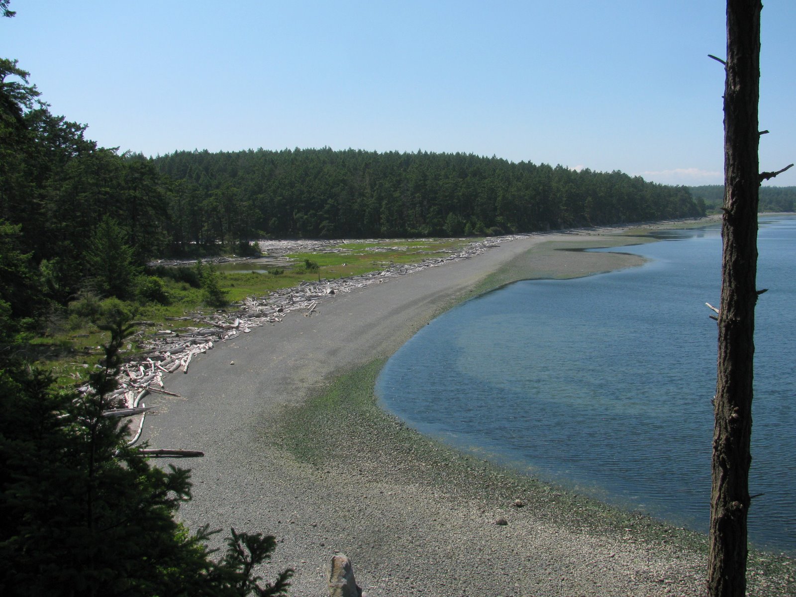
Wednesday, September 21, 2011
Lake Missoula
15,000 years ago, Missoula was underwater. Something like 40 times. And each time the ice dam would break and the water would race across Idaho and Washington and out the Columbia Gorge to the Pacific. But between dam breaks, the lake carved shorelines into the hills above the University.
Saturday morning (September 2nd) I hiked up to the "M" on Mount Sentinel, which provided great views of the strand lines across the way on Mount Jumbo. They show up well in the low light - but are pretty subtle when you're actually climbing across them.
Lake Bonneville (July 2007)
Labels:
Montana
Location:
Mount Sentinel
Sunday, August 07, 2011
Lily Point
Lily Point would have made a spectacular resort or development, but it makes a better park. Lots of hard work over many years led to its acquisition and recent dedication as a park and a marine reserve. This is the forested southeast corner of Point Roberts, a few steps removed from the residential development of Maple Beach to the north and of South Beach and the Marina to the west. For most Americans, visiting it requires a passport, since you must cross the border (twice) to get here.
From the tip of the point, you can look south to Lummi Island and Mount Constitution, northeast to the high rises of New Westminster and Burnaby in the Fraser Valley, and southwest to the Gulf Islands. On a clear day, Mount Baker rises to the east.
Lily Point itself is a cuspate foreland, bracketed by high bluffs. The bluffs to the north are bare and steep. The bluffs to the west consist include a large, deep-seated landslide, and is well-forested except in its steepest sections. It has all the classic symptoms --soft clay exposed on the beach itself, a steep shore bluff and a steeper head scarp, separated by a forested bench. I don't know how often it moves, but in the late 1990s, local residents in the area reported noise and dust when a big section let go.
Waves from the south erode the southwest bluff, carrying sediment both west to South Beach (where the sediment is periodically bypassed around the marina entrance) and north around the point towards Maple Beach. Maple Beach in the U.S. and Centennial Beach and Beach Grove on the B.C. side are part of a large complex of spits formed over the millennia by the erosion of Lily Point and then incorporated into the fringe of the Fraser delta.
Lily Point is by no means pristine and over 100 years ago it was the site of a major salmon cannery - remnants of which mark the beach on the north side of the low point. Native Americans/First Nations peoples apparently fished the point historically, but neither they nor the salmon were much of a match for industrial fishing.
Labels:
point roberts,
puget sound,
salish sea,
washington,
whatcom
Thursday, July 21, 2011
Jack Block Park
Three years ago I posted a photo of this beach but noted that it was fenced off (Jack Block Park: May 2008) Now it's open, providing access to the water from one of Seattle's best and most overlooked overlooks.
This is one of a couple of gravel pocket beaches built into the shoreline of this Superfund site on the southwest shore of Elliott Bay. Waves will gradually reshape them, but the northern exposure makes significant wave action infrequent and this molding will take time.
The largest waves, when they do reach this beach, will come from the north and will strike this beach at a fairly oblique angle. I suspect this will lead to the gravel shifting southwestward over time. Imagine a pebble on of this beach. There will be plenty of waves from the north nudging it southwest. But it's hard to conjure a wave from the southwest to move it back. There's a reason pocket beaches are swash-aligned. It represents a stable configuration. This one is like filling a tilted glass with water and expecting it not to spill.
I'm intrigued by the opportunity to build beaches along these industrial shorelines on the leading edge of old river deltas. In this way, this site is similar to the Olympic View site on Commencement Bay in Tacoma that I mentioned in March (Olympic View, Tacoma: March 2011).
Labels:
king,
puget sound,
restoration,
salish sea,
seattle,
washington
Wednesday, July 06, 2011
Golden Gardens
It's amazing that in over 430 entries and more than 5 years, I have never posted anything from Golden Gardens, even though it's the closest beach to my home and does not lack for interesting stories.
Early on the morning of July 4th, the beach was still quiet. A few vans were unpacking for the day's activities and people were beginning to mark territory for the afternoon's celebrations, but not much more was going on.
The north beach is gravel and sand and has retreated over the decades, perhaps aided by railroad, which was built along the eroding bluffs to the north and eliminated a potential source of sediment. In the mid-1990s, the City chose to nourish the north beach and restore the wetlands behind the berm. Both have done well in the 15 years since.
Meadow Point (the name of the landform, Golden Gardens is the name of the park) is the site of one of the largest relatively intact (although by no means original or pristine) backshore dune areas found in central Puget Sound. Keeping the Scot's Broom and other obnoxious vegetation in check is a full-time job for the city and the park's volunteers.
North storms appear to dominate sediment movement at this site, since this shoreline is sheltered from the more common southerly waves by West Point. The large Shilshole Marina and it's breakwater to the south may also influence Meadow Point - they certainly represent an abrupt end to the beach south of the Park.
The southern beach is swash-aligned, forming a broad crescent that faces the southwesterly waves. It is broad and sandy and by later today will be filled with people throwing frisbees, playing volleyball, picnicking, and launching kayaks. The north beach tends to be more for beach walkers and kite flyers.
Unlike Seattle's other beachfront parks where fires are prohibited, here they are not. Which probably explains the remarkable lack of drift logs on the berm.
Dixie Lee wanted to put the aquarium at Golden Gardens. Wolf Bauer did not. In the late 1960s and early 1970s, they argued about it, but in the end, the aquarium ended up on the downtown waterfront. This is neither the first nor the last beach that Wolf saved. Fittingly, Wolf was a key part of the design team that developed the 1996 beach restoration work.
Labels:
king,
puget sound,
restoration,
salish sea,
seattle,
washington
Tuesday, June 21, 2011
Friday Harbor
The University of Washington's Friday Harbor Laboratory has been perched here on the point north of the town for most of the last century. The research focus was historically more on marine biology and rocky coastlines than on beaches, which makes sense given its location.
The lab, like other water-oriented developments, has grown somewhat organically along the edge of the water - with the interest clearly more in getting to the water or using the water (the labs thrive on a lifeblood of circulating salt water) than in the shoreline itself. I found the waterfront a little ragged with its crumbling stone walls, its collapsing piles of riprap, and its abundance of pipes.
It might be interesting to look at historical photos of the lab's shoreline. I wouldn't expect too much natural change, although I saw some evidence that the beaches (limited as they are) may be continuing to erode. They would have done so anyways, plus any material that would have originally eroded from the banks to resupply them is safely secured behind all the riprap!
But it's sure a neat place to have a meeting! It's not exactly convenient, but it's a far more pleasant venue that an interior conference room in an office building in Olympia.
Labels:
puget sound,
salish sea,
san juan,
washington
Eagle Cove
If you take a rocky coastline and add a little sand and gravel, you'll get pocket beaches and there are no shortage of them here on the south end of San Juan Island. I knew this one existed, but didn't know you could actually get to it without owning it, until I found the little public access and parking area amidst the Sunset Magazine centerfolds.
The beach is only a few hundred feet long, it's sand and gravel isolated from every other beach in the world by rocky headlands and deep water. The gravel stays high, piled in steep berms and buried under drift logs. The sand forms a rippled terrace in the lower intertidal.
Labels:
puget sound,
salish sea,
san juan,
washington
South Beach
The south end of San Juan Island is why you can't categorize Puget Sound beaches in any simple way. It's the same ocean, and the same physics, both here and on the forested shores of Eld Inlet, but the beaches are cut from completely different cloth.
South Beach is a broad gravel berm that appears to have built seaward over time from the original base of the slope. It is covered with logs - apparently this is the last obstacle for logs trying to escape Puget Sound and many get no further than this. There are sand dunes - well-vegetated ones for the most part - climbing the slope to the north. The most obvious source of the beach gravel is the high eroding bluffs east toward Cattle Point, although I wonder if this beach also tells a story about the gradual erosion of Salmon Bank, which extends far offshore.
American Camp, of which this all part, is overrun with non-indigenous foxes. Cute little beggars - certainly cuter than those chickens all over the beaches on Kauai!
Labels:
puget sound,
salish sea,
san juan,
washington
Jakle's Lagoon
The north and south sides of the peninsula that ends in Cattle Point couldn't be much different. The south side is high grassy bluffs looking over the broad gravel strand of South Beach and twenty miles of water at the Olympic Mountains. The north side is forested and slopes down to Griffin Bay, where it is broken into a wonderful series of barrier lagoons. At the west end, down towards Fourth of July Beach, is Old Town Lagoon. At the east end, down towards Cape San Juan and it's exclusive nest of high end real estate, is Third Lagoon. And in the middle is Jakle's Lagoon, with it's gravel barrier, its lagoon, and its forest.
There is some evidence of an occasional tidal opening near the west end, but certainly not a persistent or regular connection. The wide gravel barrier gives rise to a broad marsh and eventually to a lagoon, its edges lined thickly with old drift logs. The pickle weed (Salicornia virginica) was doing its best to survive a colorful infestation of dodder (Cuscuta salina), a plant parasite that apparently takes many forms the world over.
I walked the cobbly beach to Third Lagoon, and then worked my way back via the mossy trail that follows the top edge of the bluff. On one shady section of beach, the upper intertidal gravel was covered with small snails (Littorina littorea, I assume). I've never seen them gathered so densely and have no explanation.
I've exceeded by usual quota of Latin, normally enforced by my ignorance of biology. Fortunately, the evening that followed this great day of beaches included dinner with people who actually understand this stuff.
Labels:
puget sound,
salish sea,
san juan,
washington
Cattle Point
Cattle Point is a rocky headland at the south east end of San Juan Island, jutting out into the eastern end of the Strait of Juan de Fuca. The lighthouse is perched on dunes, which are in turn perched on top of glacial sediments, which in turn mantle the underlying bedrock. There are a couple of wonderful pocket beaches just north around the corner and South Beach stretches out to the west.
Labels:
puget sound,
salish sea,
san juan,
washington
Ship Harbor
Ship Harbor is a north-facing cove just east of the Anacortes Ferry Terminal. It's a swash-aligned barrier beach and marsh with a long and complicated human history. It's basically a pocket beach trapped between Shannon Point and the ferry terminal to the west and the old railroad grade on the east. There may be some sediment trickling in from adjacent shorelines, but certainly no way for it to get out, except by gradual attrition or perhaps some loss offshore.
The shape of the beach is altered a bit by the remains of the old cannery -- metal slag (old tin can cuttings?), concrete foundation piers, and a forest of piles - each with it's own gull. The sand and gravel segregate themselves, both across the profile and along the beach. There was a sandy berm encroaching on the vegetation at the east end, suggesting some accretion there recently.
I'm not sure how the wetland drains - through the berm or through a pipe somewhere out of sight? There is a small "stream" bubbling from a concrete vault on the east end, carrying storm water from the new subdivision on the hill. It forms a small low tide delta -which is probably the sink for any extra sediment that makes its way to this end of the bay.
Ship Harbor, February 2009
Labels:
anacortes,
puget sound,
salish sea,
skagit,
washington
Subscribe to:
Posts (Atom)