Showing posts sorted by relevance for query salsbury. Sort by date Show all posts
Thursday, May 02, 2013
Salsbury Point
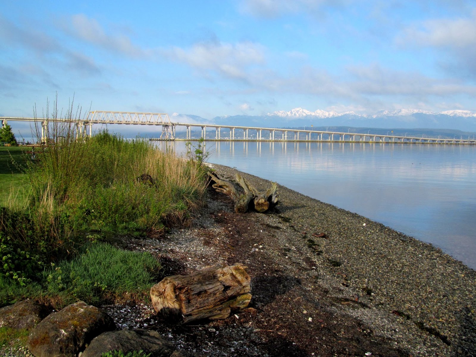
I stop briefly at this Kitsap County Park almost every time I drive to Jefferson County or elsewhere on the Peninsula, since it's right off the main road just before you get to the Hood Canal Bridge. In the mid-1990s, I came here even more often, sometimes on weekends with a small child in tow, to informally monitor the beach after the old riprap was pulled out and replaced with a small gravel beach. It's done remarkably well, given the nourishment occurred seventeen years ago (October, 1995), but the beach face has gradually eroded landward and some serious thought should be given to adding some more gravel, tweaking the backshore vegetation (maybe lowering the backshore six inches or so), and dealing with the old drain pipe that's seeping onto the beach. A solution for the failing rockwork at the eastern end would also be nice, but trickier.
AERIAL VIEW
As mentioned previously, Salsbury Point has suffered a number of insults - the floating bridge has modified the wave regime, perhaps cutting off the supply of sediment from the south. The boat ramps have isolated it from the beach to the east. And of course, this was once a narrow recurved spit with a small tidal lagoon behind it, although one would is hard pressed to see much evidence of that today!
Previous Mentions: Salsbury Point
Labels:
hood canal,
kitsap,
puget sound,
restoration,
salish sea,
washington
Location:
Salsbury Point Park, Kitsap County WA
Tuesday, March 13, 2007
Salsbury Point
Salsbury Point has suffered several insults over the decades. The eastern portion of the spit and back barrier lagoon, including the historic tidal inlet, were replaced with houses. The western part was filled for the boat launch and the park. I understand the fill material was from the excavation of the approaches to the Hood Canal Bridge.
The bridge itself appears to have had a profound effect in this beach. Littoral drift (net) was originally north up Hood Canal and east around the point (it's why there was a recurved spit here in the first place), but the bridge acts like a big breakwater, effectively reducing fetch from the south and increasing the influence of northerly storms. I believe the bridge has reversed the net drift pattern, so that sediment eroded from the park now moves south and cannot be replaced. (In an earlier post, I noted that the west side of Point Roberts is another place where net drift may have been reversed).
Erosion had been met for years with haphazard dumping of large rocks, but in October, 1995, Kitsap County Parks replaced the rock and some of the fill with a gravel beach. 11 years later, it is doing great, except that it continues to spill gravel arond the corner toward the bridge. The beach at the eastern end has dropped at least a foot. What this beach really needs is an infusion of a few truckloads of sandy gravel every few years! Otherwise, someone will panic some November night and bury the beach under riprap again.
Labels:
kitsap,
puget sound,
restoration,
salish sea,
washington
Wednesday, May 11, 2016
Salsbury Point
In the fall of 1995, Kitsap County Parks removed the old riprap and nourished the beach. And it's still doing remarkably well.
It's a difficult site - the lagoon was filled, the beach pushed out, and the coastal regime altered because of the boat ramps and because the floating bridge has cut off much of the southerly wave action (which would have continued to deliver sediment). The original plan was just to rebuild a nicer rock bulkhead, but a habitat biologist pushed back, suggesting something softer. And County Parks staff were willing to listen. A geologist with the state (much younger then) helped them sketch out some ideas and cross-sections, based on experience with some of Wolf Bauer's designs.
![]() |
| Beach east of the boat ramps |
![]() |
| Healthy beach at south end of park |
I think some adaptive management is due. Before someone gets surprised and does something dumb. I understand there is talk of doing some work on the boat ramp(s) - maybe that will be a chance to look at some options.
AERIAL VIEW
Of course, there's still a difficult stretch between the main park and the ramp - I think it's where electric cables head out under the canal. It's oriented obliquely to the waves and has no sediment - which presents a real challenge.
Labels:
hood canal,
kitsap,
puget sound,
restoration,
salish sea,
washington
Location:
Washington, USA
Wednesday, January 10, 2007
Salsbury Point

It's time to catch up a bit -- beginning with a blogger's retrospective. The picture was my best effort at something related to the web that was still taken near a beach. Salsbury Point. A great example of small-scale beach nourishment carried out in October 1995, though it could use a little refreshing. Deserves a future post.
I began this blog a little over a year ago - 60 posts and I suppose a couple hundred pictures. I don't even know if Google/Blogger limits my storage, or do they just keep adding servers on my behalf in big warehouses in places like eastern Washington with cheap land and cheaper electricity? Or maybe tomorrow they'll tell me I've exceeded my allotted space!
I have no idea how many people visit the site, though I don't expect many do unless I specifically point them to it. I know no one links to the blog, since it still fails to come up in any search engines (maybe a good thing). I think there is some way to subscribe to it, in case you want to get updated some evening when I start posting stuff after a two month hiatus. I think the site has actually served my needs very well -- I just enjoy pushing my pictures and my musings out there. Hopefully, some folks enjoy it or learn something about their favorite beach or come away with an idea for a thesis, but if someone doesn't like it, they can just click on the "Next Blog" in the top right and go visit someone else.
Labels:
kitsap,
puget sound,
restoration,
salish sea,
washington
Thursday, May 02, 2013
Hood Canal Bridge
The western end of the Hood Canal bridge is built on fill and extends across the beach. The result has been some fairly obvious changes to sediment transport and beach processes both north and south of the approach (Shine Tidelands 2007, Termination Point 2011). But here on the eastern end, the bridge passes over the beach and any effects on the beach are less obvious. I've speculated a little about the possible effect of the bridge on wave action north of the bridge in an earlier post on Salsbury Point (2007).
AERIAL VIEW
The beach continues unbroken beneath the bridge, although the character of the low tide terrace changes significantly along here and there is also a small accretional bulge in the upper beach a short distance north of the bridge. The low tide beach is likely a fairly robust feature of the landscape - it would be very difficult, short of dredging, to change the width of the low tide terrace very much. But the upper beach is a different story and I've always wondered whether the accretion might be in part to the falling off of wave action from the north due to the bridge itself. There was already a fairly wide beach here -- and a much older dock -- before the bridge was built in 1961, so this would require some serious sleuthing to sort out.
Labels:
hood canal,
kitsap,
puget sound,
salish sea,
washington
Location:
Hood Canal Bridge
Thursday, June 14, 2007
Shine Tidelands
In an earlier post, I mentioned how the Hood Canal Bridge may have modified sediment transport at Salsbury Point at its eastern end. There's no question that the bridge mucked up the beaches at it's western end. The bridge is constructed on a fill that blocks northward drift and buried the southern end of a spit and its associated lagoon. Shine Tidelands is a beach with no sediment source and far less southerly wave action than prior to 1961. The southern end of the spit is riprapped and the beach is a cobble lag - starved of sand and gravel. The marsh is largely intact and remains a bit brackish near the northern end, where you can still see salicornia and the remains of the old drift logs.
We can't make the beach whole - at least not without the bridge sinking again - but we could make it a lot better. Pull the riprap out and get some small gravel and sand back onto the beach at the southern end, remove as much of the old fill as possible and plant native backshore vegetation, and maybe even restore tidal circulation with an inlet nearer the north end.
Today's meeting was exciting - maybe some of this stuff can really happen.
Labels:
hood canal,
jefferson,
puget sound,
restoration,
salish sea,
washington
Wednesday, November 28, 2018
Port Gamble
There is a neat little beach hidden at the bottom of Teekalet Bluff in Port Gamble. People often stop to take in the view from the top, since it's a great place to monitor everything coming in and out of Hood Canal -- war canoes, sailing ships, nuclear submarines. But not so many people visit this little beach. I've known it was here for a long time, but this was the first time I'd actually checked it out.
AERIAL VIEW
When the northern shoreline of Port Gamble was developed, fill was extended out over the beach and protected with large rock (and other junk). This projection blocks the eastward drift and over time, a small wedge of beach has built out in front of the forested toe of the bluff.
I doubt there's much sediment being transported along this shoreline. It's at the end of a long littoral cell that begins farther south on Hood Canal, but I suspect the transport rates are higher where the southerly waves can act more effectively. Much of the sediment probably stalls out in the vicinity of Salsbury Point (a mile west of here), since there isn't much wave action to urge it along this north-facing shoreline (something similar happens between Point Elliott in Mukilteo and the Port of Everett, so I suppose this beach is a bit analogous to Pigeon Creek Beach), though none of this probably makes sense unless you look at the map).
It's possible that some of the sediment on this beach now makes itself around the riprap, but the fill extends into relatively deep water and I'd expect any excess material gets lost offshore. There is a small accidental beach tucked into the northwest side of the jetty a little farther east (bottom photo), but it doesn't show much evidence of continuing to accumulate sediment.
Here's another post from Port Gamble from a few years ago:
Teekalet: August 2014
AERIAL VIEW
I doubt there's much sediment being transported along this shoreline. It's at the end of a long littoral cell that begins farther south on Hood Canal, but I suspect the transport rates are higher where the southerly waves can act more effectively. Much of the sediment probably stalls out in the vicinity of Salsbury Point (a mile west of here), since there isn't much wave action to urge it along this north-facing shoreline (something similar happens between Point Elliott in Mukilteo and the Port of Everett, so I suppose this beach is a bit analogous to Pigeon Creek Beach), though none of this probably makes sense unless you look at the map).
It's possible that some of the sediment on this beach now makes itself around the riprap, but the fill extends into relatively deep water and I'd expect any excess material gets lost offshore. There is a small accidental beach tucked into the northwest side of the jetty a little farther east (bottom photo), but it doesn't show much evidence of continuing to accumulate sediment.
Here's another post from Port Gamble from a few years ago:
Teekalet: August 2014
Labels:
kitsap,
puget sound,
salish sea,
washington
Subscribe to:
Posts (Atom)


