Monday, July 06, 2015

Driftwood Shores


The spit extends across the mouth of Triangle Cove and is lined with homes and, of course, driftwood. They don't call it Driftwood Shores for nothing. South-facing beaches, particularly on Port Susan, where shorelines have collected north-drifting wood from the Snohomish River and from a century of log-rafting, tend to accumulate this stuff.

AERIAL VIEW

Somewhere back in the office I have a newspaper article describing the heroic efforts early one morning to protect this community from flooding - perhaps during the January 1983 high tide? Even if these people weren't there then, they probably remember February 2006 and December 2012. They are the benchmarks that beach communities use to mark their history.

I often hear folks these days commenting that communities like this will be doomed as sea level rises. But the reality is that these communities will persist, even as the beach that drew people here is buried beneath riprap. Unless the economics of waterfront property change drastically, we can be assured that these folks, and the folks who follow them, will be able to elevate their remodeled homes, to raise the dikes that protect them from flooding on the backside, and to stack rock as high as necessary to protect them from the sea. And because the need to rebuild will be driven by disasters "that no one could have predicted" and that private insurers have little financial interest in covering, a remarkable amount of this work may be done at public expense. This happens all the time in other places that had a head start in us!


Driftwood Heights


I think this is the appropriate name for this stretch of shoreline along East Camano and Lehman Drives, north of Cavalero Beach and south of the spit at Driftwood Shores, although I suppose it applies better to the homes on top than the beach below.

My goal was to paddle over to Barnum Point and check out Driftwood Shores along the way, which I did and which I'll post about shortly, but first I got distracted by this neat section of forested bluff south of the spit. There are a variety of types and vintages of landslides in the trees, some much more evident than others.

Wood is abundant along here and there's a pretty fuzzy distinction between the driftwood and the wood bulkheads. And in some cases, between the forest and the beach cabins. This shoreline may be a nice example of why counting bulkheads or characterizing shoreline structures is a lot more difficult than some folks think!

The large erratic coincides with a small bump in the shoreline. Like Klootchman Rock near Oak Harbor, the boulder acts like a groin, stabilizing the beach slightly on it's southern side and probably resulting in faster erosion on the north. Where the shoreline is buttressed by a long timber pile bulkhead that extends over many properties (timber bulkheads, or their remains, are so ubiquitous on Port Susan (or were) that this is nothing terribly unusual). On the other hand, one of the often overlooked benefits of these structures is that they are biodegradable.

We're still in catch-up mode - with several more May posts still to come, plus a bunch from a long road trip in June. But at least the computer and the photo library are back up and running, so there's some hope. These pictures were taken on the morning of Saturday, May 9th.

Saturday, July 04, 2015

Tracyton Beach Road


The Seattle Fault runs east-west across the Sound, leaving it's trace along the shoreline from Alki Point to Rich Passage to the north side of Bremerton. The most obvious evidence is exposures of Tertiary bedrock along the shore in the narrow band of uplift associated with the fault.  Raised beaches and stranded shorelines also occur in these areas, indicative of geologically recent uplift.

AERIAL VIEW

These rocky exposures appear on the shorelines at the south end of Dyes Inlet. Here, along Tracyton Beach Road, at the northwestern end of Port Washington Narrows, the bedrock appears where the road runs along the water and is easy to access. I believe this is all Oligocene Blakely Sandstone or variations on that basic theme. The bedrock rapidly vanishes a short distance north or south.

For the most part, bedrock (anything pre-Pleistocene) is thousands of feet below Puget Sound until you get up to Rocky Point and Deception Pass on Whidbey Island, to locations near Port Hadlock and southern Marrowstone Island, and of course, along the uplift of the Seattle Fault.  Bedrock is also widespread farther north (San Juans and Chuckanut) and along the western Strait of Juan de Fuca.


Lion's Park

Around 1990, Bremerton engaged Wolf Bauer to rethink this stretch of shoreline on the northeast side of Port Washington Narrows. I don't recall details, but I believe they cleaned out old rubble shore protection and added gravel to create a narrow low energy beach. At the time it got quite a bit of attention and I think I still have a video (VHS, not YouTube) done by the city with Wolf explaining the project.

AERIAL VIEW

A few years ago the City went back and remodeled the park again. There's still some older industrial history - left either because it was too messy or too expensive to undo or too important historically to remove - but most of the shoreline is a pleasant mix of gravel beach and fringing marsh.

This is one of those sites where the wave energy is right on the threshold of that necessary to maintain an active beach, so this mosaic of marsh and beach is to be expected (and may shift over time).
This is a soft shoreline project that hasn't gotten much attention that I'm aware of outside the local community - but probably should. Puget Sound is a huge landscape and there are an awful lot of cool projects going on that show that seawalls aren't the only way to manage a shoreline. It's hard to track all of them. One of our challenges is how to better document these. Maybe something less demanding than scientific monitoring but more rigorous than a casual blog!


Illahee State Park


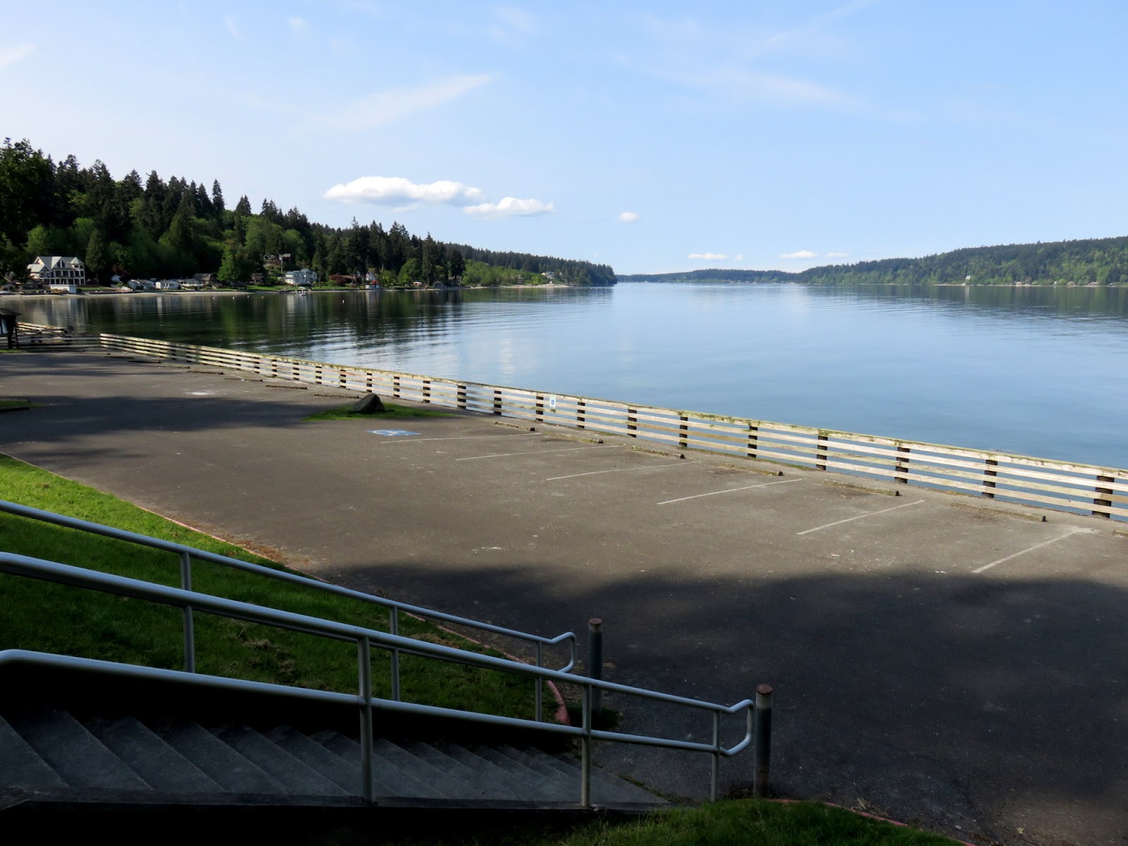
Illahee State Park lies on a high forested hill and the road down to the beach switchbacks down the steep slope to a parking lot built on fill and protected by a large timber bulkhead.

AERIAL VIEW

South of the park, the high unstable bluff reaches directly to the beach and is littered with enormous wood stumps and logs, probably an indication of what many of these shorelines originally looked like.


To the north, the shoreline is lower for the half mile north towards the mouth of Illahee Creek. This low bench is still backed by a high bluff and its origin isn't entirely clear to me. Certainly the spit at the creek mouth is depositional and it's reasonable to assume that there was fill placed to facilitate the residential (or previous) development of this area, but I wonder if there might also be a terrace of some sort. This site is on strike with the Seattle Fault and an uplifted beach might not be surprising.


Friday, July 03, 2015

Bachmann Park


Bachmann is a small park in Manette on the east side of Bremerton. It's located on Point Herron along Port Orchard. The beach itself consists of well-sorted gravel and is fairly steep, pressed up high against a tidy concrete bulkhead. It had the look of a nourished gravel beach, although I suspect it is not. 

AERIAL VIEW

Sediment movement along here may be a little complicated. There's some fetch from the southwest. But the greatest fetch may be from around the corner to the north and I suspect this may drive some material towards this point from Enetai to the north. This is also a site that may be significantly influenced by boat wakes and this area may be discussed in some of the Rich Passage ferry studies.


Seahurst Park


I visited Seahurst Park three times this spring - once between meetings in other places, once for a meeting at the park, and once for a great sunset with M after an impromptu trip to Zippy's Burgers in White Center. These photos date to first of these, way back in the third week of April.

The work at the north end was largely wrapped up at the end of last summer (Seahurst: August 2014) and the beach has had a winter to begin to sort itself out.  The beach itself looks nice - with the well-sorted gravel giving way to bands and patches of sandier material. The berm has readjusted a little, possibly at the expense of the skinny back-beach wetland, and the restored stream mouth is looking very natural, with flow disappearing into the gravel berm.


The south end shows little evidence of the old seawall that was removed in 2005 and I think most folks wouldn't have a clue of its history. The beach itself looks fine, but the toe of the bluff looks quite different than the toe of the unaltered bluff south of the park. That would be fun to come back and elaborate on in a future post when I can do a better comparison.

Guerrilla Films has just released a nice documentary about the park and its restoration:
Local Treasure: Trailer on Vimeo


Thursday, July 02, 2015

Elmira Street


Elmira Street Park, on the north edge of Port Townsend, is locally known as The End of the World. This may be a bit of an exaggeration, but it's certainly the end of the trail. It got a lot of attention two winters ago when some large chunks fell away (see video from 2013 below).

I visited the top briefly in April*, but stayed back from the edge and didn't linger, even though the likelihood of anything happening during my brief stay was low. But it's always hard to know how undercut the bluff is or what might trigger a collapse.


These bluffs of glacial drift are fairly coherent, form a steep face, and tend to fail as large slabs. These topples from the upper half of the bluff are encouraged by gradual erosion of the underlying units and by wet periods and/or freeze-thaw events.  The collapsed material is quickly redistributed by waves and in this case most is destined for Point Wilson a couple of miles to the east.

There is a small concrete observation post dating to World War II at the edge of the bluff. Rough estimates of erosion rates along here are 6 inches per year, but that suggest the structure was built 30-40' back from the edge (in the forest?)  I suspect it was built closer than that - better views of the water - and retreat isn't as rapid as those earlier estimates.  Dramatic when large slabs fall, but not the end of the world.

* I'm embarrassed to point out that this visit occurred way back in early April. This spring things fell behind, in part because of a slow-moving hard disk failure that took a long time to diagnose, then to replace. I liked my little Sony laptop, but when faced with the need to retire it, I decided to switch back to a Mac. For those who care, I rely heavily on Picasa to manage photos and it seems to run very nicely on the Apple.

Over the next week or two? I will try to gradually backfill both this blog and my companion hshipman blog with posts I drafted this spring while my hard disk was grinding to a halt.


Thursday, April 02, 2015

Otter Bay


This was our last stop before getting in line for the ferry back to the mainland. We parked off of Niagara Road and M read in the car while I walked the muddy trail down to this small beach in a northern corner of Otter Bay.

AERIAL VIEW

It's a small, sandy pocket beach.  I suspect the sandiness is due to steep slopes and a small stream that supply it with upland sediment and to its pocket nature, which keeps the sand from leaving once it arrives at the beach.

This is the last of my Pender Island posts and I should make two acknowledgements.  The first is to Theo Dombrowsi, whose Secret Beaches of the Salish Sea (The Southern Gulf Islands) has been a valuable resource, both here and on Salt Spring Island.  The other is to the Pender Island Parks and Recreation Commission and its volunteers, who have done a wonderful job of making so many beaches available, of marking them well, and of maintaining the trails and stairways.

In usual fashion, all nine of my Pender Island posts are labeled, and can be found at:
Gravel Beach [Pender Island]

Finally, this is the 700th post to Gravel Beach since December of 2005. The collection keeps growing and I trust that it is occasionally helping someone to stumble on a new beach or to look at an old beach differently.


Wednesday, April 01, 2015

Bricky Bay


Bricky Bay is a small cove and pocket beach on North Pender Island that was once home to a brick plant - rows of pile stubs crisscross the shore and the beach itself is a wonderful mix of native gravel and red bricks in various stages of rounding and disintegration.

AERIAL VIEW

There are also some nice shots at the Island Home blog (also links to other nice Pender Island photos and artwork).