Friday, March 27, 2015

Mortimer Spit


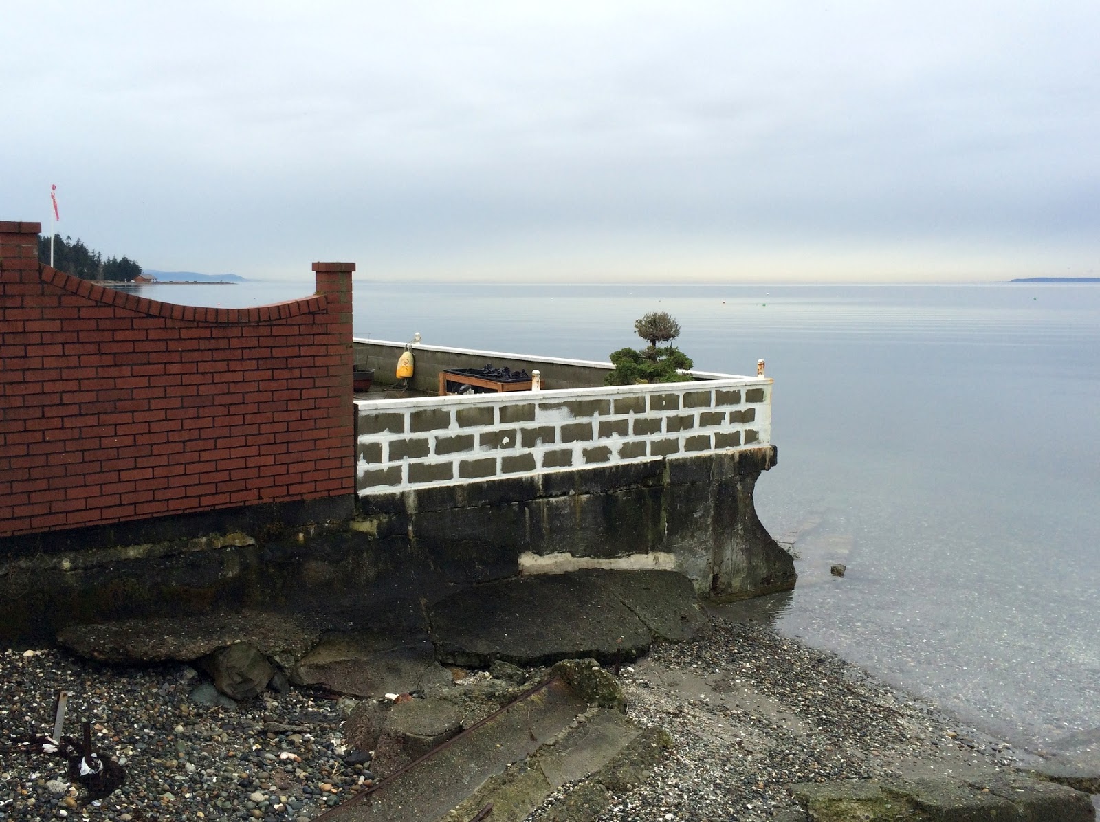
We spent last weekend exploring Pender Island, so this weekend I'll see if I can dribble out posts on a few of the beaches I collected.  We spend a week every summer on Salt Spring Island, but other than occasional ferry stops at Otter Bay, had never made it to Pender.

Mortimer Spit is located at the western end of South Pender Island and marks the northeastern entrance to the Pender Canal. It's oriented northward, shaped by waves from the southeast. Refracting waves and tidal currents have wrapped the tip of the spit around to its leeward shore. I'm not sure about the source of sediment - although perhaps it's a combination of glacial material and older Nanaimo Formation gravels (which we'll see plenty of on this island), eroded from the rocky bluffs along the east side of the island. But this is a pretty rugged shoreline and I doubt there's much longshore transport along here.

AERIAL VIEW

Mortimer Spit is a neat little site, although I'm not a big fan of beaches that look like dirt parking lots, which this one sure does.

The end of the spit provides a nice view of the Pender Canal, which separates North and South Pender. The two islands were connected by a narrow isthmus until 1903, when it was opened to provide more convenient passage for a small steamship sailing between Hope Bay and Sidney. I'm not clear from the brief accounts I've seen as to the geologic nature of the original connection and whether its opening required dredging a low spit, digging through a ridge of glacial sediment, or blasting through bedrock (all of which might be possible).

Xelisen - meaning "Lying Between" - was the name of the rich aboriginal site bisected by the construction of the Canal. This must have been a great spot, with both rocky and gravelly substrates (different things to eat), sheltered coves, and access to both ends and to both sides of the island.


Saturday, March 14, 2015

Rocky Point


I can't think of another stretch of shoreline that's undergone such major changes in the last decade, except perhaps the site of the Ledgewood landslide (also on the west side of Whidbey Island), but that was a very different kind of change. The change here is significantly greater than the sandy accretion we're seeing at Maxwelton and Useless Bay at the south end of the island.

Rocky Point (see earlier posts linked below) is where bedrock makes its reappearance as you head north along the west shore of Whidbey Island. A few rocky ledges appear at beach level and form a hard point that undoubtedly influences the shape of the coastline along here, acting much like a large groin, with a broad beach built up to the south and sharp indentation in the coast to the north.

AERIAL VIEW

Cliffside Park. The spits hadn't arrived here as recently as 2009.
It is along this shoreline north of the point where things have been changing. In the 1990s, there was no subaerial beach along this shoreline between Rocky Point and Cliffside Park (the Navy campground a kilometer north). There may have been shallow sand bars, but waves were still acting directly on the forest-topped bluff and the low bank at the campground was being rapidly undermined.

But sometime in the late 1990s or early 2000s, the sand bars began to grow and emerged as a series of north-trending spits. As new spits formed and grew north, they formed a series of small lagoons. As the berms grew in height, vegetation became established. When I visited last, in 2009, the spits had not yet reached the campground, although there was an obvious bar just offshore.

Rocky Point: February 2009
North of Rocky Point: February 2009

We visited the site on March 6th. The beach just north of Rocky Point has eroded back dramatically, but there is a wide foreland in front of Cliffside Park, as if the whole spit complex has just continued to roll north. The historical imagery on Google Earth illustrates these changes pretty well.


Forbes Point


Forbes and Maylor Points mark the southern end of the peninsula that separates Oak Harbor on the west from Crescent Harbor on the east. The 19th century t-sheets suggest that this was once almost an island, connected to the rest of Whidbey Island by a tombolo, but evidence of this is buried benath the large fill associated with the old seaplane base (now the base exchange) and the parking lot behind the Oak Harbor Marina.

AERIAL VIEW

In the late 1970s, the Corps of Engineers undertook a national initiative to look at low cost methods of erosion control. One part of this project was an ambitious series of demonstration projects. There were two on Puget Sound - one at Sunnyside Park in Steilacoom and the other here, at the base of the bluff between Forbes and Maylor Points.


Remnants of old gabion baskets
In 1978, the engineers constructed a series of erosion control structures along this relatively uniform stretch of eroding glacial drift. They systematically laid out a series of treatments, including two types of wood bulkheads, a gabion revetment, a revetment made of sacks of concrete, and a bulkhead made of old tires mounted on vertical wood posts. They did some with filter material, some without. It was quite the experiment.

In the winter of 1978-1979, the barely completed experiment was severely tested, and almost destroyed, by two storms, the larger of which was the same February 1979 storm that sunk the Hood Canal Bridge. Some treatments held up better than others.

I visited the site in the early 1990s (and am trying to track down my photos). This was my first time back. I found some of the old Corps' reports and maybe there's a follow-up story we can pull together. But that will take a little more work.

At Maylor Point, at the west end of the project, there is an old concrete structure looks like it was originally constructed to carry electrical conduit (some reports say drainpipes) down the bluff to the beach. It has been left behind as a flying buttress as the bluff has gradually retreated.


This site has been used to estimate historic erosion rates - which were earlier estimated to be about 6"/year here (pretty high for Puget Sound). A quick comparison with an old photo of mine indicates very little erosion in the past 25 years (certainly not 6"/year), but I'll see if I can document this a little better and will report back.

Monday, March 09, 2015

Oso


I've noted before that I try to keep this blog pretty focused - on beaches. Or maybe shorelines in general. Or maybe on geology. This is mainly in that last category, although there's not actually much geology in this post.

We were in New Mexico last year when I heard someone ahead of me in line ask the clerk if they'd heard about the big landslide up in Washington. Some quick work on the internet confirmed where it was. I guess I had heard other geologists mention the "Hazel" slide after the 2006 event, but knew little more about it than that. The field trip at last week's AEG workshop on landslides was my first chance to visit the slide and it was great to be able to do it in the company of people who know a lot about geology and landslides.


The Oso landslide occurred on March 22, 2014, on a Saturday morning when pretty much everyone in Steelhead Haven was at home. The hillside collapsed - on the site of an old, recurring slide - and ran out across the entire valley floor. Subsequently, geologists have begun to uncover evidence that this section of the North Fork of the Stillaguamish River has seen this kind of event before - although like earthquakes, they do not occur often and there is probably little way to predict just when and where they'll occur. And when they're not occurring, these are very attractive places to live.


Engineers and lawyers and government agencies will be debating the details for years, but I guess my takeaway was that the more we know the better, but that we can never know everything as well as we might want. Especially in hindsight. High bluffs and barrier beaches and floodplains are created and maintained by natural disasters. That doesn't mean we can't build on them, but maybe as a society we have to do more to educate ourselves about the risks.

Two miles downstream, you wouldn't know what happened less than a year ago.


Showboat Beach


For years, the old Showboat Theater floated along Portage Bay, in the midst of the oceanography and fisheries buildings, but by the 1990s, I guess they were afraid it would sink - or maybe it actually had sunk?

The old showboat went away and it was replaced by a small park and a beach, just down the hill from the South Campus Center. It's a nice place for students to hang out on nice sunny days - so it was empty on this visit.

AERIAL VIEW

I took advantage of a break at the Landslide Forum (Seattle Times article) to wander down with my coffee to see how the beach was doing. It's doing okay. I suppose it's a pretty confusing place to be a beach - a little bit of wind wave action from the south and a constant stream of boat wakes - and then add to that the strange plumbing of the Lake Washington system, which maintains higher water levels in the summer and lower ones in the winter (thus the wider beach in this photo).


Dickman Mill


This mill in Tacoma's Old Town was the last of the lumber mills along Ruston Way to close. It shut down in 1977 and burned down in 1979.

In the late 1990s, Tacoma Parks developed a plan to clean up the site and turn it into a park. It required sifting through issues of remediation, wetlands, public access and recreation, ecological restoration, and historic preservation (and probably many others, too). Which wasn't easy, but was eventually successful. 

The concept envisioned a beach and an estuarine marshand it was tricky to figure out how to configure this given the geometry of the old site, but the design actually ended up taking advantage of the historic footprint. The beach is a swash-aligned pocket beach, constrained by the concrete foundation of the mill.  The tidal lagoon fills and empties through an inlet that runs through the old structure, which reduces the likelihood that sediment clogs the inlet (an early idea was to create an inlet in the beach itself, but there was no way to make this work without extensive maintenance).

AERIAL VIEW

To see what this site once looked like, check out the Tacoma Library collection:

Dickman Mill, 1948

The old field of piles still lies offshore. The base of the old cone burner is a weird lagoon at high tide. The backshore has filled up with wood debris. and the estuary seems to be doing pretty well (as often the case, it took a while for the vegetation to get established). On the other hand, the park (completed in 2000) looked like it needed some work. Some of the concrete walkaways were having to be repaired and blackberry was taking over the fringes of the marsh.


Saturday, March 07, 2015

South Beach


February was just one sunny weekend after another! On Sunday, three weeks ago, M and I headed up to San Juan Island for the day. Tough day.

San Juan is mainly bedrock, so beaches are scattered and usually fairly small.  But at Cattle Point a thick pile of gravel has been eroding for centuries, spreading itself along the shore to form this beautiful long beach.

AERIAL VIEW


The beach faces across the Strait of Juan de Fuca towards the Olympic Mountains - a little hazy on this particular day. The back beach is probably one of the larger accumulations of drift wood on the Salish Sea.

From a previous visit:
South Beach:  June 2011


Thursday, March 05, 2015

Point Whitehorn


The gravel wasn't going anywhere on this very calm day several weeks ago!

The Point Whitehorn Marine Reserve  provides access to this coarse pebble beach just south of Point Whitehorn itself and a short distance north of the pier at BP's Cherry Point refinery. A short trail through the woods leads to a set of stairs down to the beach. One benefit of the industrial zoning along this reach is that the rest of the shoreline is relatively untouched - anywhere else it would be a continuous line of 5000 square foot houses, beach stairs, and seawalls!


Eroding till and glacial marine drift (I think both are present along here) provides a stream of coarse gravel and boulders that arrive by occasional landslides. A quick glance at the bluff face identifies more boulders that will join those on the beach in coming decades.  The beach is coarse - mainly pebbles and coarse gravel -- but with patches of finer gravel and sand below recent slides, in the lee of large boulders, and occasionally just smeared out along the upper beach for no apparent reason.

AERIAL VIEW

The direction of sediment transport along here has always been a little controversial. Predominant southerly wave action would suggest northward transport, but Sandy Point, the large spit a few miles south of here, sort of indicates the opposite. The argument for this is that the large fetch from the northwest might allow less frequent, but more powerful wave events to move stuff southward.


Just today - and unrelated to my recent visit - I received a copy of Meghan Weaver's thesis (thanks, Scott). I haven't had a chance to look at it in detail, but she traced cobbles using RF tags and used models to get at this question. Most of her cobbles moved northwest in response to southerly wave action during experiments in winter, 2012 - but a major storm with waves from the west showed that the largest waves may be able to move significant amounts of material a long ways in the other direction. 

Fetch, and therefore the largest waves in this fetch-limited system, may be be crucial to understanding long-term patterns in coarse sediment transport, even if the sense of direction is different than that dictated by more routine wind and wave patterns. 

Meghan also makes some other important observations about the importance of the tidal stage in influencing patterns of movement and about the relative mobility of the upper and lower foreshore (material moves more on the upper beach). Ultimately, what she shows is that simple models of longshore sediment movement are ... well, simple. So neat to have a new generation of geologists that are actually using data and realistic models to get at things the rest of us have been speculating about for decades!


Birch Bay - Part Two


Another post from Birch Bay, this one a little farther north along Birch Bay Drive. Unlike the residential section in the previous post, here the road follows the beach, the development is landward of the road, and the beach is both public and accessible. Unfortunately, the roadway itself and subsequent erosion has left little of the original backshore and the upper beach is littered with old seawalls, riprap, and a long series of concrete groins. It's a mess.


In the 1970s, Wolf Bauer (who just celebrated his 103rd birthday) proposed an ambitious gravel berm and enhanced public right-of-way along this stretch. Now, 40 years later, a somewhat scaled back version may actually get built. Funding has been found, plans have been drawn up, and maybe in a couple of years we'll get a new beach, a big boost for the community, and a road that doesn't get pummeled with gravel every time a storm comes through.

AERIAL VIEW

Previous posts:
March 2010
March 2009


Wednesday, March 04, 2015

Birch Bay - Part One


I read recently that although blogs have few rules, one should always endeavor to post regularly. Hah! Collecting beaches is a hobby. Sometimes work, family, or even other hobbies, can intervene. Sometimes I fall behind. In some cases, I simply don't get to the beach. In others, I get to the beach, but can't seem to find time to post. In the last month, my shoreline trips have been few (and often gray and drizzly) and my distractions have been many, so a number of potential posts have simply stacked up in a pile of JPGs on my hard drive.  I will try to dribble a few out over the next few days.

AERIAL VIEW

This is the first of two posts from Birch Bay - collected on a trip to Whatcom County several weeks ago. Birch Bay opens to the west onto the Strait of Georgia and its inner shoreline forms a broad crescent, formed and reinforced by refracting waves. Longshore drift along the bay's beaches is generally from south to north, helping to explain why the mouth of Terrell Creek is deflected almost two miles north by a long spit.

The stream-mouth spit begins in the State Park, but its northern half was developed ages ago and is lined with beach houses and bulkheads.  The encroachment of the structures across the upper beach is probably due in part to how they were originally built and in part to the progressive erosion of the beach itself -- either way, there's not much high tide beach left along here!