skip to main |
skip to sidebar
The Humboldt Lagoons are a series of three (originally four, but one was drained and unsuccessfully farmed) lagoons on the northern California coast. They represent large bays that have been isolated from the Pacific by long barrier beaches. Occasionally a big storm and high water levels break through, but the normal condition is closed. The photo above, and the aerials, show a broad vegetated backshore on much of the barrier, but a narrower stretch at the south end. I assume this is the consequence of the breach described in detail by Nic Kraus and others in Shore and Beach (2002).
AERIAL VIEW
I liked the beach here - a thick band of gravel in the swash zone, but sandy above. I could have spent a lot more time exploring, but we had a lot of ground to cover (and we wanted to be in Eureka for lunch).
 Originally, I just pulled off the road to admire the sea stacks south of Cape Sebastian, but I wound up wandering the beach for half an hour, exploring the dunes (my copilot seems content with the view from the car and a good novel). The back beach was a field of crescentic, 1.5-meter high dunes, charged by a brisk wind from the north.
 There was a lot of sand moving - although almost all of it below ankle level. It blew off the top of the dunes and settled on the slip face. Eventually, the slope would avalanche - sometimes all at once (as if all of those individual grains were in communication with one another) and sometimes as a progressive failure, usually, but not always, starting at the bottom.
The dunes were moving across a deflated surface - the flat roughs were largely bare of sand but often exhibited some neat eolian erosion features.
AERIAL VIEW

The theme of this post is sea stacks (or seastacks). From Cape Arago north, the terrace has been composed of Tertiary sedimentary rocks, but moving south we encounter Jurassic metamorphics at the coast. Here in Bandon, they are scattered across a beautiful broad sandy beach.
Sea stacks are simply the leftover bits of a receding coastline. They can occur on any rocky shoreline, but I suppose they are more common in places where geologic differences allow some areas to erode much more easily than others.
This can happen in heavily jointed or fractured areas, but it can also occur where chunks of more resistant lithology are surrounded by softer rocks. In California, this can occur when resistant blocks of Franciscan form knockers that get left behind. Or in other places where volcanic rocks are surrounded by more erodible sediments. You can probably get stacks even in uniform geology, but it seems like it would be less likely.
I have no idea what controls the formation of these particular stacks - differences in lithology within the metamorphic rocks?
AERIAL VIEW
Another interesting observation about this area. Komar and colleagues observed in the 1990s that slower cliff erosion rates in this area (evidence includes gentle vegetated slopes and intact talus) was consistent with modern uplift along this shoreline, which tends to reduce wave action at the toe.
Cape Arago is the tip of the broad headland southwest of Coos Bay - the same headland on which Sunset Bay and Shore Acres (previous posts) are located. The viewpoint offered great views down the coast - complete with whales - but it was the beach right below us that caught my attention.
AERIAL VIEW
I scrambled down to the little cove (Middle Cove) on the south side. The trail came down across what looked like an old landslide, perhaps a source of sediment for the isolated beach at the bottom. The beach itself is fairly protected by the headland and by offshore rocks, but the exposure to the south is still pretty significant and there must be enough wave energy to stack up those big cobbles!
But it's awfully hard to picture winter storms on a sunny, calm June day.
More photos of the marine terrace. More steeply dipping sedimentary rocks planed flat on top by waves 80,000 years ago and then subsequently covered by a thin layer of beach and dune deposits. Then gradually lifted 80-100' by plate tectonics and, much more recently, carved into seacliffs and sea stacks.
Sunset Bay is cut into a thick section of steeply-tilted sedimentary rocks. This geologic structure is exposed in the cliffs that surround the bay as well as in the strike of resistant layers on the eroded platform, but it is also seen nicely in the aerial images, as all of the headlands and islands follow the strike of the rocks.
AERIAL VIEW
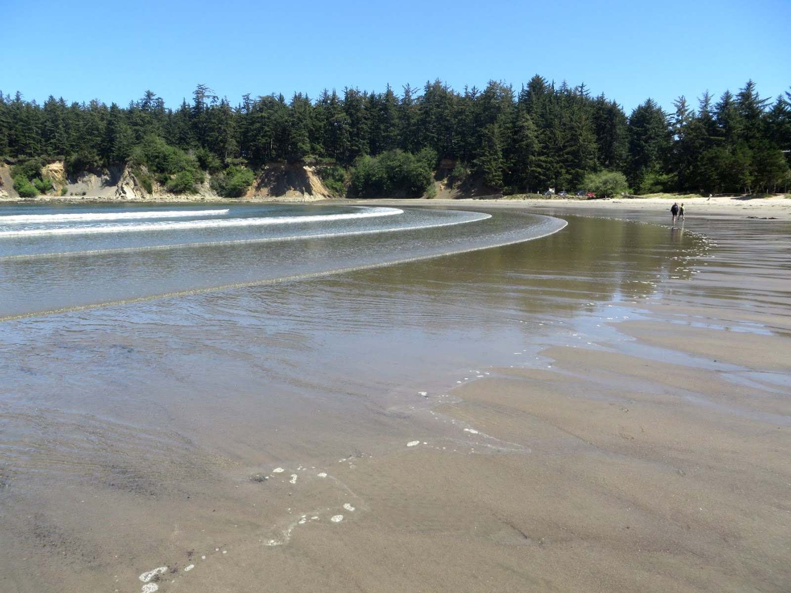
There's a nice sandy pocket beach tucked into the bay. It's protected from the worst of the open ocean by the shape of the bay and the rocks that guard its entrance, but smaller waves spread out regularly across the flat low tide terrace.
The roots of large spruce? trees appear on the lower beach on the south side of the bay near the mouth of Big Creek (not the same Big Creek as the previous post). Since these trees would not have grown in the lower intertidal, there must have been significant subsidence here. At the same time, the marine terrace that is visible on the adjacent uplands suggests long-term uplift. Or at least net uplift. These subducting coasts ratchet their way upwards, the long-term pattern punctuated by abrupt subsidence in large earthquakes every few hundred years.
I spent half an hour exploring the beach between the mouth of Big Creek and the much smaller creek at the Muriel Ponsler Wayside, a few miles north of Heceta Head.
The smaller creek emerges from a narrow ravine cut into the terrace (more later) and spreads out on the upper beach before cutting through a broad sand bar and escaping to the sea. Streams flowing across beaches are as instructive as they are ephemeral. This one exposed a cobbly substrate below several inches of beach sand. The northerly wind was causing small dunes to cascade down the north bank of the stream. The stream channel was carving a steep cliff into the south bank. There were terraces and braided channels and small deltas. But it will all be erased and completely rebuilt after the next high tide.
The elevation of the terrace is quite low here, apparently a result of the modest long-term uplift rates on this section of the coast. Highway 101 is built on the terrace, when it's not crossing Big Creek (Big Creek Bridge, for an explanation of bowstring arch bridges and a nice photo of this section of coast).
The modern shoreline has cut a small cliff into the Pleistocene alluvium of the terrace (it looks like the underlying wave-cut platform is below beach level). The cobble storm berm of the modern beach has pushed up against the terrace and modern sand dunes have formed on top.
The wind was blowing from the north, forming small dunes and a lot of other cool eolian features.


 Nye Beach in Newport is a great case study in coastal erosion and landslides. To non-geologists, the only clue besides historical signs and accounts may be the foundation of the condominiums perched on the edge of the bluff at Jumpoff Joe. Geologists, on the other hand, might recognize the characteristic slump topography along the bluffs and the unusual outcrops on the beach below.
Jumpoff Joe refers to a long-gone headland that jutted out to sea just north of the relic condos. Historic photos show a major projection complete with a large arch. Apparently it was a significant impediment to travel along the beach, requiring people to climb over and jump down somewhere on the other side.
AERIAL VIEW
A long stretch of this bluff has slid historically, aided in part by seaward-dipping sedimentary layers in the underlying geology (a frequent contributor to coastal landslides). Early development on the down-dropped block was destroyed by sliding and erosion.The British call these landslide benches the undercliff - tempting, but often disastrous, places to build. A remnant knoll between the two large slide blocks was the site of this ill-fated effort to build condos in the early 1980s - now memorialized by the incidental concrete viewing platform.
Paul Komar dedicates an entire chapter to Jumpoff Joe in The Pacific Northwest Coast (Duke 1997). One of the lessons of Jumpoff Joe is a simple reminder of the dynamic nature of coastlines and our willingness to overlook this when it comes to developing coastal property. A corollary lesson is that any developer can find a consultant wiling to write a favorable report, no matter how evident the underlying problems.
For those interested in the history of Nye Beach and Jumpoff Joe, Wikipedia is a good starting point (Wikipedia is often a good starting point, but sometimes not a good place to stop). There are also some nice historical images of the 19th century coastline and of the early 20th century buildings if you dig a little deeper (Google's image search is a helpful tool).
Beverly Beach lies along the beach that extends between Cape Foulweather on the north and Yaquina Head on the south. Oregon's coast is divided into many of these littoral cells by rocky headlands that extend out from the coast and preclude, or at least limit, the amount of sediment that can move around their ends. They might be thought of as pocket beaches, but are generally larger and more complicated than the smaller beaches we usually put in that category. Seasonal and inter-annual variation in the direction of wave action can shift beach sediment back and forth within these cells, causing erosion at one end and accretion at the other. Streams and eroding bluffs add sediment. No doubt in some cells sediment is lost offshore to deep water. And in several places on the Oregon coast, winds push beach sand onshore forming dunes and removing it, at least temporarily, from the beach system.
AERIAL VIEW
Beverly Beach campground lies at the lower end of Spencer Creek, which empties out under Highway 101. The beach is broad, sandy, and flat with a cobble storm berm. But where the stream runs across the beach, it shows a layer of beach (or stream) cobble just below the surface.

Welcome to Oregon! This will be the first of many posts from beaches on the Oregon and northern California coasts that I'll dribble out over the next week or two. I should probably be more reserved, but a week of good weather on a spectacular coast leave me little choice! Okay - it's still a little gray in these pictures, but it gets better!
 There are a few common themes that will dominate this series. One is the persistent and variable marine terraces that define much this coast. Another is the compartmentalization of the coast into cells - ranging from long strands to tiny pocket beaches - separated from one another by resistant rocky headlands. Within these broad themes are an endless variety of small stream mouths, elegant barriers, mixed sediment beaches, and human interactions. And all sorts of bedrock features, like seastacks, eroded platforms, and occasional punch bowls.
Otter Rock and Otter Crest are perched on a relatively narrow marine terrace just south of Cape Foulweather. This is the most recent, and most obvious, terrace, along this coast (not counting the future terrace forming at sea level today). It probably dates to a prolonged high stand of the sea about 80,000 years ago. Note that sea level at that time was roughly what it is today and that the raised elevation of the terrace reflects subsequent uplift of the coast. It turns out that variability in the height of the terrace along the coast is an excellent indicator of the local uplift rates.
 AERIAL VIEW
The picture shows the nice angular unconformity developed on top of the tilted sedimentary rocks. This planar surface was the wave cut platform - akin to the modern one in the surf zone. When the terrace was abandoned (by falling sea level and the uplifting coast) it was covered with a think sequence of beach, dune, and alluvial deposits, which is the lighter band on top.
AERIAL VIEW
The picture shows the nice angular unconformity developed on top of the tilted sedimentary rocks. This planar surface was the wave cut platform - akin to the modern one in the surf zone. When the terrace was abandoned (by falling sea level and the uplifting coast) it was covered with a think sequence of beach, dune, and alluvial deposits, which is the lighter band on top.