Monday, March 25, 2013

Chambers Bay


I think this beach is where I'll bring the class in May, since it's close to the classroom (which looks down on it from the top of the hill) and because it's a beach that looks like it can tell some interesting stories.  The challenge will be finding geologic stories that are relevant to other Puget Sound shorelines, not just stories unique to this strange anthropogenic coastline.

Just like Richmond Beach in the previous post, this site began as a late glacial delta, become a gravel pit (a very large one), and has ended up a park.

Previous post from here:  Pioneer:  October, 2010
Post from the active mine at Dupont, south of here:  Sequalitchew Delta, October 2011


AERIAL VIEW

A high bluff once rose steeply from this beach.  The beach itself probably ran in a fairly straight line, interrupted only by occasional clusters of large logs and downed trees.  The bluffs receded rapidly when the mining began and now they now lie 1000 meters to the east.

Beaches are active and often very young geologic landscapes.  The wave environment at this one probably hasn't changed much in the last 150 years, but much else has, and the beach has responded accordingly.  Resistant headlands have been imposed in the form of concrete structures, pier abutments, and coarse cobble lags leftover from loading operations, and these have altered the configuration of the beach. The original bluff sediment sources have been replaced by the beach itself, as one part erodes to supply another.  Transport patterns have changed to reflect the beach's new shape and the shifting sediment sources.

It's a wonderful beach, but also a very different one than the one that had gradually transgressed into the forested bluffs for thousands of years.  It tells some neat stories, but the most obvious have to do with its human history.


Wednesday, March 13, 2013

Richmond Beach


Saltwater Park in Richmond Beach is perched in a large divot (one of my favorite geomorphic terms) that apparently corresponds quite closely to a post-glacial delta on the shores of Lake Russell (or Lake Bretz?).

Steep glacial deltas are little more than well-organized piles of gravel which means that they often disappeared by the barge load in the 20th century to provide aggregate for a growing city.  The gravel mine explains the amphitheater- shaped divot and the barge-loading explains the beach.  Which might be easy to mistake for a spit of some sort if you didn't know the history - and didn't notice that it looks much more like a pile of gravel than a spit (for one thing, the backshore is much too high).

AERIAL VIEW

Richmond Beach is a great place to watch sunsets.  And I was here for a good one.

It's also a good place to watch trains.  While I was on the beach between here and Boeing Creek (previous post), a series of northbound trains passed, including two Sounders, the Empire Builder, and this coal train - which was probably on its way from southeastern Montana to a terminal near Vancouver, where the coal will be transferred to a ship going to Asia.  It will all be kilowatts and carbon dioxide in a couple of weeks. (For anyone interested in coal, a popular topic around here these days, there are more photos on my hshipman blog (selected for the word "coal", but they reflect my fascination with geology, trains, and the Wyoming landscape more than any particular position on the current environmental politics!)


And for geologists not interested in Pleistocene deltas, in Holocene beaches, or in the Anthropocene coal industry, I've included a picture of some real rocks - in this case bright red ones used to repair riprap along the railroad.  Those are Precambrian Belt Series rocks from western Montana and those are very, very old ripple marks from a billion year old shoreline (I included a similar photo from six miles north of here in a post five years ago:  Ripple Marks - June 2007).

Boeing Creek


Boeing Creek flows out under the tracks a mile or south of Richmond Beach, in a ravine that runs between the posh chateaus of the Highlands and the upscale, but somewhat less posh, suburban tracts of Innis Arden.

The creek flows through a concrete box culvert (as does the walkway) dated 1951, but there are old rusty culverts dating, I assume, to it's previous path.

It's an interesting contrast to the Elwha from the week before.  It's obviously a much smaller stream to start with and I also suspect that the delta is composed not only of stream sediment but also a significant fraction of sediment eroded from bluffs farther south, transported north by waves, and trapped in the complex dynamics of the creek delta.  Like the Elwha (particularly recently), there are broad sandy bars extending far offshore on the downdrift side of the stream mouth.

AERIAL VIEW

Like many streams in this part of the sound, Boeing Creek reaches beach level upstream of the mouth of the valley, suggesting that it may have originally been graded to a lower sea level and then its valley floor rose in pace with rising sea level over the past few thousand years.  The railroad has altered both the landscape and the movement of sediment, obscuring the historic pattern of alluvial valley, wetlands, estuary, and stream mouth spit - all of which were likely present to some small extent.


Elwha Delta


With the lower dam completely gone and the upper dam nibbled down until only a much shorter version remains, the Elwha is releasing the sediment stored in the reservoirs for many decades.  Gravel from Lake Mills is moving its way down the river between the dams as a large wave, filling pools and braiding channels across the valley bottom.  Sand is moving through the system more quickly and is now appearing as large shoals at the delta – low tide and subtidal bars that are encroaching at the base of the cobble beaches on both sides of the river’s mouth.

A bulk of the material appears to be shifted eastward, a predictable consequence of the westerly swell.  Which is fascinating all by itself.  The waves wrap around the delta from the west, breaking along the shore at incredibly high angles, with big implications for both sediment and surfers.

AERIAL VIEW
Wood has also been flushed out of the reservoirs.  Wood of all sizes from small chunks of bark to large branches has been piled into broad debris fields at the river mouth, stacked in ridges by successive high tides, and then more recently eroded or washed away, spreading out in a thin band along the beach to the east.

The new sand has had little noticeable effect on the ongoing erosion of the gravel berms on the east side of the delta, which have been retreating rapidly for decades.  Maybe the new sediment will begin to slow this process, but will it do it by accreting new sand and gravel directly to the beach face, by dissipating wave energy on the broad sandy bars, or will the current beach face simply be abandoned as a new series of spits and lagoons forms farther offshore?

The removal of the dams is unleashing a complex chain of events, much as the construction of the dams did a century earlier. Some things will change rapidly – particularly those things that are moved readily by frequent processes, like sand moving through the lower river.  Some things will take much longer, particularly those that involve difficult to move material moved by infrequent processes – like new cobble berms forming on the delta.

The Elwha isn't just about emptying the reservoir and watching the exposed soils revegetate.  It isn't just about restoring a natural grade to a river that had been ponded behind two large dams.  The removal of the dams restores an incredibly complex system that extends far beyond the reservoirs.  Fish that spend most of their time in the open ocean will now be able to swim up into Olympic National Park, for the first time in a century, to lay their eggs in the upper watershed and give rise to new generations of Elwha River salmon.  Sand and gravel that has been trapped in reservoirs will now move downstream, rebuilding the delta and influencing the beaches all the way to Ediz Hook in Port Angeles.

I’m just an excited spectator out at the Elwha.  There are many folks much more actively involved and much more knowledgeable about the river and its beaches. Here are a few of them.


Photos and images:

Recent Articles:

Irondale


The new park officially opened in January.  The toxic residues are cleaned up, much (but not all) of the historic structure is gone, and the beach has been given a fresh start.

Irondale:  November 2011

AERIAL VIEW

The foundation walls of the old beehive charcoal kilns were left in place.  They will gradually dismantle themselves, contributing to the lag of bricks and rubble on the low tide beach.  The rapid initial erosion of this beach will settle down as the grade eases and a berm re-establishes itself, within and between the semicircular kilns.


An originally unanticipated aspect of this project was the removal of a large volume of the fill on the site and the WDFW site immediately north (Chimacum Beach).  Now, instead of a 6' scarp of eroding fill, there is a smooth transition from the berm to the backshore.  This will give the beach more freedom to pick it's favorite line - there's already evidence that in some places it will end up waterward of the current line, in other places it will end up eroding the backshore a little.  But the nice thing is that it has been given room to make this choice.
 

Monday, February 18, 2013

Ediz Hook


As readers may have noted from posts over the past year or two, we're seeing more and more examples of beaches being restored - often these are relatively small projects where an old structure or a bulkhead has been removed or where historic fill has been pulled back.

AERIAL VIEW

This was an old log dump used, as I understand it, for getting logs from trucks into the water. At least as of now, the Google Maps image still shows the old looped dock. But that's all gone now, replaced by a curving beach, a revegetated backshore, and an awful lot of large wood.

I'm sure wood has always been a common component of Salish Sea beaches and there's plenty of evidence that suggests it can influence patterns of erosion and accretion - to a point. But from looking at many of the projects going in these days, you'd think beaches were all about wood, not about sediment!  I'm excited about all these neat projects.  I just hope the wood doesn't get in the way of the beach doing it's thing.  Fortunately, in most cases, the wood doesn't seem to be having too much effect on the beach doing it's thing.

Dry Creek


Dry Creek emerges from a small canyon midway along the otherwise unbroken line of bluffs between the Elwha Delta and Ediz Hook in Port Angeles.  I've posted from here before (Dry Creek March 2008; October 2009) and this entry is sort of an update, along with a way of capturing photos from last week's visit.


To the west of Dry Creek lies more than a mile of beautiful cliffs - no stairways, no seawalls. During the last few years, a broad foreland has developed along this stretch (see Elwha: August 2009).  There's a good view of this feature from the top of the landfill.  In the 1970s, a broad beach protected the bluffs along the same shoreline but in the 1990s, it was gone. Now it's back again. This is a huge amount of sand and gravel and suggests a far more complicated picture of sediment transport between the river and the spit than is typically told.  Fortunately, thanks to the Elwha Restoration, there are plenty of folks watching these beaches and maybe in another decade we'll understand more than we do now.  I suppose this feature may be gone by then - I wonder to where?

AERIAL VIEW

To the east of Dry Creek is the Port Angeles landfill.  A large seawall was built several years ago to protect the western portion of the landfill, where trash had historically been dumped over the edge.  But the cliff to the east continues to erode, threatening a more recent part of the landfill that was constructed immediately landward of the retreating bluff (nope - doesn't make sense to me either).  There's no easy or cheap fix, but moving the garbage out of the way is probably the more practical and forward thinking option - it was nice to see it getting serious consideration.


Wednesday, February 06, 2013

South Whidbey State Park


Another State Park -- another deep-seated landslide.  I used Camano Island State Park to illustrate this symbiotic relationship in November (Gravel Beach:  Camano Island SP), but much the same applies to this park on the west side of Whidbey Island.

The trail down to the beach at South Whidbey SP traverses the headscarp of the main slide, then winds through hummocks and around sag ponds, before arriving at the lower bluff, which is where the recent movement has been and which has taken some of the trail along with it.

AERIAL VIEW


This is a wonderful stretch of beach. Bush Point lies to the south, Lagoon Point to the north (Gravel Beach:  last year, same afternoon).  Other than the stairs at the park and a few drain pipes coming down the high bluff south of the park boundary, it's a pretty wild beach.

There are a couple of waterfalls that plunge directly to the beach and both were running full, their streams cutting through the thin sand layer deposited by the previous high tide.  And there is a large glacial erratic.  My petrology is rusty, but I was told once that this was a block of dunite, most likely from Twin Sisters near Mount Baker (anyone want to confirm or refute?)


There are some spectacular landslides - historic ones and new ones - on the bluffs between here and Bush Point.  The sun was going down or I would have checked them out on this hike.  Maybe later this spring.

Side note:  This is my 60th post from Whidbey Island since this little adventure began back at the end of 2005.  'Whidbey' is the most common label on the blog after 'Washington' and 'Puget Sound.'

West Beach


Sound Waters is held every year on the first Saturday of February and whether I stay for the afternoon classes or skip out after lunch to go to the beach, it's always a good day.  This year they moved the venue from Langley to Oak Harbor High School, so I started near the north end of the island and worked my way south.

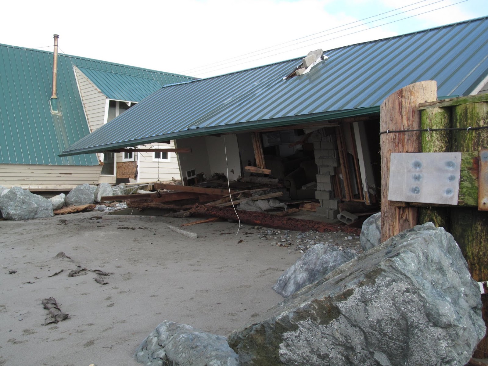
West Beach was calmer than on my last visit - back on December 17th when a storm coincided with a record high tide and caused a lot of damage to both homes and bulkheads.

Gravel Beach:  17 December 2012


This community is a poster child for imprudent development. It certainly isn't sustainable in the long run, particularly with rising sea levels.  At least not without a great deal of expense and heavy duty fortification.

AERIAL VIEW

It's a wonderful place at low tide on a sunny July afternoon, but events like December's storm are exactly what built this ephemeral spit of land and what will wallop it again and again.  Peat ledges on the foreshore are evidence of the beach's landward retreat.  Tsunami warnings are reminders of the beach's lack of elevation and proximity to shifting plate boundaries.  The old failed seawalls at the south end are a fitting monument.


Cama Beach


 Cama Beach appeared on these pages frequently last year and probably will again this year.  These are from a brief foray in mid-January following some more landsliding.  Not only has the big gully been active, but a couple of new slides have occurred as well.

The big slide we posted about last year (search on the label 'camano') was quiet all summer and early fall, but has gotten more active this winter.  Water was flowing over the top during this visit and was eroding the sandy unit below the till.  This appears to undercut the till which then fails in larger blocks, although nothing too dramatic has happened yet this year.  Most of the colluvium in the gully still looked like the trodden and rained-on remains of last year's debris.  I would expect more failures as long as the water is flowing, but I wouldn't pretend to guess how large.


One reason for my visit was reports of a new slide south of the one I just described.  Sure enough, there had been a fairly large debris avalanche on the lower half of the slope, in line with a substantial gully that probably corresponds to an earlier slide.  Water was flowing from somewhere mid-slope. This new slide is immediately north of one that occurred in the late 1990s. There is plenty of tree debris on the beach, and a fair amount of dirt, but nothing like the other slide.  There's a steep bare headwall at the very top of the slope, but the upper slope doesn't appear to have failed in this event.  I suppose the recent slide could make that more likely, at least if conditions stay wet.

There was also a small slide - a small earthflow more precisely - on the slope nearer the resort, above where the old bungalows were.  When the park was redeveloped, a decision was made to remove several of the old bungalows at the north end, at least in part due to their vulnerability to slides. Probably a very good idea.

AERIAL VIEW