skip to main |
skip to sidebar
The highlight of this beach is not actually the beach, but the lodge (hshipman: Naniboujou Lodge), and lunch in the colorful dining room took precedence over exploring the beach.
It's another long, curved gravel beach on the northeast side of a small promontory. The mouth of the Brule River nudges the beach into the lake just to the southwest. There have been some feeble, and not terribly necessary, efforts at erosion control in front of the lodge, where waves have nibbled away at the low bank - perhaps the edge of an old river terrace formed at a higher lake level?
AERIAL VIEW
This will be the first of several entries from Minnesota's north shore of Lake Superior. All are based on fairly short visits during a one day drive between Thunder Bay and Duluth. On a long trip dominated by prairies and mountains, this was the day reserved for beaches. As usual, the posts are based on a combination of cursory observations and small amounts of pre- and post- trip web-work. I hope my interpretations aren't too far off the mark - but if you're writing a term paper on the North Shore Volcanic Group or on Lake Superior sediment transport, I recommend you consult more rigorous sources! But feel free to borrow my pictures.
The bedrock along this shoreline consists largely of mafic volcanics over a billion years old, although they are contained in a broader landscape of gabbro and diabase. Glaciers modified the surface much more recently, creating the coarse grained sediment that has subsequently been reorganized to form beaches. The gravel beaches vary from dark gray to red (although red certainly dominates), depending I assume, on local variation in the oxidation of the Proterozoic source rock. In a blog about beaches, I rarely get to use words like Proterozoic, but I have written about Proterozoic beaches previously, like the rippled Belt Series rocks in the riprap at Shipwreck Point in June 2007 and the beautiful Tapeats beaches at Blacktail Canyon (Cambrian beaches composed of Proterozoic sediment) in June 2009.
The beach on Deronda Bay is typical of many beaches along the north shore. It is basically a pocket beach, oriented towards the east and therefore fairly oblique to the coastline. This presumably is a function of the dominant wave action being out of the east. On straight segments of this coastline with sufficient sediment, this would tend to transport material southwest, forming accumulations on the eastern sides of rocky promontories.
AERIAL VIEW
The gravel was stacked up into a series of berms, suggesting storms at several lake levels. And the gravel on this beach was uniformly red. I would have looked more carefully at the lithology, but my mineralogy is as rusty as the oxidized volcanics. I only picked up the flatter stones, and that was only to see how many times I could get them to skip.
Much of Thunder Bay's waterfront is industrial or otherwise difficult to access. Marina Park in the north part of downtown was nice, but all riprap. Chippewa Park south of town has two beaches. The main swimming beach (I guess some people swim in Lake Superior) is a sandy curve along a small cove sheltered by a rock breakwater.
The pictures here are of Sandy Beach, which is more exposed than Chippewa's swimming beach and lies just to the south. It's the only sand along this stretch, which made me wonder if it could have been trucked in. The beach is broken into several small curves by rock groins.
This is a uneven stretch of coastline. The adjacent shores are ragged (see aerial below), suggesting that the geology may be irregular (maybe piles of glacial cobble in otherwise soft material, or resistant ledges in softer bedrock). Or perhaps, the shoreline has simply eroded for decades and those little points are old rock groins, sort of like the ones on this beach, but without the sand in between. I have no idea and only noticed the pattern once I was back in Seattle.
AERIAL VIEW
 This beach must be icebound all winter - so wave action is probably most significant in fall before it freezes over. I don't have enough experience in these settings to know what peculiar things moving ice does to beach gravel, although I assume under certain conditions it can leave some pretty cool landforms - ice thrusts, rafted pebbles, ice scour.
Thunder Bay at hshipman. As usual, my other blog parallels this one, but instead of rambling commentary about beaches, you get rambling commentary about other stuff. Sometimes it includes a little non-beach geology; sometimes it just has pictures of food.

 We spent most of the day mapping our way around McNeil Island. As a result of its prison status, the island has actually avoided the intense waterfront development typical of much of the rest of Puget Sound. Much of the shoreline consists of remarkably pristine bluffs and forested shorelines, although almost every stream and small estuary has been blocked off or otherwise altered. We saw strange groin-like structures extending offshore in two places and the remains of old ship or barge hulls on the north side.
The erosion control structures of choice were massive piles of coiled cable (old submarine nets? but they looked like giant mattress springs) and tall stacks of precast Ecology blocks.
 This is a place with a complicated history and probably an even more complicated future. It has been both a federal and a state penitentiary and now it's still used to house various types of offenders. But as the use of the island as a prison has gone down, interest in what happens next goes up.
AERIAL VIEW
This is a place with a complicated history and probably an even more complicated future. It has been both a federal and a state penitentiary and now it's still used to house various types of offenders. But as the use of the island as a prison has gone down, interest in what happens next goes up.
AERIAL VIEW
 This little pair of spits is located just north of Hyde Point on the east side of McNeil Island. Most of our mapping was from the boat, but we had permission to land and this was a great spot to pull the boat up and wander over to look at the back-barrier marsh. The aerial view shows the relationship of these two small lagoons - the southern one tucked into a cove in the upland, the northern one enclosed within a hooked spit.
AERIAL VIEW
At one time, I suspect these two lagoons may have been connected with everything draining out the north end, but now they seem to be plumbed separately since the southern one has it's own tidal channel.
This little pair of spits is located just north of Hyde Point on the east side of McNeil Island. Most of our mapping was from the boat, but we had permission to land and this was a great spot to pull the boat up and wander over to look at the back-barrier marsh. The aerial view shows the relationship of these two small lagoons - the southern one tucked into a cove in the upland, the northern one enclosed within a hooked spit.
AERIAL VIEW
At one time, I suspect these two lagoons may have been connected with everything draining out the north end, but now they seem to be plumbed separately since the southern one has it's own tidal channel.


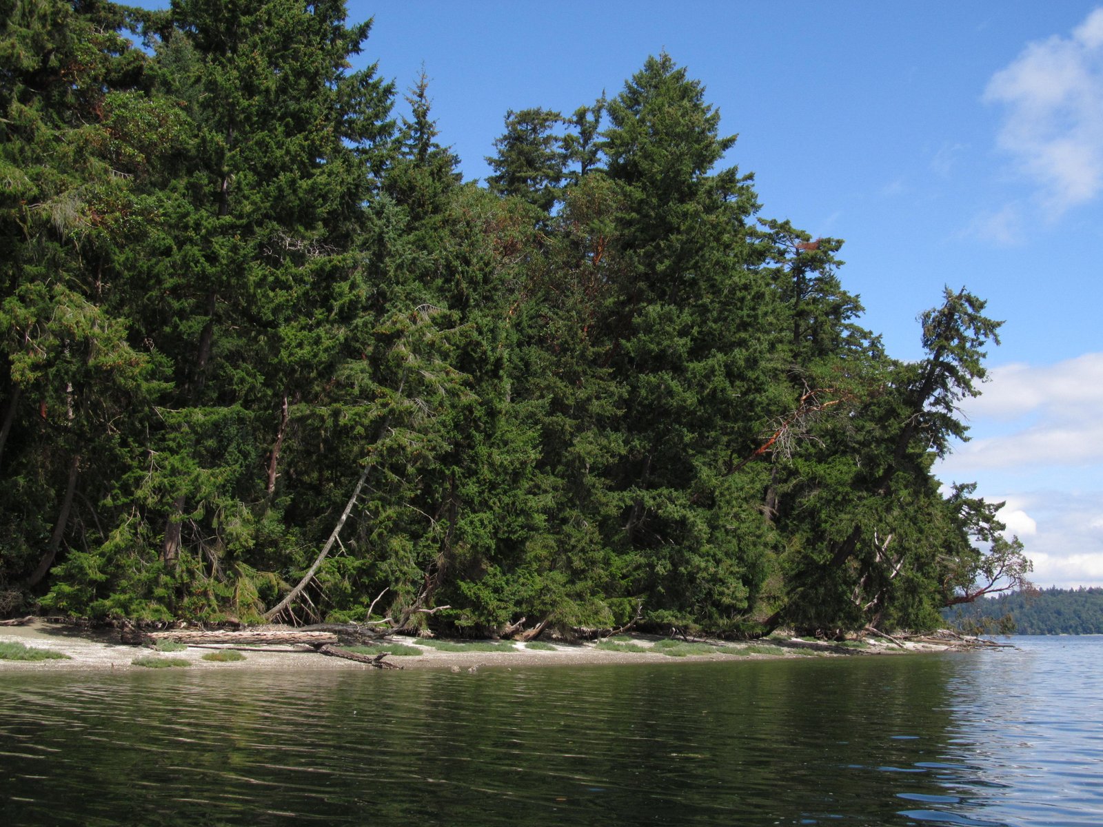
 Gertrude is another small island just offshore of McNeil, this one on the north side at the mouth of Still Harbor. It's off limits to folks like us to protect the seals that haul out on the beaches - particularly at the south end. The east side is very sheltered, with salicornia growing on the beach and a low bank overhung with trees. The west side is a bit more exposed and there is more evidence of erosion.

The funky little spit at the south end appears to be a low terrace -- the flat surface is well above normal backshore elevations and consists of a low erosional scarp. Another geologic question goes unanswered!
AERIAL VIEW

Pitt Island is pretty small - a hectare or so of madrone and fir and poison oak sticking out of the narrow channel between the Key Peninsula and McNeil Island. Wave action from the north (infrequent but significant fetch) and from the south (frequent but sheltered) results in two small cusps at the east and west ends - about the extent of the beach on this island.
AERIAL VIEW
This is part of the McNeil Island Corrections (now Commitment) Facility, so we had permission to land (although it took a phone call to remind the guards with the bullhorn on McNeil about that).
 Some of these outcrops were a reminder that I don't know my South Sound geology as well as I'd like.
Garry Point is the end of the road in Steveston, where the Fraser River heads out to sea. I suppose Steveston was originally built on the natural levee along the historic distributary, but now it's simply the bottom left corner of the sprawling city of Richmond.
AERIAL VIEW
Garry Point Park was created with fill (dredged sediment from the river, I assume) and then armored with riprap and shaped to create a series of pocket beaches along the riverside.

The Fraser River delta extends out into Georgia Strait, forming the large, shallow Roberts Bank. The Tsawwassen Ferry Terminal is located at the end of a long causeway that extends across Roberts Bank to end just short of the U.S. border. A parallel causeway a couple of kilometers to the north serves the large coal and container terminals.
AERIAL VIEW
 The two jetty-like projections have undoubtedly mucked up circulation and sedimentation patterns in the vicinity, but they sure move a lot of ferry passengers to Vancouver Island and a lot of Rocky Mountain coal to steel plants in Japan and Korea.

This log-choked salt marsh originally formed behind a tenuous spit, but sometime last century, a dike was built along the general line of the spit, cutting off tidal influence so the area could to be pastured. There have been years of debate about what to do with this site, in part to address a mosquito problem that tidal circulation would help alleviate. Now the Nature Conservancy is excavating a portion of the old dike and restoring a tidal inlet at the northern end, which should result in much more efficient exchange and a marsh much more similar to what used to be here.
The beach here doesn't amount to much. Iverson Spit, located a short distance south, is much larger and probably traps a bulk of the sediment transported from Barnum Point. The limited sand on this beach may come from the reworking of older marsh or tidal flat deposits, although I suppose some sediment may find its way north from Iverson. Up here at the north end of Port Susan, most of the wave action is from the south, across the broad flats that extend over from the Stilliguamish Delta.
AERIAL VIEW
Over the past few years, a new sandy spit has grown north from this site into the marsh. In a year, the new tidal channel will wind out behind this spit. The big question will be whether the new channel will allow all those trapped logs to escape, or whether they will simply choke the new channel until a really high tide occurs.