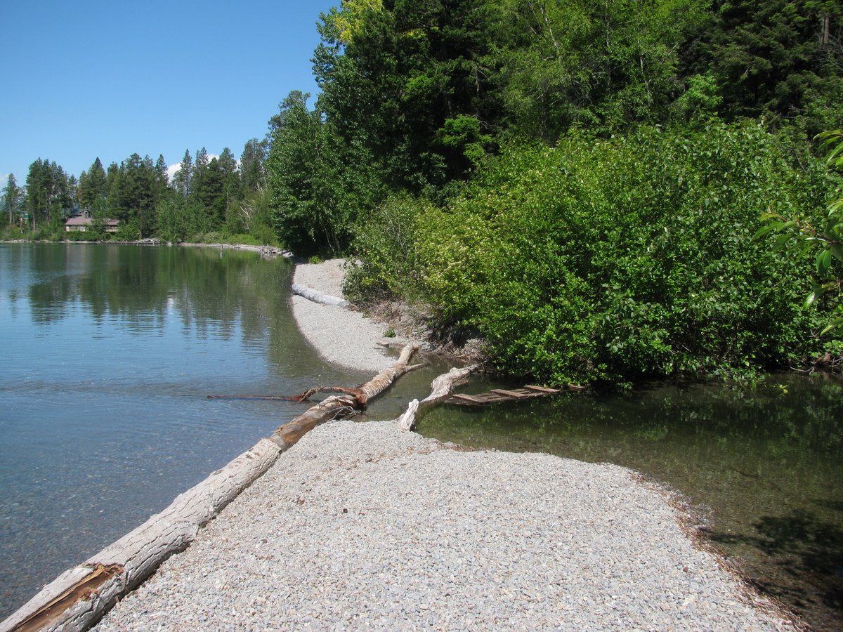
Apparently, our trip along the south shore of Lake Superior is fated to be gray, and rushed. But we stopped at McCarty Park in Marquette for lunch and to toss the frisbee. This sandy beach is just around the corner north of town and stretches off to the northwest. Bedrock outcrops (I bet they are ancient) created an elegant little tombolo.
Sunday, June 27, 2010
Marquette
Apparently, our trip along the south shore of Lake Superior is fated to be gray, and rushed. But we stopped at McCarty Park in Marquette for lunch and to toss the frisbee. This sandy beach is just around the corner north of town and stretches off to the northwest. Bedrock outcrops (I bet they are ancient) created an elegant little tombolo.
Labels:
great lakes,
lake superior,
michigan
Saturday, June 26, 2010
Duluth
Duluth (Minnesota) and Superior (Wisconsin) are located on the shores of a back-barrier lagoon at the mouth of the St. Louis River, at the western tip of Lake Superior (I suspect most folks wouldn't use the term lagoon for Superior Bay). But the barrier is an impressive 6-7 mile long feature with one natural entrance (stabilized with jetties) and one additional artificial channel (the one here at the Duluth end).
We checked out the beach and dunes a mile or so south of downtown, then came back to Canal Park to check out the bridge and the possibility of a large ship passing through (no such luck). The waterfront in town is heavily filled and riprapped, but the beach farther out was really nice, but awfully foggy.
Labels:
great lakes,
lake superior,
minnesota
Thursday, June 24, 2010
Yellow Bay
Yellow Bay is another site on the east side of Flathead lake that is tucked in behind a small southward pointing headland. The beach is a pocket beach and small spit, with a little stream flowing out across the berm.
It would be interesting visit these places in the winter when the lake levels are 8 feet lower! It would be fun to come back with several days and really explore Flathead Lake - as opposed to two quick stops on Day Two of a trip where Day Eight is New York City. Time to go.
Blue Bay
Blue Bay is on the eastern shore of Flathead Lake. I was drawn here knowing Flathead Lake had some nice gravel beaches and having read some stuff about Mark Lorang's work on constructed gravel beaches on the lake.
Blue Bay is formed by a southward point. The inside contains small pocket beaches formed by the bay's geometry and the various marina structures. These beaches consist of fairly small gravel, the red and green metamorphics (Belt Series?) so common in western Montana. The berm was a couple of feet above today's water level - which is relatively high (the level of Flathead Lake is carefully controlled by releases at the Kerr Dam), but typical for this time of year.
The beach on the outer (western) side of the point along the campground has recently been rebuilt with coarse gravel to address erosion. Apparently, the work was done at lower lake levels earlier this year. The new gravel is fairly large and was piled higher than I suspect the natural berm would have been (isn't this so often the case with nourished beaches!). The material appeared to be still rearranging itself. but it seemed like a nice fix to a problems that traditionally would have been met with riprap.
Sunday, June 13, 2010
Alki Beach
Alki Beach on a summer day is a great urban beach, crowded with picnics and volleyball and rollerbladers and sunbathers. There are even a few people going into the water.
The beach is classic Puget Sound. Sandy backshore, gravelly foreshore, and sandy low tide terrace. There is even some eelgrass trying to survive the foot traffic. The break between the foreshore and the terrace is distinct and occurs pretty close to Mean Lower Low Water. The long straight beach disappears under Harbor Avenue at the east end and under the Alki Seawall at the west end.
For an aerial view, see Alki Point, 2007.
And to see what high tide looks like, try January, 2010.
Labels:
king,
puget sound,
salish sea,
seattle,
washington
Alki Point
Travel and distractions have led me to fall behind. This post and the next date back to a Sunday in June, a low tide, and a walk on one of Seattle's most heavily used beaches.
Alki Point juts out into Puget Sound (April 2007). It is both a low point and a resistant headland. It is formed of Tertiary bedrock uplifted along the east-west strike of the Seattle Fault. These folded sedimentary rocks are exposed in the intertidal on the south side of the point and form a rich biotic community that lends itself to trampling during spring low tides by hordes of school children and strollers.
The story of longshore transport is messy here -- probably for reasons related to the seismic history. Drift is from south to north, but only a narrow band of gravel reaches the the point. There's not much loose sediment in the system south of here, at least for a few miles. There are plenty of human culprits - groins, seawalls, etc - but I suspect the main reason is geologic. If nothing else, when this shoreline was shaken and raised 1100 years ago, any beaches would have been stranded on the raised terrace, probably removing most of the sediment from the active beach (it's now beneath lawns and homes along Beach Drive). The beaches north of the point are doing better. As I pointed out in the 2007 post, I suspect Alki Beach is a fairly stable swash-aligned beach, oriented to face the northerly fetch.
Labels:
king,
puget sound,
salish sea,
seattle,
washington
Sunday, May 16, 2010
Zenith
Des Moines' South 239th Street ends at a narrow set of public stairs that drop to the beach between waterfront homes and a terraced bluff. There is little sign of the original slope and the shoreline is lined with high seawalls of various histories. This is one of those old communities where I suspect the structures we see today are the 4th or 5th version of something (maybe a timber pile bulkhead) built early in the 20th century.
There isn't much beach left. Maybe it was buried beneath the walls. Maybe the last sources of sediment have long been shut off. Or maybe the beach has just continued to erode, despite the fortresses on the bluff, and 80 years has left little of the original sand and gravel beach. The sediment that used to be here has had ample time to move north and is now trapped half a mile north against the south side of the Des Moines breakwater. At least someone got a nice beach out of all of this.
Labels:
king,
puget sound,
salish sea,
washington
Wednesday, May 12, 2010
Skagit River
Another freshwater shoreline, although one still influenced by the tides. This spot is really a point bar, not a gravel beach, after all it was formed by the flowing river, not by waves. Today, it was a little hard to believe that this river drains the entire western side of the North Cascades, but given a big fall or spring flood this place might get pretty exciting.
The river here (just upstream of the I-5 bridge north of Mount Vernon) is carefully confined between high levees and riprap. Overbank flooding and channel migration may be the river's natural inclination, but would be messy and inconvenient for the floodplain towns and their rapidly developing subdivisions and commercial strips. I guess we should hope that future floods stick to the script we have provided for them.
Labels:
puget sound,
salish sea,
skagit,
washington
Saturday, May 01, 2010
Carkeek Park
This isn't the first time I've featured the railroad and it won't be the last. Trains only run on a few tens of miles of Puget Sound's beaches, a small fraction of the total, but the railroad grade and its accompanying seawall stand out in a way that a thousand miles of smaller, residential-scale bulkheads do not. The seawall, which is about 100 years old, is elegant - most of it a rock wall with a slight batter that rises 5 feet or so above the highest tides ever recorded around here. Occasional streams emerge through culverts built into the structure. Occasional landslides flow over the tracks and eventually end up on the beach (although the amount of sediment reaching this beach must be far, far lower than historical levels). Of course, there isn't much beach anymore. What there once was is now buried beneath the double track mainline. The only upper beach remaining along the 26 miles stretch from Seattle to Everett is at the occasional stream deltas and cuspate spits that extend seaward of the tracks.
Labels:
king,
salish sea,
seattle,
washington
Duwamish River
I probably get glimpses of the Duwamish pretty much every week, usually at 55 mph on the way to or from a meeting south of Seattle, but I rarely get a chance to explore. On the other hand, doing so isn't too difficult, since all these shots are taken within a stone's throw of either 99 or I-5. They include the river flowing under the interstate, the river in front of the Tukwila Community Center, and several shots from North Winds Wier, where a large restoration project has recently been done (but where some more work clearly still needs to happen).
The Duwamish is an interesting river with a complex geologic history, especially if you include its major replumbing in the early 20th century.
Last March, I posted some photos from South Park, a little farther down the river:
Duwamish River (March, 2009)
Labels:
king,
salish sea,
seattle,
washington
Subscribe to:
Posts (Atom)