skip to main |
skip to sidebar
The entrance to Port Gamble - the bay - is marked by two spits. The one on the east is Point Julia and is actually a recurved spit or a cuspate foreland. The one on the west, below the town of Port Gamble, may have looked similar, but is now lost beneath the old Port Gamble mill site. I'll come back to that in my next post.
AERIAL VIEW
Point Julia lies on the lands of the Port Gamble S'Klallam Tribe. It's a complicated feature due to the presence of a couple of small stream mouths, but the primary tidal marsh drains out through a narrow channel near the tip of the point. It looks like there's been some fill added to the old berm and marsh and it's possible this has influenced the plumbing a little, but unlike its counterpart across the channel to the west, this one still works!
I'm falling a little behind, but wanted to post some photos from earlier in the month before they get so old that I just abandon them entirely - which sometimes happens.
Cape Shoalwater forms the northern entrance of Willapa Bay, but defining it precisely is tricky since it has been shifting north and shrinking rapidly for many decades. I guess the simple explanation is that the ebb tide channel that drains Willapa is migrating northwards - but just why this is happening and when it might change - is much more complicated.
 AERIAL VIEW
Washaway Beach continues to wash away, at something like 100' every year. Because the retreating bluff is cutting through the street grid on a diagonal, it always tends to look sort of the same. It's always cutting across the road at an angle, there are always a couple of houses on the brink. There are always trees falling over the edge and old water pipes sticking out of the beach. A lot of homes have gone in since I first visited in 1990 - even since my last visit in 2010.
Washaway Beach: March 2010
 Just east of Washaway, the migrating channel intersects older Pleistocene sediments. The highway is trapped against the higher, more resistant ground here - since all that's left to seaward are a few resistant knobs and a lot or riprap (and the old box culvert that I assume went under the old highway before the road was relocated).
Considerable effort and money has been spent to protect the road along here, including a large groin built just to the west about a decade ago. But the shore continues to retreat. During the past decade or two, the spit to the east (Graveyard or Empire) has unraveled and the Corps has recently carried a large nourishment project near Tokeland.
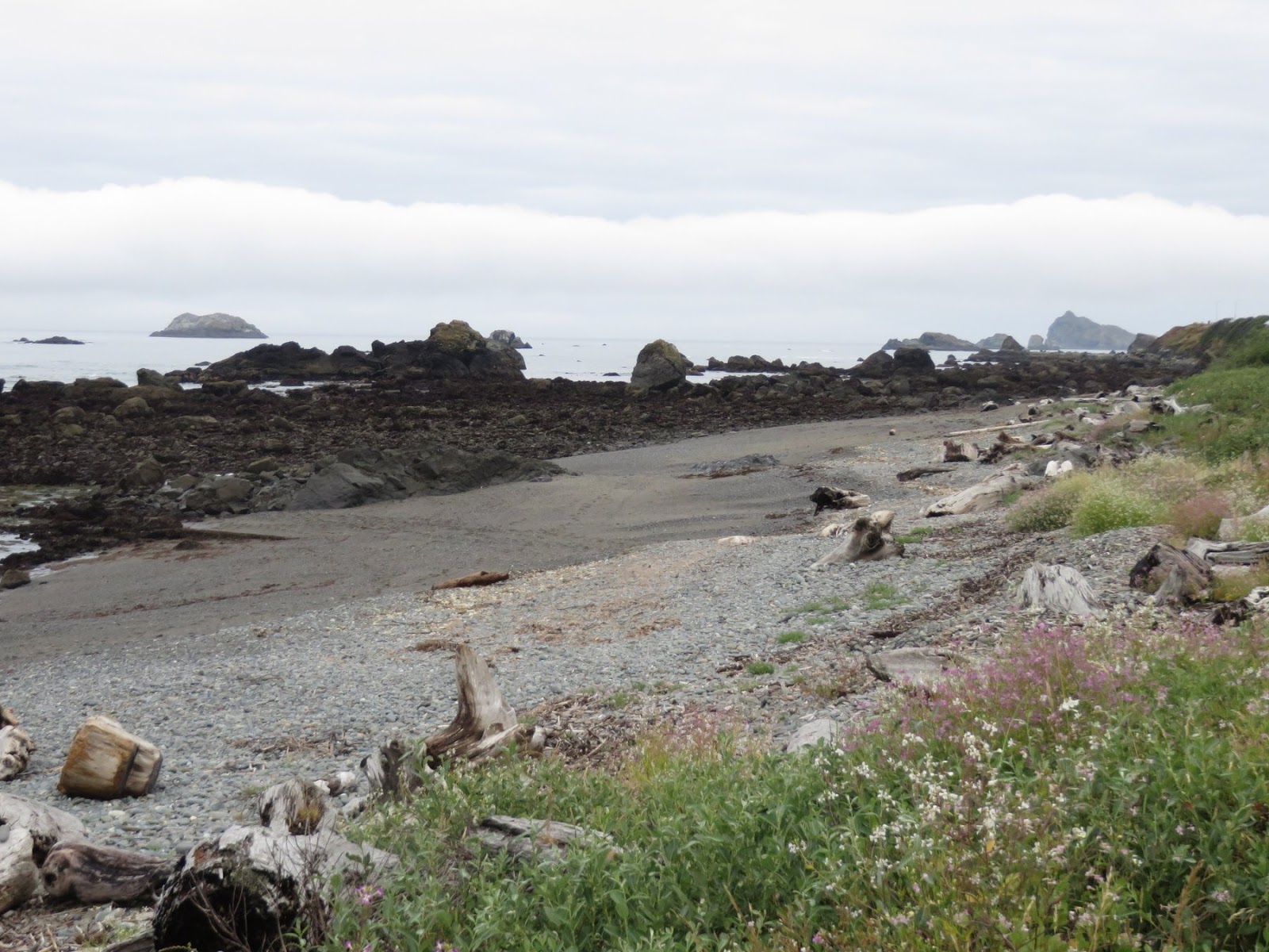
In contrast to our leisurely drive down the coast, our return to Seattle was much faster. We took two days, with the night spent in Crescent City. My beach time was limited to some evening glimpses of the Humboldt Lagoons (reported on during the trip down) and an early morning walk on the beach in front of the hotel.
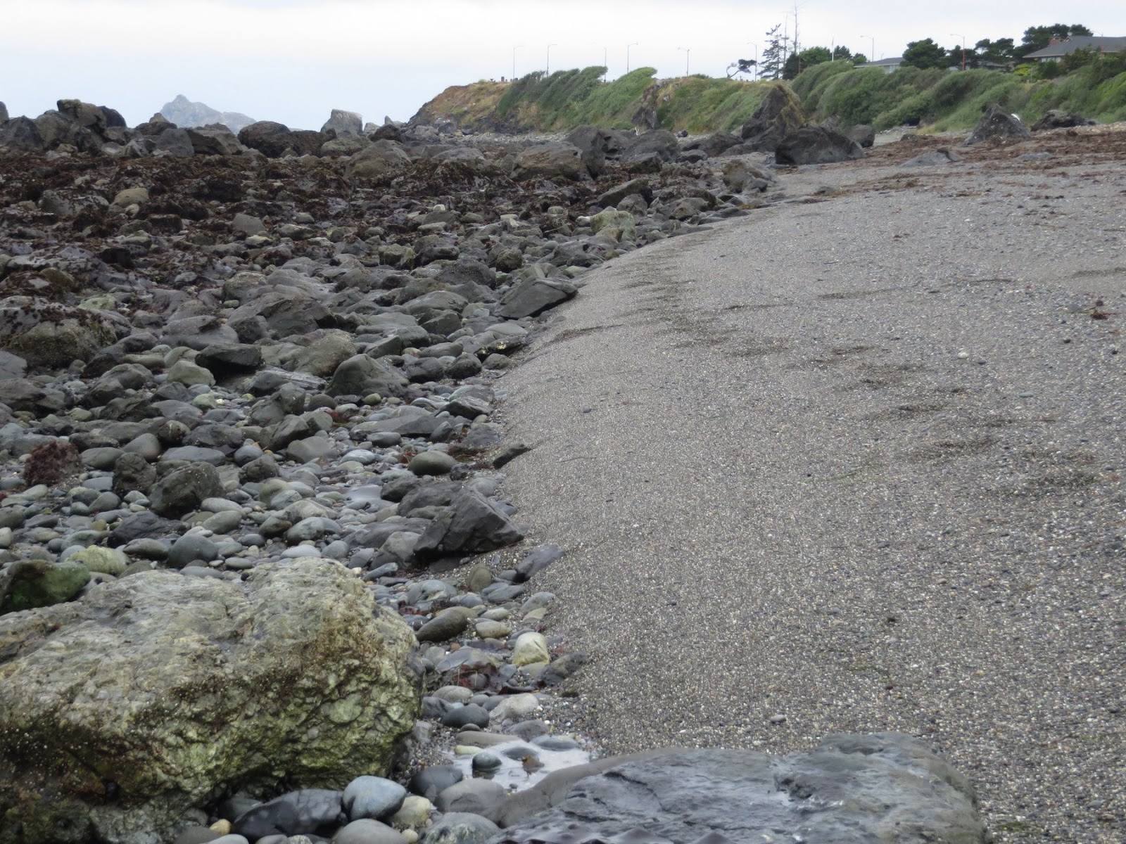 What caught my eye was the abrupt lower edge of the gravel beach. This isn't that unusual, but sometimes it is more distinct than others. This is just a snapshot in time - I don't know what this beach looks like at other times - but I generally associate this morphology with beaches where the amount of sediment is limited and the combination of wave conditions and sediment size conspires to push material exclusively onshore. I'm sure there are other factors, too.
AERIAL VIEW
Crescent City is probably best known in coastal circles for its attractiveness to tsunamis, which tend to stack up and strike with more vengeance here than elsewhere on the west coast. I guess it's mainly about the shape of the coastline and more importantly, the shape of the bottom offshore.

After so many spectacular beaches in the last few days, I almost hate to include this one, but my beach collection is an attempt to compile a wide range of specimens, not just the prettiest ones. This is the south end of San Francisco's Ocean Beach, which I also posted about a couple of years ago. But that post was taken where both the beach and the weather were doing a little bit better.
Ocean Beach: December 2012
That post also includes a little bit more of the complicated story that explains why the beach to the north is healthier than this section near the zoo.
AERIAL VIEW
Admittedly, when a beach starts to unravel, expediency and budgets often lead to ugly fixes, and sometimes there really isn't a fix at all - but it sure screws up my romantic notions of treating our coasts like we really care about them! And this is in a city that is otherwise so incredibly beautiful.
Our run of great weather has run into summertime coastal fog, which isn't surprising, but certainly impacts our ability to see and photograph the coast. We had a few brief breaks of blue sky on the drive from Fort Bragg to the Golden Gate where local conditions had caused the fog to sit a little farther offshore, but for the most part, it was gray.
AERIAL VIEW
Point Arena is located at the north end of a narrow sliver of California that is on the Pacific Plate, moving towards Alaska relative to the hills just to the east, which are on the other side of the San Andreas Fault and are part of geologic North America. The point itself is a broad gently-sloping terrace (or terraces - there are often several) that cuts across the planed-off ends of a thick stack of steeply tilted sedimentary layers.
Like many coastal communities, Fort Bragg used to toss much of its garbage over the edge. Folks don't do it anymore, but the legacy remains in the form of Glass Beach on the north end of town, where a little coagulated metal and a lot of ground up glass mark the old dump site. Glass is actually a very successful substitute for natural beach sand - since it's basically the same thing (silica, even if not quartz).
AERIAL VIEW
There are many glass beaches - some accidental, some more purposeful. There's another one much like this on Kauai in Hanapepe (Ele'elu 2008). And a more subtle one at Cornwall Beach in Bellingham (2006). For that matter, my first full post in this blog, back in December 2005, was also titled Glass Beach, albeit one near Port Townsend (and no pictures of glass - maybe I should go back and revisit that one).
The shoreline north of Fort Bragg up towards Ten Mile River includes a series of dune fields blown inland across a low terrace. But at the southern end, these dunes are interrupted by some rocky headlands, including Laguna Point in MacKerricher State Park. The point is flat on top - maybe 6-8 meters in elevation - and characteristic of the terrace along here. Just north of the point is Lake Cleone, located in low drainage behind the barrier beach.
AERIAL VIEW
100 years ago, local log mills hauled their lumber on rails to a dock out on the point and the remnants of the rail bed and the trestles still remain perched on the beach.
This was our last look at the coast before seeing it again many hours later down near Point Bragg - there aren't a lot of places to get to the coast between here and there, except for Shelter Cove.
AERIAL VIEW
But what a neat spot! Just a small river mouth and a spit on a remote coast with very few other people around. A beach dominated by dark sands, which is common along here, and I suppose reflects a combination of the provenance (the source rocks) and the freshness of the beach material (which means a lot of the darker minerals that will eventually be ground up and lost are still abundant compared to the tougher quartz that dominates many more established lighter colored beaches).
I think when I choose beaches from my collection to put on display, this would definitely be a top pick.

This sort of follows on the previous post, but focuses on something quite different. Singley Flat is a steep series of marine terraces marking rapid (and episodic) uplift of this section of coast just south of Cape Mendocino. But weak rocks (perhaps aided by frequent shaking?) leads to unraveling of the steep hillslopes. Scars and debris-filled stream channels can be found up and down this coast in aerial photos.
AERIAL VIEW
Here, an area of rapid erosion high on the hill appears to be creating a constant (well, not quite) stream of dirt and gravel that's building an alluvial fan across the terrace, which happens to be where the road is. The public works folks have tried to create a channel for the material and an oversized bridge, so that the material can pass below the roadway on its way to the beach.
 I suppose this is a significant local supply of sediment for this section of beach - though figuring out the behavior of this beach given the complexities of offshore rocks, rapid (and recent - 1992) uplift, large storms, and this episodic sediment supply, would be challenging!
A foot note: Much of what I write here is based on general observations and a smattering of internet or book work. One of my standard go-to resources for California is Gary Griggs' (and Patsch and Savoy), 2005, Living with the Changing California Coast, and I would recommend it as a starting point for anyone exploring the state's shorelines.
I suppose this is a significant local supply of sediment for this section of beach - though figuring out the behavior of this beach given the complexities of offshore rocks, rapid (and recent - 1992) uplift, large storms, and this episodic sediment supply, would be challenging!
A foot note: Much of what I write here is based on general observations and a smattering of internet or book work. One of my standard go-to resources for California is Gary Griggs' (and Patsch and Savoy), 2005, Living with the Changing California Coast, and I would recommend it as a starting point for anyone exploring the state's shorelines.
Cape Mendocino is the westernmost point in California, at the northern end of the state's remote "Lost Coast."
AERIAL VIEW
But it's also the mainland address of the Mendocino Triple Junction and the northern end of the San Andreas Fault. Just offshore, the San Andreas curves westward to meet the Mendocino transform fault (which then heads west out to sea) and the Gorda Ridge, which heads north off of Oregon.
The San Andreas began in the Gulf of California and cut northwards up the state until going out to sea at Daly City, just south of San Francisco. It followed the coast north, bisecting Stinson Beach and Tomales Bay (forming the Point Reyes Peninsula), and also geologically isolating a splinter of the coast between Fort Ross and Point Arena, before finally arriving here.
Plate boundaries are active enough. Bring three together and add a sharp bend to a big fault and you're bound to have problems. This is the most seismically active area in California which we'll come back to in a minute. Ironically, just as we were winding our way out here, there was a magnitude 7.9 quake in the Aleutians, which caused me a short pause before heading down to the beach (we learned quickly that no big wave was generated, and even if there had been one, it would have arrived here many hours later, but wouldn't that have been exciting!).
The big seastack off of Cape Mendocino is Sugarloaf. I've tried unsuccessfully to find clues about its geology online. Much of the geology around here is Franciscan, which means this could be any number of things, including a very big lump of basalt. But I don't know.
To the south is a distinct terrace. Singley Flat is actually several terraces, formed by successive uplifts of the coast. The most recent excitement was in late April, 1992, when a 7.2 earthquake lifted this section of coast several feet (the amount varied locally). A little more on Singley Flat in the next post.
Big Lagoon is the southernmost and the largest of the Humboldt Lagoons. I was intrigued by the secondary landforms on the inside of the 3.5 mile long barrier. At each end, there is a series of regularly spaced spits. The ones at the north end are directed northward; the ones at the south end are directed southward. Presumably the direction reflects the fetch within the lagoon. Regularly-spaced arrangements of spits have been described in places as diverse as the Sea of Azov (Zenkovich) and Nantucket (Rosen). They've probably been described here, too, but I don't have a reference.
AERIAL VIEW
The little community at the south end of Big Lagoon appears to have suffered some attrition over the decades, with roads disappearing over the edge of the bluff and older photos showing more houses.
The Humboldt Lagoons are a series of three (originally four, but one was drained and unsuccessfully farmed) lagoons on the northern California coast. They represent large bays that have been isolated from the Pacific by long barrier beaches. Occasionally a big storm and high water levels break through, but the normal condition is closed. The photo above, and the aerials, show a broad vegetated backshore on much of the barrier, but a narrower stretch at the south end. I assume this is the consequence of the breach described in detail by Nic Kraus and others in Shore and Beach (2002).
AERIAL VIEW
I liked the beach here - a thick band of gravel in the swash zone, but sandy above. I could have spent a lot more time exploring, but we had a lot of ground to cover (and we wanted to be in Eureka for lunch).
 Originally, I just pulled off the road to admire the sea stacks south of Cape Sebastian, but I wound up wandering the beach for half an hour, exploring the dunes (my copilot seems content with the view from the car and a good novel). The back beach was a field of crescentic, 1.5-meter high dunes, charged by a brisk wind from the north.
 There was a lot of sand moving - although almost all of it below ankle level. It blew off the top of the dunes and settled on the slip face. Eventually, the slope would avalanche - sometimes all at once (as if all of those individual grains were in communication with one another) and sometimes as a progressive failure, usually, but not always, starting at the bottom.
The dunes were moving across a deflated surface - the flat roughs were largely bare of sand but often exhibited some neat eolian erosion features.
AERIAL VIEW