skip to main |
skip to sidebar


 The Black Swamp used to extend along most of this southwestern shoreline of Lake Erie, but much of it has been drained or otherwise converted. A number of canals have been dredged into the landscape, connecting marinas and nuclear power plants to the lake. Where the wetlands still remain along the lake, the shoreline has been riprapped to prevent erosion. From what I can tell, the beaches along this shoreline must have been narrow, sandy, and eroding landward rapidly, probably with some variability around points of land or river mouths.
Maumee Bay State Park abuts the marsh and has a system of trails, but the developed portion is an artificial landscape, with an artificial beach on the lake, an artificial lagoon (with its own created beach), and a large resort, complete with a golf course. It looks like a recreational magnet, even if it bears little resemblance to the original shoreline (aerial view).
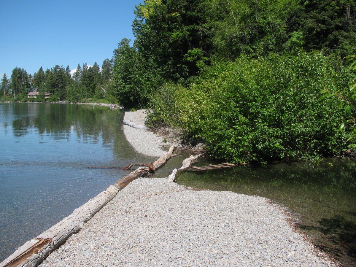
The beach was built about 20 years ago with fine gravel made from crushed limestone. The shoreline is configured using a series of segmented breakwaters, which form artificial headlands separating a series of small pocket beaches. The beach berm was piled high with mussel shells - zebra mussels, I think, although they could also be quagga mussels (also invasive). The lake was incredibly turbid - I don't know if this reflects recent runoff from the Maumee River or whether this is typical of this end of the lake or this time of year.

 We skirted the northeastern edge of Lake Michigan in the dark and wound up in St. Ignace for the night. We stayed on the lake and in the morning I was reminded that we were back on Lake Huron (the eastern extension of Lake Michigan - it's not like there is anything actually separating the two except for the bridge) by the grassy shoreline exposed out in front of the seawalls. It reminded me of the shorelines in Inverhuron and Craigleith, where the falling lake had left similar stranded shorelines.


One of the neatest places to find coastal sand dunes is high on the top of bluffs. The Grand Sable Dunes, west of the town of Grand Marais, on the southern shore of Lake Superior are one of the best examples of perched dunes anywhere. Wind blowing across the lake accelerates up the bluff face, eroding the sandy sediments and carrying the sand over the crest where it is deposited to form dunes.
Our visit, and these pictures, captured very little of the actual dunes. The dunes themselves are on top of the bluffs, which consist of sandy non-aeolian deposits. The Google Maps aerial image linked to the title of the shows the dunes better. The bluffs are still very dune-like and I'm sure when D ran down and slogged back up the 300' vertical log slide, he didn't really care that it was a bluff and not a sand dune.
My post-visit homework was fascinating. Like dunes in many places, these have built in discrete episodes, the most recent 300 years ago. The episodes are driven by sand availability, which in turn is driven by the condition of the bluffs. High water levels lead to more rapid toe erosion. More rapid toe erosion leads to active, exposed bluffs. Active, exposed bluffs make more sand available for the wind to blow up the face of the bluff. More sand makes bigger dunes. And when the dunes are growing, they block streams, raising base level and creating ponds, which can create a stratigraphic record of dune building events and of variations in the level of Lake Superior.
We have perched dunes on Puget Sound, too. One set are high on the northwestern shore of Protection Island, north of Port Townsend. My favorite ones on Puget Sound would have been the dunes perched on the high bluffs of northwest Whidbey Island, overlooking the Strait of Juan de Fuca. Unfortunately, these dunes have been pretty much eliminated - leveled and buried under view homes on West Beach Road. They were not as large or extensive as these in Michigan, but they still would have been cool.


 Travel and distractions have led me to fall behind. This post and the next date back to a Sunday in June, a low tide, and a walk on one of Seattle's most heavily used beaches.
Alki Point juts out into Puget Sound (April 2007). It is both a low point and a resistant headland. It is formed of Tertiary bedrock uplifted along the east-west strike of the Seattle Fault. These folded sedimentary rocks are exposed in the intertidal on the south side of the point and form a rich biotic community that lends itself to trampling during spring low tides by hordes of school children and strollers.
The story of longshore transport is messy here -- probably for reasons related to the seismic history. Drift is from south to north, but only a narrow band of gravel reaches the the point. There's not much loose sediment in the system south of here, at least for a few miles. There are plenty of human culprits - groins, seawalls, etc - but I suspect the main reason is geologic. If nothing else, when this shoreline was shaken and raised 1100 years ago, any beaches would have been stranded on the raised terrace, probably removing most of the sediment from the active beach (it's now beneath lawns and homes along Beach Drive). The beaches north of the point are doing better. As I pointed out in the 2007 post, I suspect Alki Beach is a fairly stable swash-aligned beach, oriented to face the northerly fetch.