Monday, February 06, 2006

Cama Beach


The bulkhead survived the storm, although much of the footing has been re-exposed. The launch area in front of the boathouse didn't fare as well. It looks like the damage was mainly due to erosion by return flow. The waves dumped large volumes of water over the seawall and it had to drain out somewhere - it chose to do so around and under the ramp, removing a large volume of the underlying gravel and resulting in the concrete collapsing. Must have been quite a stream during yesterday's falling tide.


The stream at the south end, which has ended in a mini-lagoon behind the gravel berm for most of the last decade, is now flowing freely across the beach. We believe this is a result of the heavy rains in January, not Saturday's storm. It is building a nice little delta on the lower beach face. The stream has exposed some old concrete slabs beneath the beach surface.


Flooded cabins behind seawall at southern end. This area is probably old fill and drains poorly. The lower areas farther north (the original lagoon) flood quickly at extreme tides, but also drain quickly as the tide recedes.

Sunday, February 05, 2006

Camano Island


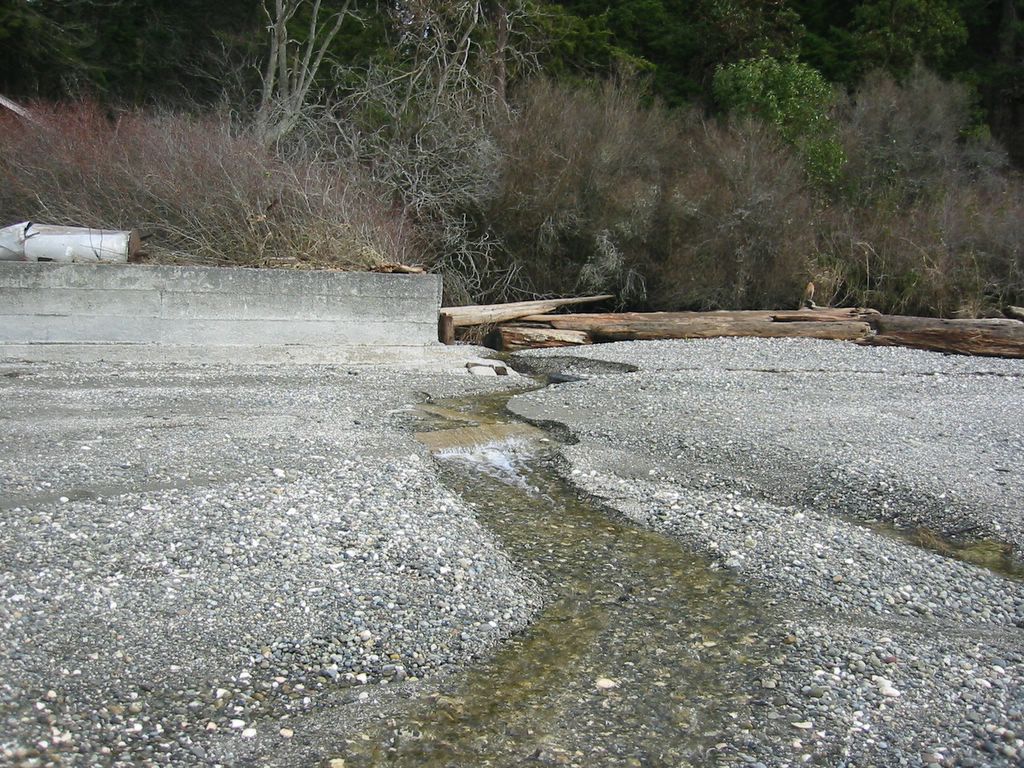
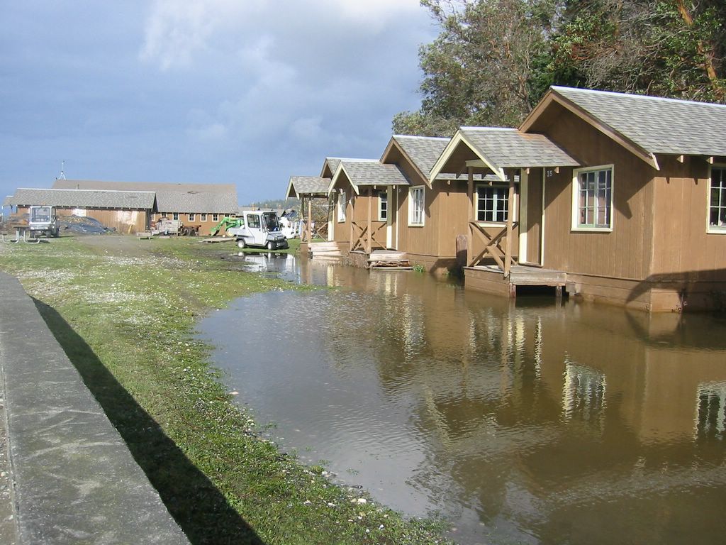
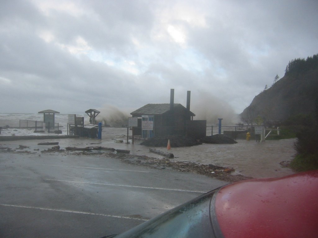
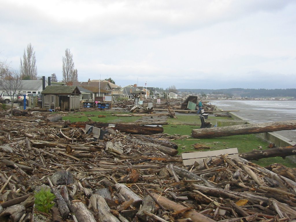
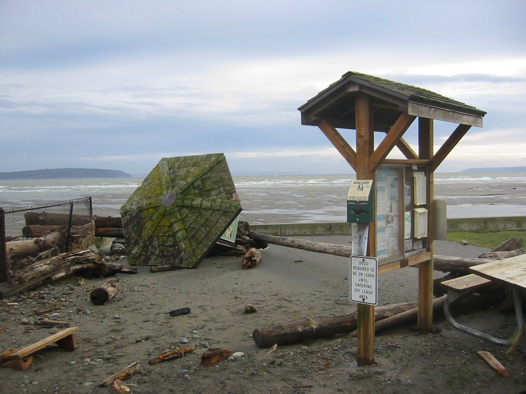
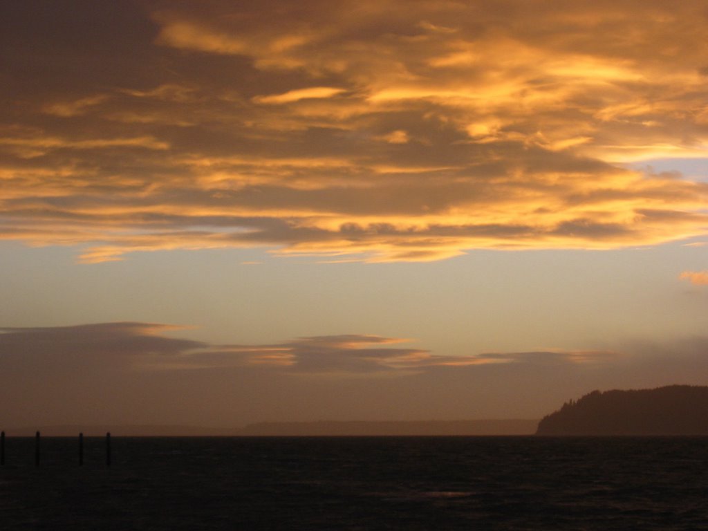
Camano Island State Park, the day after the big storm. Sunshine and lots of fresh gravel on the backside of the barriers. The most dramatic overwash was at the south end, but there was evidence of gravel being moved across the berm all the way north past the boat ramp. Farther north at Saratoga Shores, the same basic thing happened, except that the waves had to throw the gravel over the bulkheads to get it where it belonged.

Saturday, February 04, 2006

Double Bluff Park


High tide was at 9AM this morning. The predicted tide was 12.3', but according to Seattle gage, it was closer to 14'. With gale force winds from the south, Whidbey (and most of the rest of the Sound) got pretty exciting for a few hours.

At the Double Bluff Beach Access, waves were breaking on the seawall. I couldn't get close due to heavy spray, moving logs, and standing water, but managed to get some wet pictures. I came back later in day after the tide had fallen to see what the storm had left.

Whidbey Storm


The much anticipated wind storm arrived early in the morning. The Cathlamet broke down, leaving only one boat on the Mukilteo-Clinton run. I thought about driving around the north end of the island, but toook my chances with the ferry - which I just made.

7:50AM. Waves were breaking along the seawall on Columbia Beach. 8:15. At Possession County Park, the waves washed over the berm and then drained into the wetland on the backside, eroding a channel next to the pedestrian bridge. 8:30 The eastern end of the Cultus Bay sand spit was underwater. 8:40 Water was coming over the berm on the Maxwelton spit and was about to reach the road. 8:55 Double Bluff (see next post). 9:00 High tide. A long line of SUV's streamed from the homes along the Useless Bay sand spit. Water was still standing over the road and in garages many hours later. 9:15. Water gushed from a storm drain at Robinson Road, making what was once a back-barrier marsh start to look like one again. 10:00. Power went out at the Coupeville Middle/High School - as folks got ready for the first round of classes at the Beach Watchers' annual Sound Waters workshop. So much for slide shows.

On the way back: Logs and wood debris were piled into a neat 3' high storm ridge all along Keystone Spit. A tree had fallen on the house next to the beach access at Ledgewood. Water was still flooding the road in Freeland next to Nichols Brothers. And they'd closed off the pedestrian walkway on the southside of the Clinton ferry dock - since the waves had popped out many of the translucent deck tiles.

Friday, February 03, 2006

Deltas


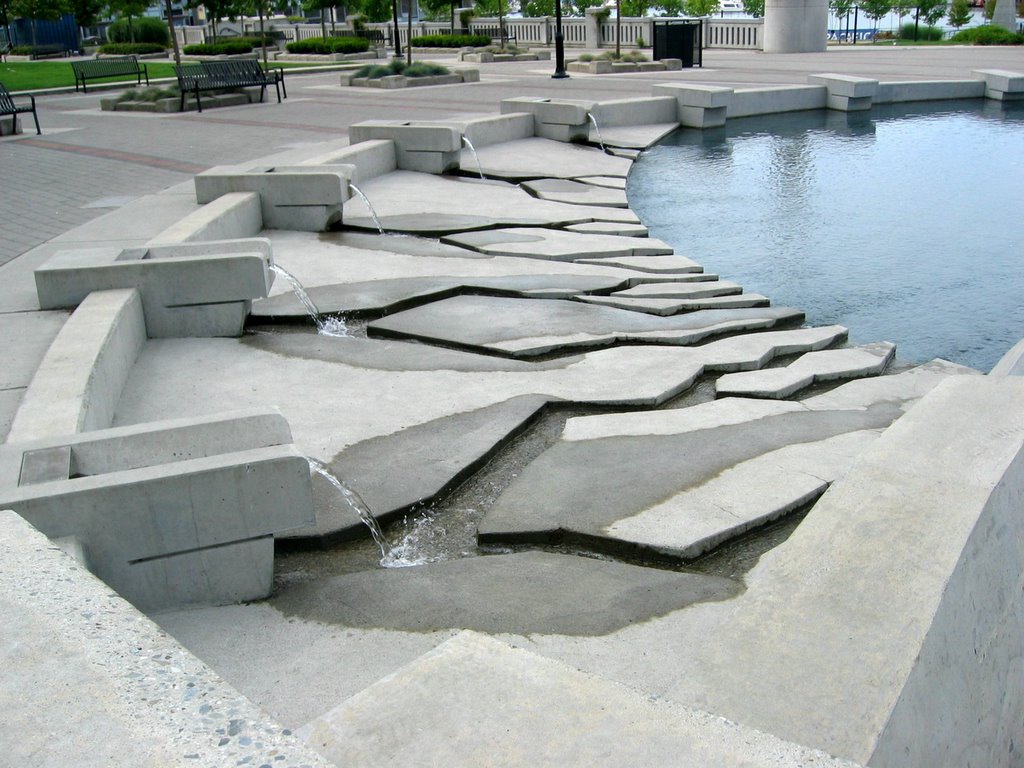
In nature, as in art. Or is it the other way around?

The one with the sediment is the south fork of the Skagit. The other one is in Yaletown, on the north side of False Creek in Vancouver.

Thursday, February 02, 2006

Partridge Point


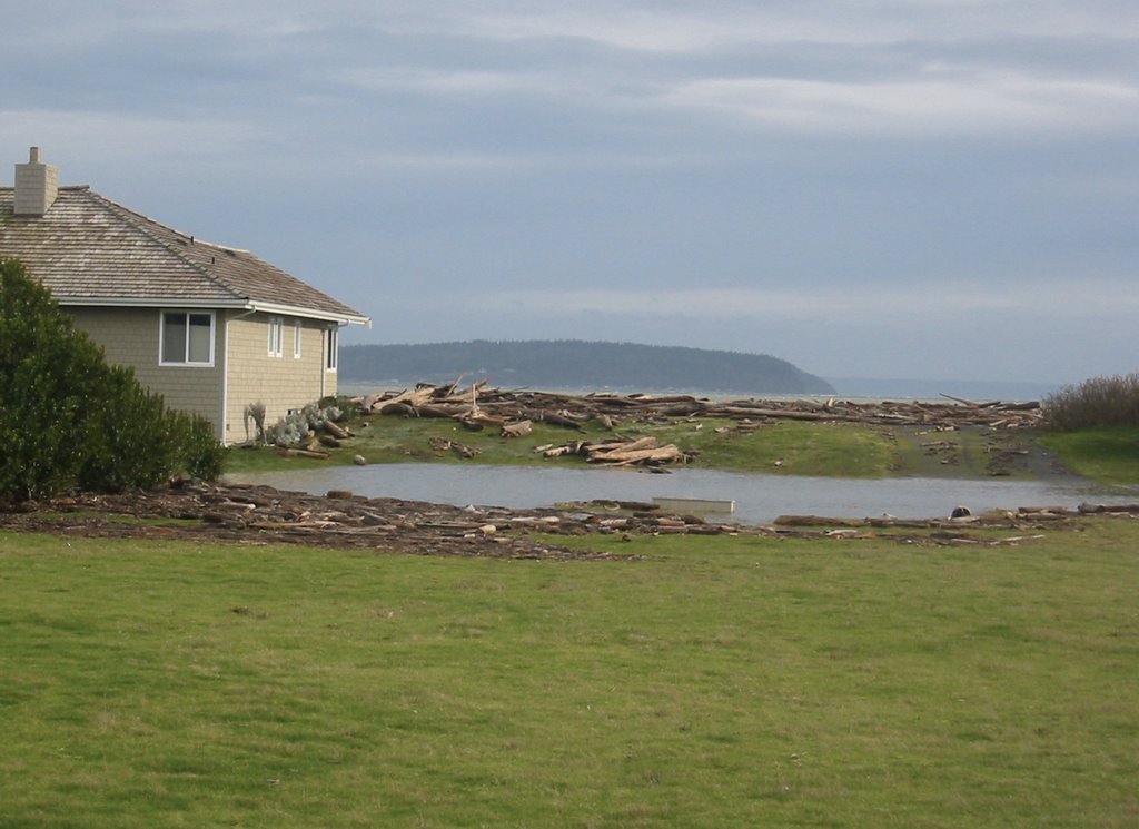
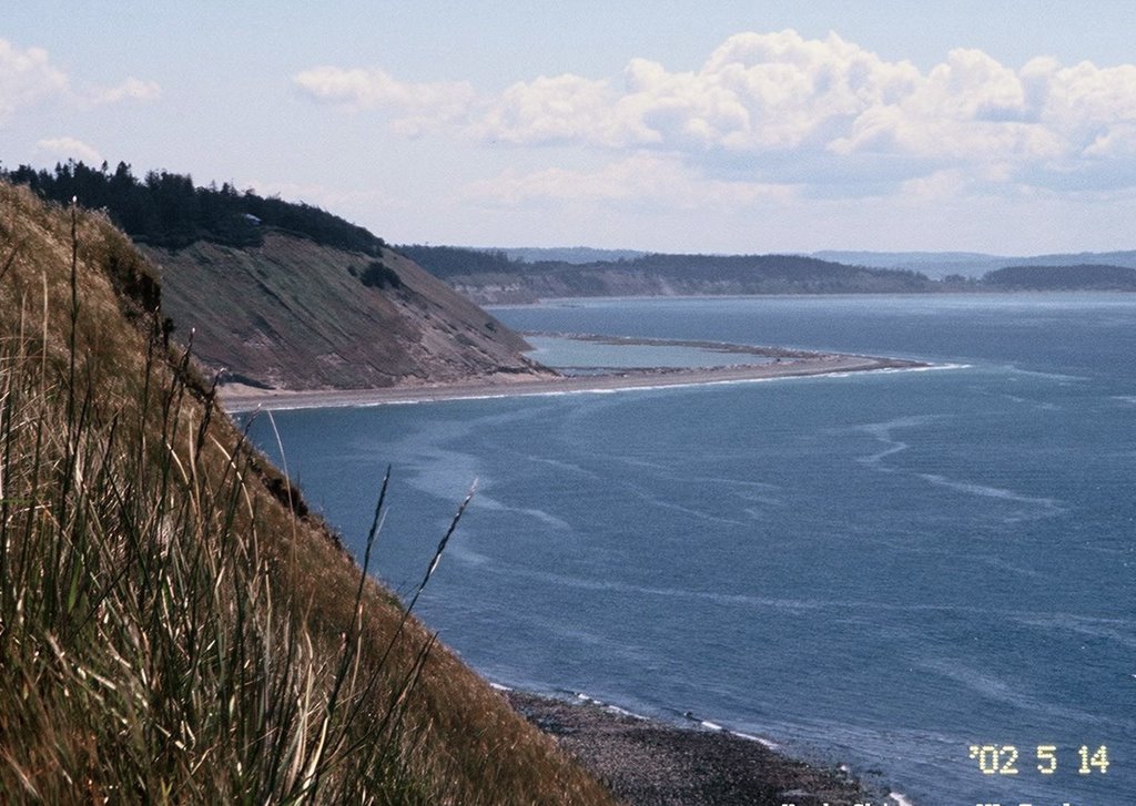
View south along the west side of Whidbey Island. Perego's Lagoon in the distance (note: this picture was taken several years ago).

Redondo


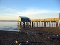
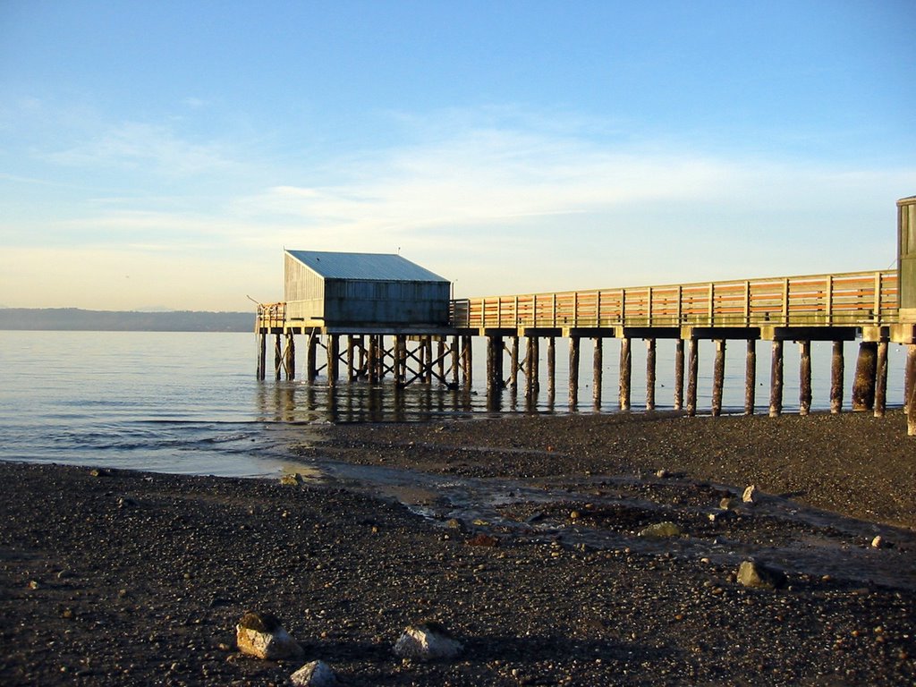
I stopped at Redondo late one afternoon last week, taking advantage of a rare break in the weather.


The Redondo seawall was hit hard by the severe northerly storms of 1990, leaving the road that parallels the beach partially closed to traffic. After much wrangling -- some of it related to environmental concerns, some of it related to funding, but much of it related to conflict between beach residents and regular users of the road -- the mile-long seawall was rebuilt with a walkway hung over the edge.

In the 1920's, Redondo was the site of a popular amusement park and a dance hall. The dance hall was later converted to a skating rink, but burned down in 1951. During the 1990s, I recall community members describing how the beach had dropped many feet over the decades since those early days. Geologically, this makes sense. The beach would have continued to erode with or without a seawall and the result would have been less and less beach in front of the wall. Erosion may have been aggravated by the loss of natural sediment sources as local bluffs were bulkheaded, although Redondo and other local creeks may have continued to deliver sediment until the modern era of good development practices and sediment detention ponds began to dry up upland sources.

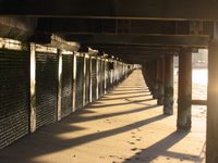
But just to prove that nature is never simple, I noted that the beach at the north end, toward the boat ramp and piers, looks like it has built up appreciably (see photo beneath walkway). I haven't been down here enough to know if this has been gradual, or whether it reflects a recent event.


Paul Dorpat on Redondo (link added 4-21)