Tuesday, August 28, 2012

McNeil Island


We spent most of the day mapping our way around McNeil Island.  As a result of its prison status, the island has actually avoided the intense waterfront development typical of much of the rest of Puget Sound.  Much of the shoreline consists of remarkably pristine bluffs and forested shorelines, although almost every stream and small estuary has been blocked off or otherwise altered.  We saw strange groin-like structures extending offshore in two places and the remains of old ship or barge hulls on the north side.

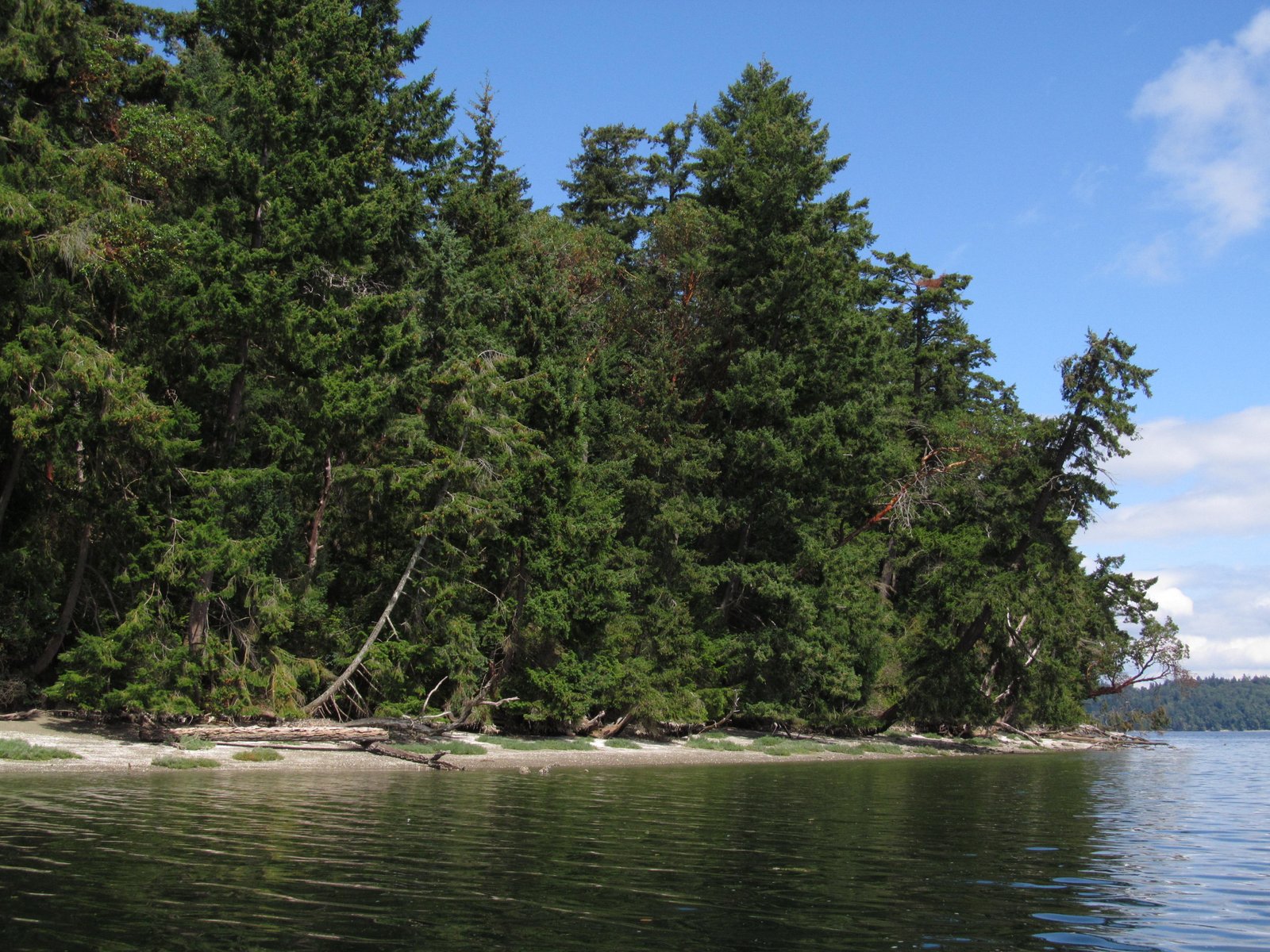
The erosion control structures of choice were massive piles of coiled cable (old submarine nets? but they looked like giant mattress springs) and tall stacks of precast Ecology blocks.

This is a place with a complicated history and probably an even more complicated future. It has been both a federal and a state penitentiary and now it's still used to house various types of offenders.  But as the use of the island as a prison has gone down, interest in what happens next goes up.

AERIAL VIEW

Hyde Point


This little pair of spits is located just north of Hyde Point on the east side of McNeil Island.  Most of our mapping was from the boat, but we had permission to land and this was a great spot to pull the boat up and wander over to look at the back-barrier marsh.  The aerial view shows the relationship of these two small lagoons - the southern one tucked into a cove in the upland, the northern one enclosed within a hooked spit.

AERIAL VIEW

At one time, I suspect these two lagoons may have been connected with everything draining out the north end, but now they seem to be plumbed separately since the southern one has it's own tidal channel.


Gertrude Island


Gertrude is another small island just offshore of McNeil, this one on the north side at the mouth of Still Harbor.  It's off limits to folks like us to protect the seals that haul out on the beaches - particularly at the south end.  The east side is very sheltered, with salicornia growing on the beach and a low bank overhung with trees. The west side is a bit more exposed and there is more evidence of erosion.

The funky little spit at the south end appears to be a low terrace -- the flat surface is well above normal backshore elevations and consists of a low erosional scarp.  Another geologic question goes unanswered!

AERIAL VIEW

Pitt Island


Pitt Island is pretty small - a hectare or so of madrone and fir and poison oak sticking out of the narrow channel between the Key Peninsula and McNeil Island.  Wave action from the north (infrequent but significant fetch) and from the south (frequent but sheltered) results in two small cusps at the east and west ends - about the extent of the beach on this island.

AERIAL VIEW

This is part of the McNeil Island Corrections (now Commitment) Facility, so we had permission to land (although it took a phone call to remind the guards with the bullhorn on McNeil about that).

Some of these outcrops were a reminder that I don't know my South Sound geology as well as I'd like.

Garry Point


Garry Point is the end of the road in Steveston, where the Fraser River heads out to sea.  I suppose Steveston was originally built on the natural levee along the historic distributary, but now it's simply the bottom left corner of the sprawling city of Richmond.  

AERIAL VIEW

Garry Point Park was created with fill (dredged sediment from the river, I assume) and then armored with riprap and shaped to create a series of pocket beaches along the riverside.

Roberts Bank


The Fraser River delta extends out into Georgia Strait, forming the large, shallow Roberts Bank.  The Tsawwassen Ferry Terminal is located at the end of a long causeway that extends across Roberts Bank to end just short of the U.S. border.  A parallel causeway a couple of kilometers to the north serves the large coal and container terminals.

AERIAL VIEW


The two jetty-like projections have undoubtedly mucked up circulation and sedimentation patterns in the vicinity, but they sure move a lot of ferry passengers to Vancouver Island and a lot of Rocky Mountain coal to steel plants in Japan and Korea.


Wednesday, August 08, 2012

Livingston Bay


This log-choked salt marsh originally formed behind a tenuous spit, but sometime last century, a dike was built along the general line of the spit, cutting off tidal influence so the area could to be pastured. There have been years of debate about what to do with this site, in part to address a mosquito problem that tidal circulation would help alleviate.  Now the Nature Conservancy is excavating a portion of the old dike and restoring a tidal inlet at the northern end, which should result in much more efficient exchange and a marsh much more similar to what used to be here.

The beach here doesn't amount to much.  Iverson Spit, located a short distance south, is much larger and probably traps a bulk of the sediment transported from Barnum Point.  The limited sand on this beach may come from the reworking of older marsh or tidal flat deposits, although I suppose some sediment may find its way north from Iverson.  Up here at the north end of Port Susan, most of the wave action is from the south, across the broad flats that extend over from the Stilliguamish Delta.

AERIAL VIEW

Over the past few years, a new sandy spit has grown north from this site into the marsh.  In a year, the new tidal channel will wind out behind this spit.  The big question will be whether the new channel will allow all those trapped logs to escape, or whether they will simply choke the new channel until a really high tide occurs.

Saturday, May 12, 2012

Hope Island


 It's a short paddle from Ala Spit across to Hope Island, although there can be a lot of water moving through this passage, leading to some tricky rips and swirls.

AERIAL VIEW

The island is about a mile long and less than half a mile wide and is entirely managed as a Washington State Park (there's another Hope Island State Park in South Sound, just to keep things confusing).  There's a small primitive camping area on a protected cove (Langs Bay) on the north side - the camp sites are on a low bench that looks like it is several feet of shell midden sitting on several feet of clay.


The highlight of the island is the small 40' high promontory at the southeastern corner, which is connected to the main island by an isthmus that is part bedrock ridge and part tombolo.  Most of the rock appears to be serpentinite and some of the exposures are pretty complicated.  There's a wonderful gravel beach extending west along the southern shore - backed by serpentinite cliffs and a dense band of very large wood (a south facing beach north of the mouth of the Skagit is a natural trap for large wood).

The metamorphic bedrock on the island is mantled in some places with till or other Pleistocene materials. A small bluff at the northeast corner of the island displays a series of gravelly shell-rich beds - are these old beaches (but why so tilted?) or are they reworked deposits - sort of a shell-conglomerate or coquina?  To the south, there are even more complex deposits that include fossil shells.


Friday, May 11, 2012

Smith Island


Two weeks ago, I had an opportunity to fly up to Friday Harbor.  On the way I saw plenty of familiar beaches and took an awful lot of crummy pictures.  But I thought it might be an opportunity to highlight a shoreline that few people (myself included) have ever visited, but for which I have some interesting historical views.


Smith Island lies west of Whidbey Island and is sometimes called Battleship Island due its appearance from land - five miles away.  It's a lighthouse station and now a portion of the San Juan Island National Wildlife Refuge.  It's the remaining subaerial portion of one of several large shoals in the western Strait of Juan de Fuca.  Waves coming down the Strait from the west erode the bluff on the west side, redistributing the coarse sediment in a long tail to the east, ending in Minor Island.


The first two shots are mine from late April.  The next photo is a nice one taken in 2007 by Jeff Bash - the wave refraction patterns are worth checking out. The map is from Ralph Keuler's 1988 USGS Map (Misc Invest 1198E) - that's a 69cm/yr average erosion rate on the west side. 

The Lighthouse was reportedly 200' from the bluff when it was built in 1858 (Wikipedia).  In the 1960s, a new tower was constructed when folks realized the old lighthouse might not last.  By the end of the 1990s, it was gone.


1948 (National Archives and Wikipedia)
1970s (Wolf Bauer)

1980s (Gerald Thorsen)
AERIAL VIEW

Woodway Beach


There's not much beach left below Woodway - the upscale bluff-top community just south of Edmonds.  Once upon a time, this would have been a wonderful beach walk from Edmonds south through Woodway to Point Wells at all but the highest tides, but in the late 1800s the railroad chose the beach at the toe of the bluff as its route between Seattle and Everett and the beach got narrower.

Unfortunately, the bluffs along this stretch continued to fail magnificently long after the waves stopped cutting at their base, and landslides and busy rail corridors don't mix well.  
In the 1950s, Great Northern, faced with the high costs of keeping the Empire Builder out of Puget Sound, relocated the entire line away from the bottom of the cliff.  The result was a long linear lagoon between the old grade at the bluff and the new causeway on the lower beach. The beachface has become a lagoon. Large slides in the 1970s filled portions of this trough, as did the 1997 Woodway landslide near Deer Creek.

Burlington Northern Santa Fe - the inheritor of the Great Northern - plans to eventually complete double tracking of this corridor (all the better to hall Powder River coal to Bellingham? - 2011 Wyoming, 2012 Black Thunder Mine).  Meanwhile, the local police are kept busy enforcing BNSF's No Trespassing signs - shooing away teenagers trying to navigate Woodway Beach at high tide.


AERIAL VIEW