Showing posts with label san juan. Show all posts

Thursday, May 17, 2018

Yellow Island

Yellow Island sits in San Juan Channel, one of the small Wasp Islands between Orcas and San Juan Island. Like all of these islands, it consists primarily of metamorphic bedrock and most of the shoreline is marked by rocky cliffs. But also like on many of them, there may be patchy deposits of glacial drift, which form an erodible substrate that forms small bluffs in the few places it reaches to the water.


AERIAL VIEW


At each end of the island, small spits extend out to rocky ledges, creating tombolos, with small gravel beaches on both sides of each. In addition, there is also a pocket beach below a low bluff on the south shore of the island. 

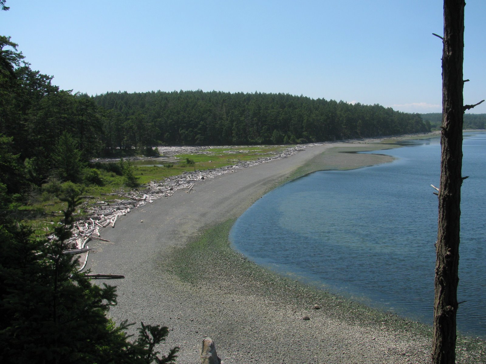
On some rocky islands, the dearth of erodible sediment and the abundance of shellfish and barnacles on the resistant substrate gives rise to beaches consisting primarily of shell  debris. But as far as I can see, the beaches here are primarily gravel, presumably derived from the glacial deposits -- although there's not an obvious active source of this material, aside from occasional erosion of the toe of the bank associated with particularly major storm events. Of course, what we don't know is whether there might be a source, or at least a reservoir, of sand and gravel in shallow water offshore.

According to Phil, who has been watching this place carefully for a long time, the eastern tombolo is subject to significant changes from year to year. In particular, the cobble on the south beach is sometimes exposed (as on this trip), but may be covered in gravel some years. The fact that the beach changes significantly from year to year is not surprising, but understanding what drives this is more challenging. On a low tombolo like this, there may be large transfers of gravel back and forth across the berm during high tide storms from one direction or the other.

For more on the Preserve:
Yellow Island: The Nature Conservancy

And for a first hand account of life on Yellow Island:
Island Time on Yellow


Saturday, March 07, 2015

South Beach


February was just one sunny weekend after another! On Sunday, three weeks ago, M and I headed up to San Juan Island for the day. Tough day.

San Juan is mainly bedrock, so beaches are scattered and usually fairly small.  But at Cattle Point a thick pile of gravel has been eroding for centuries, spreading itself along the shore to form this beautiful long beach.

AERIAL VIEW


The beach faces across the Strait of Juan de Fuca towards the Olympic Mountains - a little hazy on this particular day. The back beach is probably one of the larger accumulations of drift wood on the Salish Sea.

From a previous visit:
South Beach:  June 2011


Tuesday, June 21, 2011

Friday Harbor


The University of Washington's Friday Harbor Laboratory has been perched here on the point north of the town for most of the last century. The research focus was historically more on marine biology and rocky coastlines than on beaches, which makes sense given its location.

The lab, like other water-oriented developments, has grown somewhat organically along the edge of the water - with the interest clearly more in getting to the water or using the water (the labs thrive on a lifeblood of circulating salt water) than in the shoreline itself. I found the waterfront a little ragged with its crumbling stone walls, its collapsing piles of riprap, and its abundance of pipes.


It might be interesting to look at historical photos of the lab's shoreline. I wouldn't expect too much natural change, although I saw some evidence that the beaches (limited as they are) may be continuing to erode. They would have done so anyways, plus any material that would have originally eroded from the banks to resupply them is safely secured behind all the riprap!

But it's sure a neat place to have a meeting! It's not exactly convenient, but it's a far more pleasant venue that an interior conference room in an office building in Olympia.

Eagle Cove


If you take a rocky coastline and add a little sand and gravel, you'll get pocket beaches and there are no shortage of them here on the south end of San Juan Island. I knew this one existed, but didn't know you could actually get to it without owning it, until I found the little public access and parking area amidst the Sunset Magazine centerfolds.

The beach is only a few hundred feet long, it's sand and gravel isolated from every other beach in the world by rocky headlands and deep water. The gravel stays high, piled in steep berms and buried under drift logs. The sand forms a rippled terrace in the lower intertidal.

South Beach


The south end of San Juan Island is why you can't categorize Puget Sound beaches in any simple way. It's the same ocean, and the same physics, both here and on the forested shores of Eld Inlet, but the beaches are cut from completely different cloth.

South Beach is a broad gravel berm that appears to have built seaward over time from the original base of the slope. It is covered with logs - apparently this is the last obstacle for logs trying to escape Puget Sound and many get no further than this. There are sand dunes - well-vegetated ones for the most part - climbing the slope to the north. The most obvious source of the beach gravel is the high eroding bluffs east toward Cattle Point, although I wonder if this beach also tells a story about the gradual erosion of Salmon Bank, which extends far offshore.

American Camp, of which this all part, is overrun with non-indigenous foxes. Cute little beggars - certainly cuter than those chickens all over the beaches on Kauai!

Jakle's Lagoon


The north and south sides of the peninsula that ends in Cattle Point couldn't be much different. The south side is high grassy bluffs looking over the broad gravel strand of South Beach and twenty miles of water at the Olympic Mountains. The north side is forested and slopes down to Griffin Bay, where it is broken into a wonderful series of barrier lagoons. At the west end, down towards Fourth of July Beach, is Old Town Lagoon. At the east end, down towards Cape San Juan and it's exclusive nest of high end real estate, is Third Lagoon. And in the middle is Jakle's Lagoon, with it's gravel barrier, its lagoon, and its forest.

There is some evidence of an occasional tidal opening near the west end, but certainly not a persistent or regular connection.
The wide gravel barrier gives rise to a broad marsh and eventually to a lagoon, its edges lined thickly with old drift logs. The pickle weed (
Salicornia virginica) was doing its best to survive a colorful infestation of dodder (Cuscuta salina), a plant parasite that apparently takes many forms the world over.

I walked the cobbly beach to Third Lagoon, and then worked my way back via the mossy trail that follows the top edge of the bluff. On one shady section of beach, the upper intertidal gravel was covered with small snails
(Littorina littorea, I assume). I've never seen them gathered so densely and have no explanation.

I've exceeded by usual quota of Latin, normally enforced by my ignorance of biology. Fortunately, the evening that followed this great day of beaches included dinner with people who actually understand this stuff.

Cattle Point


Cattle Point is a rocky headland at the south east end of San Juan Island, jutting out into the eastern end of the Strait of Juan de Fuca. The lighthouse is perched on dunes, which are in turn perched on top of glacial sediments, which in turn mantle the underlying bedrock. There are a couple of wonderful pocket beaches just north around the corner and South Beach stretches out to the west.

Friday, April 16, 2010

Iceberg Point


There's not much beach along this spectacular stretch of rocky coast at the south end of Lopez Island, but there sure is a great view in pretty much every direction. The bluffs of Whidbey Island are seen in the east. Smith Island is southeast. Dungeness Spit and the Olympic Mountains are lost in clouds to the southwest. San Juan Island and Cattle Point are to the west, obscured by the haze of the late afternoon sun.


The metamorphic bedrock is littered with granitic boulders from Canada and furrowed with north-south grooves, both the legacy of glaciation a mere 16,000 years ago (give or take a few millenia). Sedums, lichens, and other small, but hardy, plants cling to irregularities in the rock surfaces.

Spencer Spit


This year, we wrapped up the beaches class with a trip down to Spencer Spit. We really didn't have enough time to do it justice, given the late hour and the logistics of folks having to catch ferries back to other islands, but still a worthwhile excursion. This place provides eroding bluffs, an elegant barrier beach, and a large salt marsh and lagoon -- all in a county better known for its rocky shorelines!

Spencer Spit reaches for rocky Frost Island, but doesn't quite get there (map view). I guess the tidal currents make it hard to close the gap. On the other hand, tombolos have formed in similar settings where the sediment must have eventually been too much for the currents to keep clear. Maybe it's just a matter of time. I suppose it's a function of the strength of the currents, the volume of sediment being delivered, and the bathymetry of the nearby area (which controls the "accommodation space" - the less space, the easier it is to fill it).

The last time I was here was shortly after the February, 2006, storm:
Spencer Spit, March 2006

Sunday, April 19, 2009

Deer Harbor


The west side of Deer Harbor on Orcas Island is rocky, but the east side collects sandy sediment transported north along the shoreline from eroding bluffs to the south. The sand has built a series of small prograded beaches and quasi-spits in the vicinity of the marina.

The shoreline north of the marina is now part of a local park and a wonderful little community beach. Some historical fill and structures were removed and now there's a nice combination of low energy beach and marsh strung out along several hundred meters of shoreline.

English Camp


English Camp is located on the shores of Garrison Bay, near Roche Harbor on San Juan Island. It was established in the 1860s during efforts to solve the Pig War.

The old blockhouse was built over the bank edge and little has changed since. There's not enough wave action in this sheltered bay to cause much erosion - or even to form much of a beach for that matter. The beach is pretty muddy - wave action is necessary to winnow the fines out of a beach -- and the gravel is stable enough to grow barnacles and rockweed. Salicornia occupies the uppermost beach. The National Park Service has instituted some simple measures to reduce erosion - which generally work because they keep visitors from clambering down the bank.

This site is a little peculiar - the terrace on which the camp is built is too high. I should read some of the geo-archaeology reports done on this site - there was also a long native history prior to the Brits showing up - and find out whether they clarify the historical setting.