skip to main |
skip to sidebar
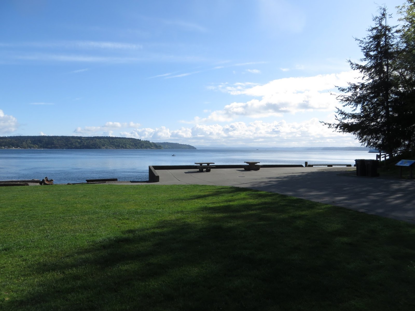
The Dick Gilmur Shoreline Access point is located along Marine View Drive on the north side of Commencement Bay, on the way out towards Browns Point. It's a relatively recent soft shore project intended to restore a more natural beach while also allowing for a small parking area and kayak launch.
AERIAL VIEW
One of the questions that keeps coming up for me is how to catalog and disseminate information about the large number of soft shore and beach restoration projects going on around Puget Sound. Overall, it's a remarkably positive story that needs to be told. It would provide people with design ideas and inspiration to do more projects and to do them better. It might provide an inventory from which people could choose sites for monitoring, for documentation, or simply for visiting.
But this has proven difficult. The number of projects is large, but they vary enormously and there is much disagreement about what types of projects should be included and how to assess performance. Many are poorly known and poorly documented. There is sensitivity among funders and landowners and contractors about possible problems and this makes it difficult to discuss the less successful projects (or more commonly, successful projects with unsuccessful elements), even if those are the ones we would all learn the most from.
This mill in Tacoma's Old Town was the last of the lumber mills along Ruston Way to close. It shut down in 1977 and burned down in 1979.
In the late 1990s, Tacoma Parks developed a plan to clean up the site and turn it into a park. It required sifting through issues of remediation, wetlands, public access and recreation, ecological restoration, and historic preservation (and probably many others, too). Which wasn't easy, but was eventually successful.
The concept envisioned a beach and an estuarine marshand it was tricky to figure out how to configure this given the geometry of the old site, but the design actually ended up taking advantage of the historic footprint. The beach is a swash-aligned pocket beach, constrained by the concrete foundation of the mill. The tidal lagoon fills and empties through an inlet that runs through the old structure, which reduces the likelihood that sediment clogs the inlet (an early idea was to create an inlet in the beach itself, but there was no way to make this work without extensive maintenance).
AERIAL VIEW
To see what this site once looked like, check out the Tacoma Library collection:
Dickman Mill, 1948
The old field of piles still lies offshore. The base of the old cone burner is a weird lagoon at high tide. The backshore has filled up with wood debris. and the estuary seems to be doing pretty well (as often the case, it took a while for the vegetation to get established). On the other hand, the park (completed in 2000) looked like it needed some work. Some of the concrete walkaways were having to be repaired and blackberry was taking over the fringes of the marsh.


While Owen Beach was broad and stable and seemed well stocked with sediment, the situation changes as you walk north toward Point Defiance itself. Much of this stretch consists of relatively high sandy bluffs, eroding over the top of clay layers exposed at beach level. There's tilting to the beds, and some faulting, suggesting more structural activity than we typically see on Puget Sound bluffs. And as you approach the point the beach thins and there are dramatic ledges of older, more resistant materials outcropping at low tide. This stretch really deserves a post of its own, but this entry is actually about something else.
AERIAL VIEW
The best part is on the western side of the tip of Point Defiance, where a dramatic divot has been taken out of the beach. The beach simply vanishes -- dropping off into the head of a deep submarine ravine. Locals said that it had cut back significantly just this past winter. There wasn't much room to get around and there was something pretty spooky about this spot. I'd love to see some high resolution bathymetry of this place.
Rounding the point and heading back south along the Tacoma Narrows, the beach changes completely. There really isn't much beach on this side -- a combination, I suspect, of the steep topography/bathymetry and the strong tidal currents that probably carry most loose sediment off into deep water pretty rapidly.
Point Defiance is a distinctive feature in the geography of Puget Sound - something pretty special is going on here, most likely related to the underlying geology and its subsequent influence over glacial drainage patterns.
 The shoreline of Point Defiance offers some interesting contrasts - as this and the next post will show. On the east side, Owen Beach is a broad gravel beach that shows little evidence of long-term erosion or accretion. Southeasterly winds blowing out of Commencement Bay probably wrap into this beach with enough energy to drive sediment northwestward. Northerlies coming down Colvos Passage do the opposite. The net result appears to be a fairly stable beach. Some new sediment may get here from the bluffs towards the Point, but I suspect most of that goes north and is lost over the edge (see next post).
AERIAL VIEW
 The beach to the south is backed by a long seawall that supports the promenade that connects with the southern end of the park. At the northwest end, in front of the parking area, the wall ends and the sidewalk is stepped back far enough so that a modest berm and backshore remains, along with the normal drift logs. Again, it looks like a pretty stable beach, although I suppose on exceptionally high tides, waves can push debris back onto the lawn. But that's flooding, not erosion.
 Farther north, concrete debris has been used to stabilize some old fill (on which a trail is built), and this is eroding (slowly) - but that's because the fill extended waterward of the natural beach profile. It would be easy to just pull it out.
 Tacoma, the City of Destiny, was destined to be built on the hills that rise above the western edge of the Puyallup Delta. The Foss probably began as a tidal slough along this edge, fed by the creeks that emerged from the hills to the south and west. In some ways, this is still what it is, albeit straightened, deepened, and devegetated. The streams enter through storm drains - two very large ones at the head end, in particular -- cascading across rocks at low tide and into the Sound.
It's hard to define what a natural shoreline is along such an artificial body of water, but the current banks are probably higher and steeper than they were before the waterway was dredged and the adjacent land was filled. In recent years, there have been some efforts to soften the edges a little bit - for habitat, for recreation, for aesthetic variety.
 Beaches have been built near the mouth of the Foss where wave action is higher -- without waves, beaches become something else. These include the tightly constrained gravel pocket beach at Thea's Park and the north-facing beach along the Olympic View shoreline to the east.
On the west side of the Foss, where most of the recent redevelopment has occurred, there have been attempts to build narrow benches into the steep bank, often just below the seawall at the edge of the promenade. These benches become narrow strips of marsh, perched atop walls made from rows of logs and large boulders. I can't speak to how much biological value these features add, but they certainly appear more diverse and more interesting than the uniformly rocked banks typically found in such situations.
 Figuring out how to do this offers some interesting possibilities for enhancing the inside edges of marinas (which for all practical purposes, the southern part of the Foss Waterway is), but some design issues need be worked on. For example, perching boulders atop the steep slopes looks like a challenge, since in several places they have toppled, leaving a ragged sheet of geotextile.
More pictures at hshipman: Tacoma


 By all rights, there should be no beach here at all. This was once mud flats on the delta of the Puyallup River, but progress filled the marshes and the flats, bringing dry land as close to deep water as earth-moving economics would allow. This shoreline was marked by wharves and industry - and much of it still is. But the shoreline faces into the major fetch, raising the possibility of stable beaches, and as old piles and rubble have been removed, and as sand and gravel has been brought in to cap contaminated sediment, beaches are appearing.
This site is complicated - most sites are. A small pocket lagoon has been created in order to restore marsh and intertidal habitat, something rare in Commencement Bay. But the tide must come and go through an opening that the newly formed beach wants to bridge with a berm. Storms drive the gravel up the profile, building the small spit higher and pushing it into the mouth of the inlet, where it might potentially raise the sill elevation of the lagoon. One could engineer a "stable" configuration, but maybe it's better to let the tides and the waves sort this out themselves.


