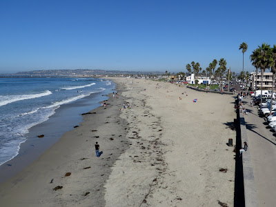
The Ocean Beach pier marks a distinct change in the coastline - the steep bluffs of Sunset Cliffs to the south, the wide open beaches that shelter Mission Bay to the north. Just north of Ocean Beach, jetties mark the mouth of the San Diego River and the adjacent mouth of Mission Bay.
 Artificial berms, almost pseudo dunes, are commonly employed along this coast. My understanding is that these are basically storm-protection, since even a little elevation and sediment can provide at least some short-term protection to the low lying areas behind them during high water events. I know quite a bit has been written about these, but this was my first introduction to them on this scale.
 Dog Beach is the spit or sand bar that largely fills the jettied mouth of the river (check the aerial view). I suppose this all gets flushed out during big flood events, but probably restablishes fairly quickly.
Mission Bay used to be called False Bay and would have been the natural lagoon or estuary at the mouth of the river, but this whole system has been reshaped and replumbed and bears little resemblance to what Cabrillo encountered back in 1542.


No comments:
Post a Comment