For better and more up-to-date information on the geology of this landslide, see:
DNR's Ear to the Ground: Whidbey Island Coupeville Landslide

 Early this morning (4:15AM, 3-27-2013), a very large landslide occurred up at Ledgewood Beach on Whidbey Island. This neighborhood is no stranger to slides, but nothing like this has happened in a long time. The slide was a large rotational failure within the much larger landslide complex that extends along this stretch of shoreline. It may have been 700-800' long and several hundred feet deep, with the head scarp stepping back several tens of feet into the 200' high upland surface. The failure surface - based on what we've seen on the beach elsewhere along here, but confirmed by today's observations - is a little below sea level.
AERIAL VIEW
KING5: Huge landslides damage, threaten homes on Whidbey Island

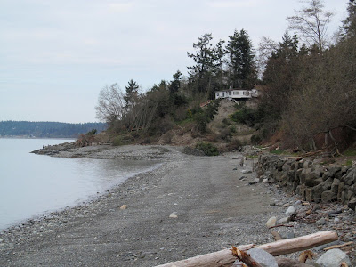
Previous Post on Ledgewood Beach (April 2006)
For a beach wonk, the toe was the coolest part. The shoreline along here was relatively straight prior to the slide and is now marked by a bulge that extends more than 100 feet into Admiralty Inlet. This is not just a big pile of debris from the slope above, but rather it is the uplifted toe of the rotational landslide. Distorted dark gray clay is pushed up along the base (the tide was too high to see the lowest portions of the toe), but as the clays pushed up, they simply raised the beach into the air. The toe bulge is mantled by a remarkably intact sand and gravel beach. Barnacle covered boulders sit on the surface. The driftwood still marks yesterday's shoreline, which just happens to be 20' higher and 100' seaward of where it was a few hours ago. I could still follow a discontinuous band of dead eelgrass and beach wrack, marking an earlier high tide. Sections of the raised beach were broken by tension cracks, or arrayed in a series of terraces (drift logs on the top step, sand and gravel on the middle steps, cobbles on the lowermost steps).


I've posted several entries recently about deep-seated landslides:
South Whidbey State Park, February 2013
Camano Island State Park, November, 2012
These geologic landscape are best reserved for open space or parks, not subdivisions. In this case, we were very lucky that only one or two homes along the lower bench were affected -- in other places along here it could have been much more serious.


4 comments:
Thanks for posting this. It made the national news. It will be interesting to watch how the shore and beach respond.
Thanks for your post and pictures. Despite being on maternity leave, I've been (im)patiently waiting to hear your thoughts on the slide. Certainly an impressive sight.
Thank you very much for your observations and explanations. I don't understand the dynamics very well and am interested to learn more. Much appreciated.
This is cool!
Post a Comment