Saturday, February 25, 2012

Wolf Bauer


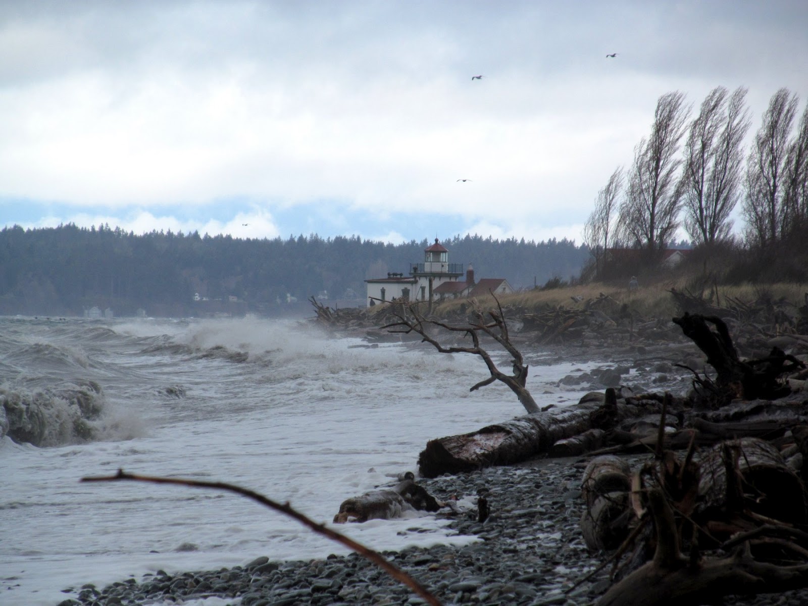
West Point 2004


Golden Gardens 2011


Seacrest 2011


Brackett's Landing 2009


Ambleside 2011

Tolmie 2009


West Point 2010
Birch Bay 2010 
24 February 2012

Wolf,
As you begin your second century, I wanted to remind you of what an amazing difference you have made for Puget Sound shorelines and for the people who visit them.

You were instrumental in raising awareness of shorelines and in creating a demand for shoreline protection.  Today, it’s easy to take our beautiful beaches for granted, but without the amazing efforts of you and others in the early 1970s, this place would be a very unattractive place.  Your language and your ideas have remained lasting elements of Shoreline Master Programs across the state.


You described accretion beaches as an endangered species.  At the time, you may have doubted our progress, and it’s true that we have lost some special places.  But thanks to your work, many remain intact and more are becoming public. 
Lily Point on Point Roberts is now a county park.

In the 1980s you spoke adamantly of the need to restore our urban beaches and to enhance the public’s shoreline experience.  But you did not just talk about it, you gave us examples.  Today, we have examples everywhere: in Seattle, Tacoma, Bremerton, and elsewhere.  And there are a new generation of projects such as the Sculpture Park Beach in Seattle and Marine Park in Fairhaven that were inspired by your example and carried out by impassioned individuals who had learned from you.


People enjoy our most spectacular urban beaches, yet many do not realize that these places were once buried in riprap and would be still were it not for your efforts.  People love the beaches at Discovery Park, Golden Gardens, Birch Bay, West Vancouver, and Tolmie State Park.  They think these places have always been this nice!


This year, we are mapping feeder bluffs throughout the Sound – the feeder bluffs that you taught us were such a critical element of the shore-process corridor.  Also this year, I was approached about what to do about salt marshes choked with cut logs from decades of sloppy log-rafting practices.  I jumped at the chance to share your presentation on this subject from almost two decades ago.


Increasingly, parks managers and and government regulators and fish biologists are looking for opportunities to restore beaches and to put sediment back into the system, not lock it away behind walls of rock.  People still build bulkheads, but doing so is widely discouraged and is increasingly difficult. In some places we are actually pulling seawalls off the beach and removing riprap from our spits.


Your legacy runs deep on Puget Sound and our shorelines are far, far better places today than they ever would have been without your incredible passion and your tireless commitment.


Thank you,
Hugh

NOTE:  Wolf turned 100 on February 24th. These photos, most taken recently, are all nourished beaches designed by Wolf in the 1970s and 1980s. Their captions link (in most cases) to previous posts on those places. Previous Gravel Beach posts mentioning Wolf can be found at:  Bauer Posts.

Monday, February 20, 2012

West Point


On Saturday afternoon, the north and south shores of West Point were very different places.  A strong south wind was hammering South Beach.  The waves wrapped tightly around the riprap at the lighthouse, rapidly transforming into much more gentle westerly waves breaking along the sandy North Beach.  Well, sandy at least until it vanishes below the enormous rock revetment that cuts off the beach in the vicinity of the old tidal inlet.

The south bluffs in Discovery Park have been active this winter - there was dirt sliding over the Olympia beds from above even as I watched - and it wasn't even raining.  It's interesting to contrast the photo with ones taken two winters ago  (
November 2009; February 2010).  There's also been fresh sliding on the north side where the riprapped spit merges with the bluff, toppling trees and spilling mud onto the beach.


Last year I chose West Point for a photo essay that was posted on the Coastal Care website:
      Coastal Care - Beach of the Month - November 2010

By the way, this is a fantastic website for people interested in understanding and protecting shorelines. The organization has an international scope, highlights a wide range of coastal issues, and hosts hundreds of great photos.


AERIAL VIEW (Google Maps)
Another AERIAL VIEW (Department of Ecology 2006 Aerial Photo)
(I'm not sure yet whether this second link will always work as predicted)

Monday, February 13, 2012

West Beach


The Hastie Lake boat launch is built on a depositional beach - in this case, a small spit that interrupts a long stretch of high bluffs.  Of course, it's hard to tell it's a spit beneath the asphalt, the riprap, and the houses.  There are more photos of the area in the preceding post and at:  Hastie Lake: Nov 2011.


The spit terminates about a quarter mile north of the boat ramp and the bluff begins to rise again.  The till gradually emerges above beach level and the bluffs continue to get higher.  Continuing north, the bottom of the till finally appears and the underlying stratified sediments emerge.  A few hundred feet farther north and the entire lower bluff consists of Whidbey Formation and the till, if it remains at all, is much thinner and much higher in the sequence.


Gerry Thorsen first called my attention to the distinct dogleg in the bluffs at the point where the till rises above the beach.  The till resists erosion south of the point much better than the Whidbey Formation to the north.  This is a nice example of how lithology at beach level can influence erosion rates.  It is not the only factor - wave exposure and beach character are both important, too.


The Whidbey Formation - imagine rivers flowing north across a broad floodplain towards a long-gone delta somewhere in the Strait of Juan de Fuca about 100,000 years ago - makes up a bulk of the bluffs to the north all the way to Swan Lake.  The bluffs rise to upwards of 250', higher if you include the perched dunes along the top edge of these bluffs (most now bulldozed for home sites).  Perched dunes, in case you weren't paying attention two years ago in Michigan (Grand Sable Dunes:  June 2010), are dunes formed by sand blown up and over the top of sandy bluffs.


AERIAL VIEW


Air Photo Note.  The Department of Ecology has just upgraded it's online coastal Atlas and air photo site.  You can find it at:
Washington State Coastal Atlas


It takes a little learning to navigate, but it is an incredibly powerful site, with a number of useful tools.  One feature, that I have long wanted, is the ability to link to individual photos.  I'll be looking for new ways to link between the blog and the Atlas in coming months.


Here's a link to a photo of the dogleg north of Hastie Lake:  2006 PHOTO


Friday, February 10, 2012

Hastie Lake


It's not unusual on Puget Sound beaches, particularly on the west side of Whidbey Island, to find maroon and black streaked sands on the uppermost beach face.  They are often just an extremely thin layer and appear to be left by the highest reaches of the swash in sandy areas. These are basically small placer deposits, where wave action (and sometimes wind?) has separated out slightly heavier minerals from lighter ones.  I believe the red grains are probably garnet.  I'm not sure what the black ones are - hornblende, magnetite (I didn't have a hand lens and even if I had, it's been a long time since I took mineralogy).


Most of this southern portion of West Beach - the general name for this northwestern shore of Whidbey Island, - consists of high bluffs, but here the upland surface drops toward sea level.  The county boat launch and the small development immediately north (Whitecap Lane) are actually on a small spit that extends another quarter mile to the north.  At low tide, and in years when beach sediment is thin, there is a well displayed peat bed on the beach containing lots of intact wood.  It is probably the remnant marsh from when the barrier lay farther offshore.  A little farther north at Swan Lake, similar peat has been dated to about 2000 years ago.


AERIAL VIEW


I was last here on Veteran's Day (Hastie Lake: November 2011), listening to the wind howl and watching the waves. Today is very different.


Lagoon Point


I lingered at Sound Waters through lunch time, but then headed out to enjoy an amazing February afternoon.


Lagoon Point is a relatively large barrier beach on the west side of Whidbey Island.  Old maps show a tidal inlet near the south end and a large salt marsh.  In 1970, the bulldozers were hard at work dredging channels in the marsh and using the resulting dirt to build finger peninsulas.  A mini-Venice, where everyone gets waterfront and their own moorage.  In 1971 folks started writing laws to prevent this kind of thing.


The water was calm and their were several fishermen and a bald eagle fishing from the beach.  The beach on the southern limb of Lagoon Point looked like it had been planed off (it was almost flat), perhaps in one of the season's early storms, and now there was a swash berm trying to rebuild the profile.


I walked south for a mile or so to the northern end of the smaller barrier south of Lagoon Point.  I had recently run into an old Wolf Bauer photograph of a log-choked lagoon and thought it was probably this one -- it was.  This photo is an attempt to recreate Bauer's shot from 40 years earlier.  Things don't look much different.  The logs are all still there - they rot slowly and there's no mechanism to release them once they become trapped in the lagoon.


The short stretch of beach between the two barriers is backed by a 60-80' high bluff of Vashon Till.  Till is a poorly sorted mixture of sediment sizes that has been compacted by the ice into something that often resembles concrete.  As a result, it tends to stand in vertical faces and often erodes through the failures of large slabs.  Boulders from the eroding till were scattered over the beach.  And more boulders, some very large, could be seen jutting out from the bluff face, waiting to join the others.


Unlike the gravelly sand beaches of the barriers themselves, this stretch of beach was all coarse gravel and cobble.  The source of the coarse material is no mystery, given the till bluff.  But why no sand?  It is possible that it is simply buried under the coarser armor layer - as is often the case.  Or is it related to the fact that this is a cove between two points and nature for some reason prefers to stack the finer material on either side.  Conventional coastal geomorphology suggests that just the opposite should occur, but in these mixed sediment systems with highly oblique wave action, conventional often doesn't work.

AERIAL VIEW


Possession


Boat ramps are nice meters of changing beach profiles.  Presumably, this ramp was originally built at beach grade - or at least at something close to typical summertime grade.  But the beach has continued to accrete and now the ramp is a foot or more below grade.  Which means that left alone, there would be a foot of gravelly sand on top of the ramp.  Which sort of negates the purpose of the ramp.  To keep the ramp clear probably requires near constant excavation and re-excavation with a loader.  Here, and at other ramps in similar predicaments, the result is often growing piles of gravel on both sides of the ramp, portions of which gradually erode back onto the beach, sometimes to simply rebury the ramp.


This morning there were two large piles of gravel down the beach - downdrift that is.  This boat ramp maintenance project has become a bypass operation, much like dredging sediment from a shoaling inlet and placing it on the downdrift beach. The concept is good but the level of disturbance (and effort) it creates for a small boat ramp seems awfully high.


There are probably dozens of these high maintenance ramps on the Sound, but a few that come to mind are Lighthouse Park on Point Roberts, Camano Island State Park, Port Hadlock, Kayak Point, and Phil Simon Park in Langley.


The best solution might be to raise the ramp to match the new beach grade, but that would be expensive.  And of course, the flip side of this problem is that when groins are built too high, or when they are built on eroding beaches, they increasingly begin to act like small groins.

AERIAL VIEW

Thursday, January 19, 2012

Clinton


The eastern shore of southern Whidbey Island forms a well-defined drift cell with the dominant southerly storms and waves transporting sediment northward.  The cell originates at Possession Head at the south end of the island and terminates at Sandy Point, near Langley.  The abundant sandy sediment has led to the development of long spits parallel to base of the high bluffs.  One of these lies just north of Possession Head (Possession County Park lies at its southern end).  Another is Columbia Beach, the long low strip of land lined with waterfront homes that you see from ferry as you approach the Clinton terminal.


North of the ferry dock, the shoreline bends slightly westward and another barrier beach emerges, forming Randall Point, Brighton Beach, and Camper's Row along Hastings Road (aerial view). The original spit must have fizzled out along here somewhere, but ingenuity and some earth-moving equipment (perhaps just a big hose) filled the narrow strip of low beach berm and wetlands to create a wide enough platform on which to build cabins.


It makes for a neat neighborhood, but a geologically hazardous one, as homes are tucked into the base of steep slopes that periodically fail during heavy rain storms.  Elliott, my guide today, recalls living in one that got hit by a slide several decades ago.  Some owners have built walls to block or divert possible mud and debris. In addition, a couple of steep stream gullies also empty onto this beach, their lowermost reaches in pipes and channels that would be challenged by a large debris flow or a flash flood.


I have no trouble seeing the appeal of these places, but the geologist in me can't help but shake my head.  I doubt I'd sleep comfortably during rainy spells.


For more on the history of this community and a wonderful sense of what draws people to these places, look for Frances Wood's Down to Camp:  A History of Summer Folk on Whidbey Island.


AERIAL VIEW


Golden Gardens


This time of year, the highest tides arrive right around sunrise. A couple of days after Christmas I headed out early to Golden Gardens to see the effect of the month's highest water levels. The predicted high tide was 12.7' above MLLW (Mean Lower Low Water or a "0" tide).  According to the Seattle tide gauge, the actual water level may have come in a couple inches higher.   These photos were taken 15-30 minutes after the peak tide.


This is not an unusually high tide.  A 13' tide (these numbers hold for central Puget Sound, but would need to be adjusted for other areas) occurs an average of 7-8 times a year, although the annual variability is huge.  Some years never see a 13' tide at all.  And in El Nino years, we may get 20 or 30!  (Alki Beach:  January 2010).  


The number of high tides at progressively higher levels falls off quickly.  In Seattle, Mean Higher High Water (the average of the highest high for every day of the year) is 11.35' - and we can expect a couple hundred every year.  As noted, 13' tides average less than 8 times a year.  And 14' tides take extraordinary conditions:  either a strong El Nino, like January 2010, or a big storm with a strong surge (February, 2006). Seattle's highest high tide was 14.5' and occurred on January 27, 1983 (another El Nino year).


In these photos at Golden Gardens, we see that the still water level is probably a foot or so below the sandy berm, but that the runup of the waves is just enough to send water over the berm crest.  Berm elevations vary and can depend on wave exposure and the abundance of gravel, among other factors, but 2' above MHHW is often a good place to start.


More on Golden Gardens:
Golden Gardens:  July, 2011


Bay View


I'm trying to catch up with some posts started in December.


The original shoreline here consisted of a low bluff, a narrow beach, and the endless tidal flats of Padilla Bay.  Development involved building a rectangular fill jutting out into the bay, using sediment dredged out from under the eelgrass on the flats.  No, they couldn't get permits to do that today!  The aerial image (see link below) shows the artificial geometry of this piece of the world.


The north and south ends are marked by riprap walls, which are extended out into the bay to act as terminal groins for the artificial beach that lies on the western shore of the feature.  Two more intermediate rock groins apparently help control the beach's shape - although I'm not sure how much they add.


The original beach was built of imported sand and gravel - the material in the tide flats is too fine - and was renourished as the beach gradually eroded back into the artificial fill.  There is no sediment in the corner south of the fill, but a very nice little pocket beach has formed on the north side. Some of this sediment may have come from the eroding bluffs to the north - while some may have leaked around the northern groin from the nourished beach.


I have only heard rumors of the plans for fixing this beach -- but I admit I'm still not clear what's broken that a fairly small amount of work and additional sediment couldn't solve.

AERIAL VIEW