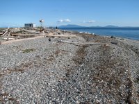
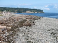
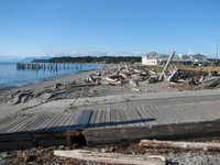
 Lighthouse Park is at the southwest tip of Point Roberts, that little orphaned piece of the USA that hangs down below Vancouver. The high ground of Point Roberts and neighboring Tsawwassen was once an island, until subsumed by the growing Fraser Delta.
The west side of Point Roberts is one of the few places in the Salish Sea where humans may have managed to alter the direction of net longshore drift (there may be another smaller example northeast of the Hood Canal bridge). We can block it or reduce it, but it took the Canadians to actually reverse it. Prior to the causeways to the Tsawwassen Ferry Terminal and the Roberts Bank Delta Port, net shore drift was probably to the south, driven by the extended fetch from the north, but the causeways may provide some shelter, increasing the relative importance of southerly winds and waves. This is all pretty speculative, but makes an interesting story.
Lighthouse Park has a difficult erosion history, probably complicated by changes to wave and sediment patterns and the unfortunate location of the old lighthouse building. Seems like everything would be easier if the structure could be removed (the navigation beacon could remain) and the beach allowed to do its own thing (but then I always say that).
This visit was pleasant, but didn't match my first visit, when a kid's concert was going on at one of the shelters and a pod of Orcas headed past just offshore.
 The beaches on English Bay benefit from their orientation (using groins) and added sand. They are just one element of Vancouver's magnificent, public shoreline, and are located between Stanley Park and the dense urban neighborhood sprouting along False Bay. The 13 mile seawall path allows bikers to go from downtown around Stanley Park and False Bay all the way to Kitsilano.
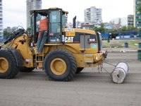
Four evenings every summer, the beach hosts a few hundred thousand people for fireworks. Each following morning, Vancouver Parks cleans up the mess and makes the beaches look like new again, with the help of big beach toys.
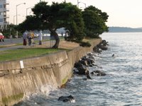
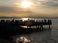 In the early 1900s, Luna Park was an amusement park on a pier - must have been a neat place on summer evenings. A couple years ago, the city fixed up the little park, removing the decaying seawall and allowing the sea to flow underneath.
Harbor Avenue was once on piles over the beach, below the high bluffs of Duwamish Head. Eventually, they filled it all in, burying the original beach under the road and beach houses. Now the beach houses are five story condos, the better to stop landslides from knocking roller bladers into the Sound.
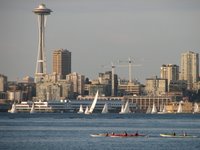

Three pocket beaches tucked into the western shore of Elliott Bay, separated by riprapped headlands of 19th century fill. The pockets probably correspond to location of wharves, where fill wasn't dumped. The coarse, well-sorted gravel leads to steep beach faces. The beaches were constructed in the late 1980s.


