
I was up in Oak Harbor again for Sound Waters (Saturday, Feb 1st), which meant that I had a few hours in the afternoon to work my way down the island. I spent much of that walking below the bluffs south of Swan Lake, turning around when I got a little south of Fort Nugent Road (which is how about how far I got walking north from Hastie Lake (February 2012) on a comparable Saturday afternoon two years ago).

 This is a wonderful stretch of 200-250' bluffs, the bulk of which are sandy units that probably belong to the Whidbey formation (lower) and Vashon advance outwash (upper). As noted previously, wind erosion is significant along here and the homes along the top are built among the perched dunes where this windblown sand collects. The dunes are largely obliterated by the development, but the sand still collects on decks and driveways.
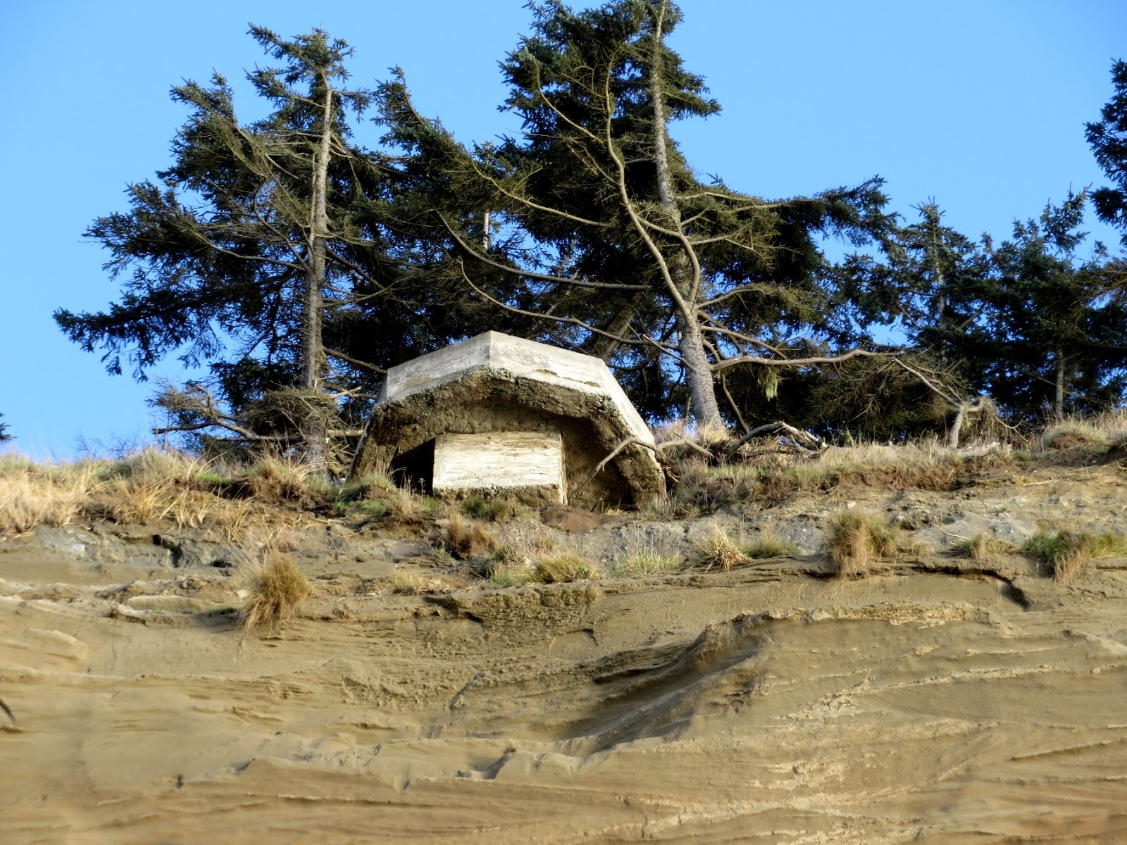
 I wish I knew more of the story of these two concrete structures. The one on the beach must have come down fairly recently, although I haven't been down here in a long time so don't know for sure. On Google Earth (image dated 8-25-2011), it is already on the beach. There's another hanging on the edge a short distance north and destined to come down soon. From their proximity and general similarity, I assume they are a pair - are these observation posts of some sort associated with the island's military history?
AERIAL VIEW

No comments:
Post a Comment