skip to main |
skip to sidebar
 I'll try to keep this post relatively short. The recent work has only just been completed and I'm sure I'll be back often to check on how the restored beach performs. Also, I don't know all the construction details, so there are elements I can't really comment on very intelligently (I suspect some readers will point out that this has rarely stopped me before).
Here's a post from several years ago to compare with:
Cornet Bay: 2008

 The old creosote timber bulkhead is gone and much of the fill has been removed. The beach and backshore slope has been regraded and erosion control measures have been put in place. I suspect this is to protect the site until planting and landscaping can be completed (possibly late this winter, but maybe they're planning to do something sooner?).
Based on the tides during my visit, I believe the straw wattles are located 6-12" above MHHW. This means that the final beach should extend up into the area that is currently covered in bark, so it's a little hard to appreciate the scale of the beach restoration in these photos.
AERIAL VIEW
This will be a valuable site to watch and I hope to be back up a few times over the next few months. There are a whole suite of neat beach projects in the vicinity - too bad that my informal monitoring is sort of an extracurricular activity!
I suspect this short stretch of beach just east of Keystone Harbor wins the award for most rapid, sustained, long term erosion rate on Puget Sound. But there's a catch!
We don't know a whole lot about erosion rates on Puget Sound, but we know that one foot per year is unusually high, at least over any significant period of time, and such rates are probably limited to the most exposed sites along the Strait or the toes of big, recently reactivated, deep-seated landslides.
Where erosion rates are unusually high, we usually find out that it is an area that was historically filled. You pile dirt out into the ocean and, of course, it goes away quickly.
This particular gravel bank erodes 5-10 feet per year, every year, and has done so for five decades. Every five years or so, the Corps dredges gravel from the mouth of Keystone Harbor (so the ferry doesn't run aground) and places it on the adjacent beach - a classic, albeit fairly small, bypass operation. The pile of material forms a steep, rapidly eroding bluff that advances rapidly on the parking lot for five years, at which time the Corps comes back, dredges again, and the whole process repeats.
AERIAL VIEW
The simple version of the sediment transport story is that drift is from north to south, so that gravel eroded from the bluffs farther north on the island gets moved south around Admiralty Head and then east past Keystone to accumulate on Keystone Spit (the large barrier that fronts Crockett Lake). This is why the bypass notion works. On the other hand, storms here are still largely form the south, so why isn't the drift the other direction? This issue arises elsewhere on the west side of Whidbey, too. My preferred explanation, but one that is purely speculative, is that longer period waves from the north, down Admiralty Inlet, are more effective at moving sediment than the choppier waves that come more frequently from the south.
This is another site where an old bulkhead - or perhaps more accurately, several old bulkheads and a lot of rubble - have recently been removed. A complex partnership of many different people came together to make this project happen.
This is a relatively low energy shoreline - wave action fades quickly entering the bay and the last real beach ends just short of this site. That doesn't mean that the banks aren't subject to erosion, but the rates are low and the site is developed in such a way that minor erosion is not a problem. Over time, some of the bank will crumble and a few trees will fall, but the resulting shoreline will be richer and more natural. Ironically, it looks like much of the past erosion is of fill material that was placed over the natural bank - which is so often the case.
This is a concept that could apply to many, many sites in Puget Sound and maybe some more examples like this one will help show folks that unarmored shorelines can provide as many benefits as those that are buried in rock and concrete.
The old concrete bulkhead at Anna Smith Park had stood for decades - well, most of it had stood for decades. Some segments hadn't made it so long. But its original purpose was at best a fuzzy memory and it offered an opportunity to recover a natural shoreline. The wall, along with some of the rubble behind it, was pulled out a few weeks ago and the remaining back fill is rapidly redistributing itself on the beach.
AERIAL VIEW
Kitsap Sun (30 August 2012)
The sites that lend themselves to removing seawalls are probably a lot harder to find than the sites that lend themselves to building seawalls - although there is some thinking these days that maybe some sort of balance can be achieved. I suspect that even if we can, we will find that the types of locations where we can take them out are significantly different than the types of locations where we can't stop them from going in! Which makes simplistic thinking about the net gain or loss of armored shorelines ... simplistic.
Two weeks ago, I headed up to Cama Beach to give a Friday night talk. I've always like Cama for its accessibility - 75 minutes or so, door to door, no ferry to catch, in the middle of the night when the wind is howling and the waves are breaking over the seawall. Which I've done. But late on Friday afternoon, there was a slow wall of traffic moving north through Everett and it took forever! Somehow I made it in time to get the laptop set up and still had time to wander down to the beach for the sunset and a chance to gather my thoughts.
I've posted from Cama Beach many times and there's no particular geologic message buried here, but the light was nice and the beach always looks different.
Note the band of sandy gravel a couple of feet above the water line. It corresponds roughly with the morning high tide. Because subtle differences in wave action sort sand and gravel so differently, and do so differently on rising and falling tides, mixed beaches often record small details. This band is bracketed by two tiny beach ridges - I can picture two boats, maybe 30 minutes apart, going past between 9 and 10 in the morning as the tide was beginning to fall.
The big slide at the north end can be seen in the background of the photo with the two boys walking on the beach.
AERIAL VIEW
The story behind Rat Island is a little ambiguous - I've heard slightly different versions. But basically it goes like this. Rat Island is the distal portion of a long spit that extends westward across the mouth of Kilisut Harbor from Marrowstone Island. At some point, the spit was artificially breached, perhaps to bring larger boats in -- there were old warships of some sort parked in here at one time. And the breach has never really healed - it might take more sediment and more time than has so far been available.
AERIAL VIEW


I think the reason these posts got stalled back in April was that I kept meaning to go back to the geologic maps and do some homework. I still haven't, but it's time to move on.
There is a band of Tertiary bedrock (reddish sandstone) that runs roughly east-west through the southern part of Marrowstone and Indian Islands. It first appears a short distance north of Mystery Bay (on the inner shore of Marrowstone) and is exposed well into the southern part of the harbor.
What I found most impressive was the exposure above the rock seawall on the lead photo. That's till on top, but look at those beautifully cross-bedded, angular sandstone cobbles! I'm surmising that this is the result of the glacier advancing southward across the sandstone surface (but those stones are dipping north) -- this is another of those spots where I wish there had been a better geologist along to help explain this.
AERIAL VIEW
The next three posts are out of order - they date to an April paddle on Kilisut Harbor and somehow got lost in my drafts folder. A conversation with a colleague reminded me about them and prompted me to finish them up. I thought about back-dating them, but then decided there was no reason to.
I do want to note that this is the 500th post to this blog! I'll have to write up something in honor of the occasion -- but haven't yet.
Kilisut Harbor (hshipman: April 2012) is the narrow bay between Indian and Marrowstone Islands, cut off at the south end by a tombolo (Marrowstone Isthmus: 2010) and almost cut off at the north end by a long spit - there will be a subsequent post on it's orphaned tip (Rat Island).
AERIAL VIEW
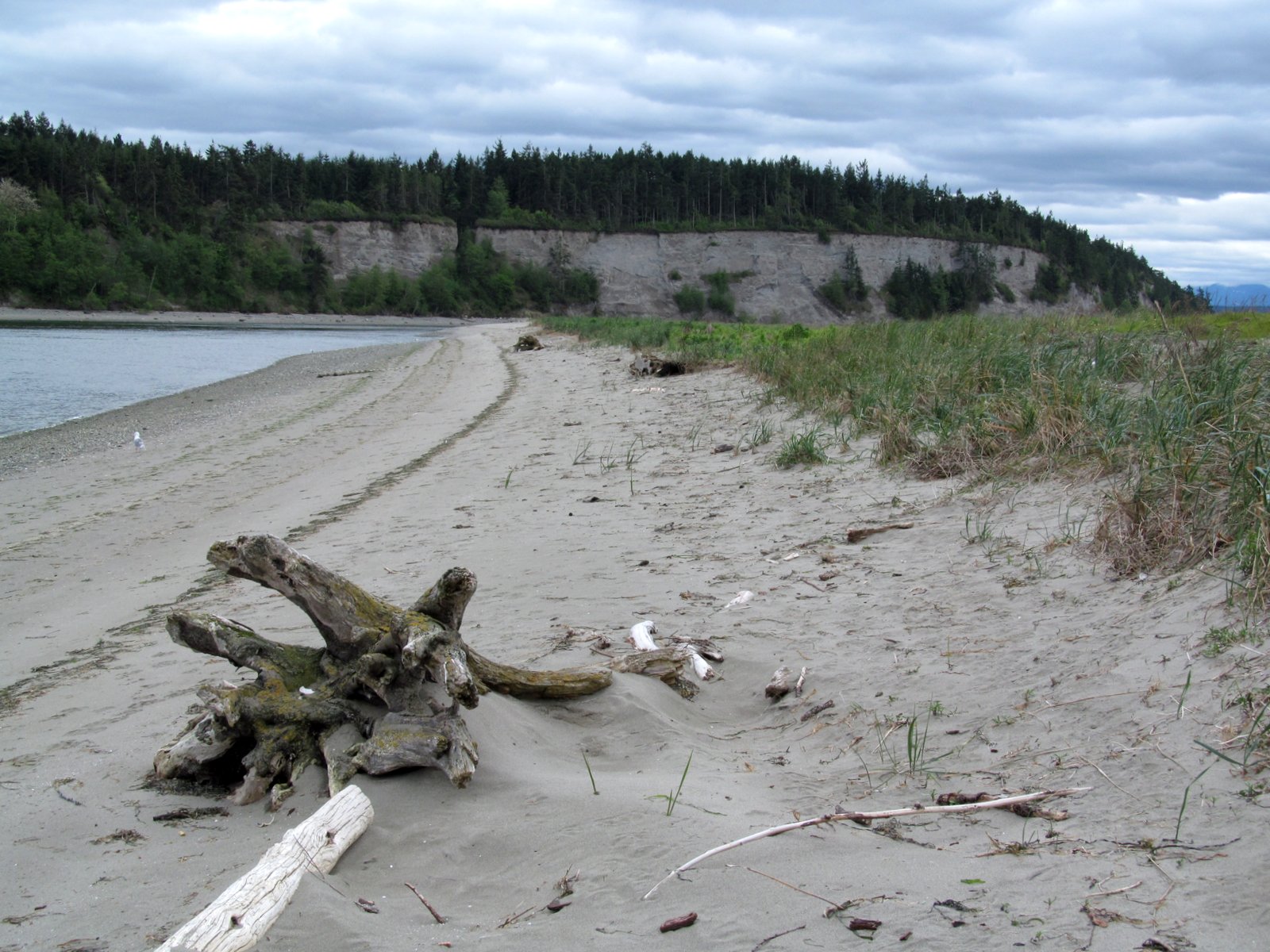
Indian Island is a naval munitions facility and is off limits without clearances and escorts, but paddling a discrete distance from shore seems to be okay. Unfortunately, some of the more interesting features along this eastern shore of the island are a couple spits and back-barrier marshes - which are difficult to observe from kayak level. Most of this side of the island consists of a modest bluff - mainly till as far as I could tell. There were some impressive boulders - including one that was practically as high as the bluff behind it.


 The old creosote timber bulkhead is gone and much of the fill has been removed. The beach and backshore slope has been regraded and erosion control measures have been put in place. I suspect this is to protect the site until planting and landscaping can be completed (possibly late this winter, but maybe they're planning to do something sooner?).