Thursday, March 30, 2006

Narrows Park


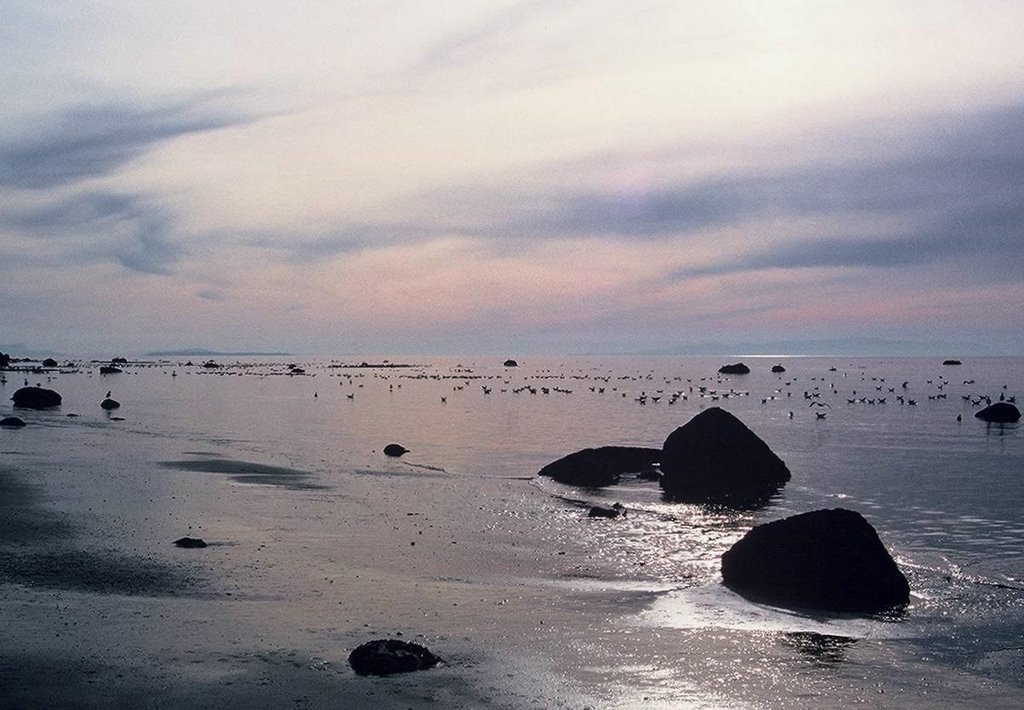
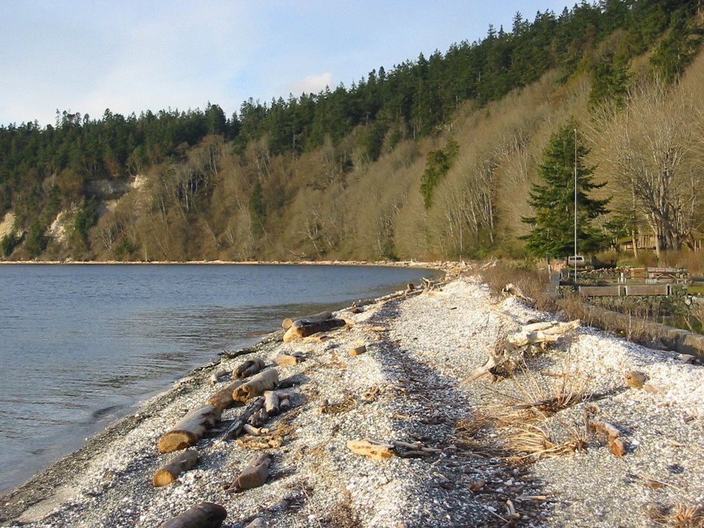
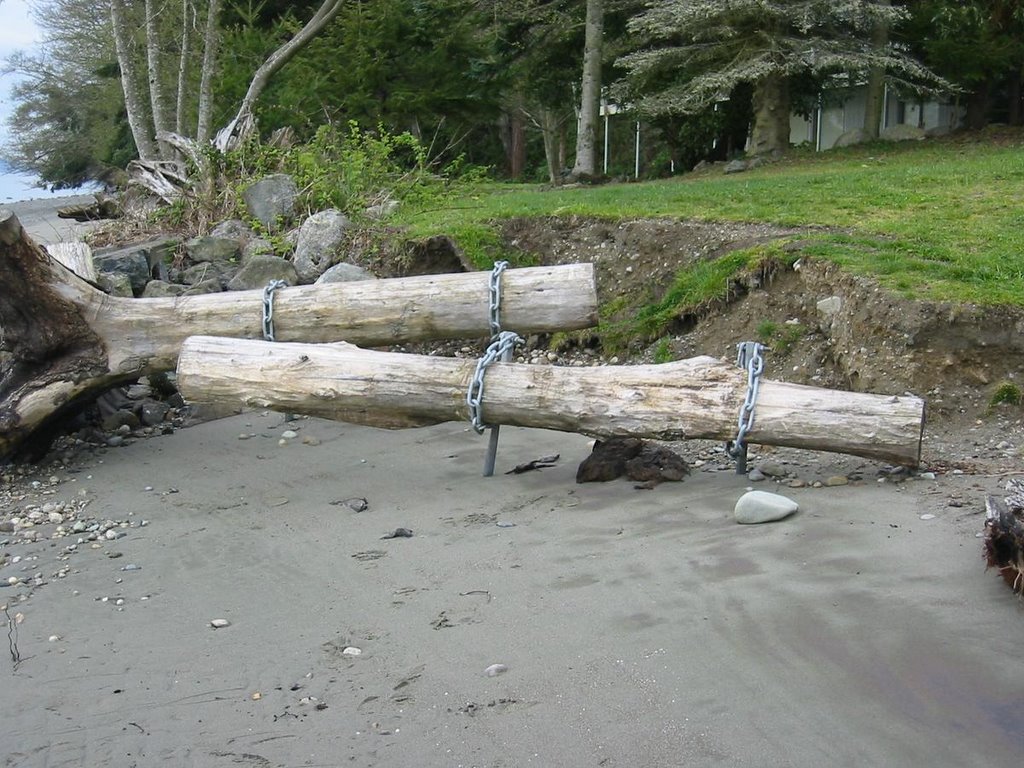
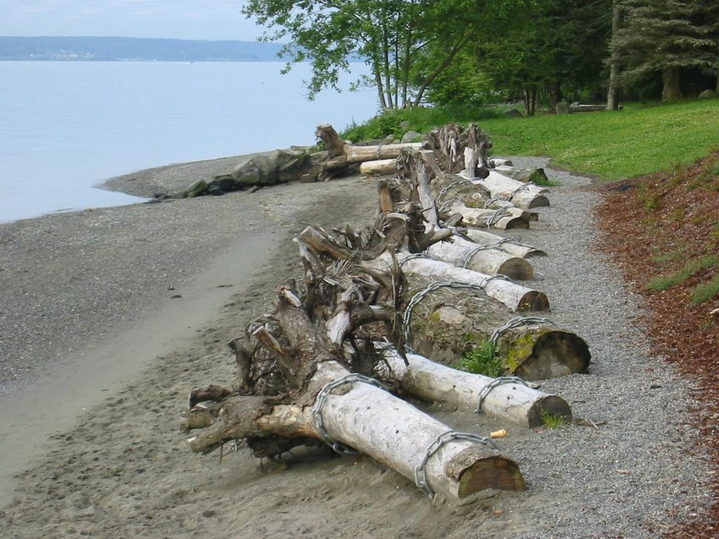
Nice little park at the mouth of a small stream valley on the west side of the Tacoma Narrows. Great place to watch the new bridge being built. Less than two years ago the large rock bulkhead to the north was removed and replaced with a row of logs. The logs are securely anchored with large chains attached to steel posts. The logs are all the same size, the same distance apart, and oriented in the same direction. Very tidy -- probably just like the plans showed (bottom picture, last year). But nature is already rearranging the site, leaving some of the logs in awkward positions (top picture, taken this morning).

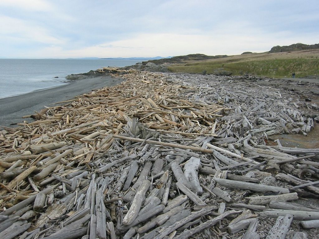
The goal was a softer, more natural shoreline. The result is a lesson about beaches. The removal of the rock bulkhead along with some of the old fill was a big step in the right direction, but the placement of the anchored logs was a small step backwards. The beach is seeking a more stable configuration and the logs have little influence on it's desire to do this. They will simply look more and more out of place as the beach profile adjusts. It's not that logs aren't an important component of Puget Sound beaches, nor that logs might help mitigate erosion in some situations. It's just that there are more significant things affecting this beach. The bank is old fill that probably extends seaward of the original shoreline. In addition, the curious concrete stream outfall structure acts like a groin to northward drift, exacerbating erosion just to the north.

There are probably some great solutions to this site, but they'll require some money, some excavation, and some geologic understanding. If it's done right, the stream will be set free and the logs will show up on their own.

Wednesday, March 22, 2006

Semiahmoo


The first day of a long two-day meeting sent me into the archives searching for relief. Be grateful I don't post pictures of the meetings.

I thought about calling this post "mixed sediment beaches." Boulders, sand, and mud. One of the photos was taken just south of Semiahmoo Spit on the Strait of Georgia. The other was taken inside Drayton Harbor, which lies behind Semiahmoo Spit.

Saturday, March 18, 2006

Cama Beach


Recent storm berms at Cama Beach. The upper ridge is from February 4th. I think the lower one is from a storm earlier this month. The amount of shell (broken clam shell, mainly) is always impressive at Cama, but in today’s late afternoon sun it almost looked like snow.

Iverson Spit


Sand bars lapping onto a gravelly beach. The County Preserve includes the end of the spit and the associated marsh. To the south the spit is buried under a long line of houses and the original marsh was long ago diked and drained, but down here the beach is a bit wilder. Like all the beaches at the north end of Port Susan, there are logs everywhere.

Jefferson County


Kala Point.Great place to bring a class. Steep, forested bluffs, a beautiful spit with small dunes and a large lagoon, the 100-year remains of a lumber ship, and big logs. Really big logs - cut into chunks the size of box cars. Kala Point is a cuspate foreland surrounding a lagoon and salt marsh, the entrance to which is on the south limb. Like most of these barrier beaches, the tidal entrance favors the side more protected from wave action and with less abundant sediment.


Oak Bay.This large barrier (a tombolo) was sliced in half by the cutting of the canal from Oak Bay into Port Townsend Bay. The portion of the barrier left on the western side of the cut is the site of Oak Bay Park. A large lagoon lies behind it. Prior to the cut, the lagoon drained north into Port Townsend Bay but the now jetty prevents this and for almost 100 years the lagoon has cut through the barrier on the south. This has allowed beach sediment to be transported into the lagoon - a substantial flood tide delta has formed - and I suspect this is the main factor in allowing the barrier to migrate northward. In addition, much of the spit has been riprapped (yes, that's a verb, or at least it should be) and a boat ramp was built that aggravated erosion immediately east (downdrift). This, and continued shoaling adjacent to the jetty, may help explain why in 2003 the tidal channel jumped westward.


The February storm ripped asphalt off the road in the county park, behind the riprap, sparking discussion of possible improvements. Improvements to the beach, not to the riprap. Maybe we could start by removing the boat ramp and pulling a few hundred feet of riprap from the eastern end? A strategic retreat.

Tuesday, March 07, 2006

San Juan Island


South Beach, American Camp. From the color of the logs, you can see which ones arrived or moved around during last month's storms. The road down at Cattle Point is still there, although I expect to see renewed erosion over the next year or two thanks to higher tides and recent storms. Time to move the road, although that will be neither cheap nor simple, given the visual landscape of the area.


False Bay. Just a couple miles northwest of South Beach, this broad embayment is an anomaly. Broad sandy bars across a cobble-strewn platform. Olympic Mountains in the distance.


Westcott Bay. It's been a bad few years for eelgrass in Westcott Bay, maybe due to sediment changes, but meanwhile, in the forest and meadows above the salt marsh new flora and fauna are taking hold. Westcott Bay Sculpture Park

Orcas Island


North Beach. The riprap was removed almost 14 years ago and the beach still looks great. Some years the beach builds up and some years it erodes, but the gravel responds with the changes, whereas the big rock did not. My theory is that erosion on these broad pocket beaches reflects multi-year changes in the dominant storm direction, with the beaches essentially sloshing back and forth within their rocky containers.


Deer Harbor. A road along the top edge of an eroding bluff is never a great idea. Usually we end up with a revetment burying the beach and a road that continues to fail. But here, the county moved the road inland, leaving a public trail and viewpoint and the beach, too. Thank you.

Spencer Spit


More shots from last week. The State Park was closed for the season, but the walk in from the gate was pleasant. The spit is actually a cuspate foreland or an open point, with a large salt marsh and an inlet on the northerly, leeward side. The south beach is fed from the erosion of bluffs along the east side of the island. Several fresh slides and a beach littered with small boulders.

Sunday, March 05, 2006

Sperry Tombolo

The Sperry Peninsula is connected to Lopez Island by a beautiful tombolo and salt marsh. Last month's storm eroded the beach and redeposited the gravel along the fringe of the marsh on the backside of the spit. This probably has happened every ten or twenty years for several thousand years. It may never happen again.

A simple gravel road along the spit has provided access to the peninsula for decades. Undoubtedly, it has been damaged and repaired many times before. But this time, the response appears to have been more substantial, with more rock and a more substantial roadbed. And that moves this spit one step closer to becoming a causeway. The next big storm may still carry gravel and logs over the roadway, but the damage to the road will be more significant and the pressure to protect it will be greater.

For a barrier beach to remain the same, it must be able to move. The answer is less money for road improvements and more emphasis on periodic maintenance. Let the road move with the beach. That way, in a hundred years, it will still be a beach.

Watmough Bay


This is a wonderful little pocket beach near the southeast end of Lopez. High basaltic cliffs on the north side and an extensive marsh behind the barrier. Nice beach cusps/ripples last Thursday. The high points, a little over 2 meters apart, are gravel, while the low points are sandier. Most extend uniformly up and down the beach face, indicating that their formation was sustained, and consistent, throughout an entire tide. I would speculate on the nonlinear dynamics behind this, but would trip all over myself doing so. These features seem more common on swash-aligned pocket beaches like this one, but are by no means limited to them.


As with virtually every other beach I've seen since last month's storm, there was fresh gravel deposited on the backside of the barrier. The gravel had washed over the grass and logs and into the dense thickets (nootka rose?) behind the beach. I am guessing that the barrier moved a foot or so landward during this last event. But I don't know if that event was a 20-year storm or a 100-year storm, so I can't estimate a long-term migration rate.